


Lizard_Porthallow
Details
Creation:
Last update:
–
–
-
 Activity: Walking
 -
 Distance: 24.53 km
 -
 Average duration: 8h 30
 -
 Difficulty: Not specified
 -
-
 Back to start: No
 -
 Ascent: + 535 m
 -
 Descent: - 559 m
 -
-
 Highest point: 77 m
 -
 Lowest point: 3 m
-
 Country:
United Kingdom
Country:
United Kingdom
-
 District:
Landewednack
District:
Landewednack -
 Start: N 49.95959° / W 5.20646°
 -
 End: N 50.068° / W 5.07975°
 -


 Hour-by-hour weather


Waypoints
- S : km 0 - alt. 32 m - Start near South West Coast Path, Helston, Cornwall TR12, UK
- 1 : km 0 - alt. 32 m - Walk west on S W Coast Path
- 2 : km 0.02 - alt. 31 m - Turn right onto Lighthouse Rd
- 3 : km 1.14 - alt. 75 m - Turn right onto Beacon Terrace
- 4 : km 1.54 - alt. 74 m - Slight right onto Church Cove Rd
- 5 : km 1.81 - alt. 64 m - Turn left to stay on Church Cove Rd
- 6 : km 2.27 - alt. 22 m - Slight left onto S W Coast Path
- 7 : km 3.14 - alt. 52 m - Walk north on S W Coast Path
- 8 : km 4.58 - alt. 52 m - Turn right to stay on S W Coast Path
- 9 : km 4.73 - alt. 30 m - Slight right onto Prazegooth Ln
- 10 : km 4.81 - alt. 19 m - Turn right onto New Rd
- 11 : km 4.96 - alt. 15 m - Turn right towards S W Coast Path
- 12 : km 5.06 - alt. 27 m - Continue onto S W Coast Path
- 13 : km 6.28 - alt. 37 m - Walk north on S W Coast Path towards S W Coast Path
- 14 : km 9.19 - alt. 64 m - Walk east on S W Coast Path
- 15 : km 10.29 - alt. 57 m - Walk east on S W Coast Path towards S W Coast Path
- 16 : km 10.37 - alt. 58 m - Slight right to stay on S W Coast Path
- 17 : km 13.26 - alt. 66 m - Walk south-east on S W Coast Path towards S W Coast Path
- 18 : km 15.83 - alt. 9 m - Sharp left onto B3294
- 19 : km 16.39 - alt. 13 m - Slight right
- 20 : km 17.02 - alt. 30 m - Turn right onto S W Coast Path
- 21 : km 17.91 - alt. 8 m - Walk east on S W Coast Path
- 22 : km 20.06 - alt. 7 m - Walk north on S W Coast Path
- 23 : km 20.88 - alt. 33 m - Walk north-west on S W Coast Path
- 24 : km 20.99 - alt. 41 m - Turn right towards S W Coast Path
- 25 : km 21.1 - alt. 49 m - Turn right towards S W Coast Path
- 26 : km 21.38 - alt. 64 m - Turn left onto S W Coast Path
- 27 : km 21.54 - alt. 56 m - Walk north-east on S W Coast Path
- 28 : km 21.69 - alt. 36 m - Turn right
- 29 : km 21.89 - alt. 5 m - Turn right
- 30 : km 21.91 - alt. 6 m - Turn right
- 31 : km 22.19 - alt. 15 m - Walk north-east
- 32 : km 22.61 - alt. 45 m - Walk north
- 33 : km 23.16 - alt. 72 m - Walk north-west
- 34 : km 23.2 - alt. 71 m - Turn left towards S W Coast Path
- 35 : km 23.49 - alt. 63 m - Turn right onto S W Coast Path
- 36 : km 23.77 - alt. 48 m - Walk north-west on S W Coast Path
- 37 : km 23.88 - alt. 43 m - Turn right
- 38 : km 24.23 - alt. 7 m - Walk north
- 39 : km 24.51 - alt. 3 m - Turn right
- E : km 24.53 - alt. 3 m
Other walks in the area
Circular walk around Lizard Point
 Visorando member 9.78 km
+219 m
-220 m
3h 25
Visorando member 9.78 km
+219 m
-220 m
3h 25
 Easy
Departure from Landewednack (Cornwall)
Easy
Departure from Landewednack (Cornwall)
A gorgeous circular coastal walk to visit the famous Lizard Point.
Pen Olver, Lizard Point and Kynance Cove from Lizard village
Visorando member 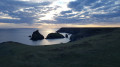 9.39 km
+191 m
-191 m
3h 15
9.39 km
+191 m
-191 m
3h 15
 Moderate
Departure from Landewednack (Cornwall)
Moderate
Departure from Landewednack (Cornwall)
This circular walk mainly using The Lizard Coastal Walk is a good way to explore the most southerly point on mainland Great Britain including beautiful coves, turquoise seas and impressive cliffs
Vellan Head and Kynance Cove from Predannack Wollas
Visorando member 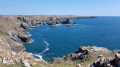 7.93 km
+111 m
-117 m
2h 35
Easy
Departure from Mullion (Cornwall)
7.93 km
+111 m
-117 m
2h 35
Easy
Departure from Mullion (Cornwall)
This pretty flat circular walk allows discovering impressive cliffs walking along Vellan Head until you reach the lovely Kynance Cove. Then, the return route goes straight across The Predannack Downs.
Porth Mellin from Predannack Wollas
Visorando member 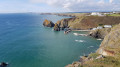 5.80 km
+133 m
-132 m
2h 00
Easy
Departure from Mullion (Cornwall)
5.80 km
+133 m
-132 m
2h 00
Easy
Departure from Mullion (Cornwall)
This pleasant circular walk explores a beautiful section of the South West Coast path leading to Mullion Cove. You can visit Porth Mellin as well before you go back using paths and tracks inland.
Mullion, Polurrian Cove, and the Chocolate Factory
Visorando member 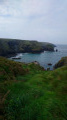 4.17 km
+59 m
-53 m
1h 20
Easy
Departure from Mullion (Cornwall)
4.17 km
+59 m
-53 m
1h 20
Easy
Departure from Mullion (Cornwall)
From the small village of Mullion on the south Cornish coast, the walk leads down through the valley to Polurrian Cove. As the South West Coast path winds its way back along the coastline to Mullion Cove, before heading back past the Chocolate factory, and back through the old village.
Mullion, the Poldhu Marconi Centre, and the Monument
Visorando member  4.02 km
+46 m
-46 m
1h 15
Easy
Departure from Mullion (Cornwall)
4.02 km
+46 m
-46 m
1h 15
Easy
Departure from Mullion (Cornwall)
Walking from the small Cornish village of Mullion to the coast, and following the South West Coast path, along with the coastal views, passing the historic monument and museum of Marconi, where the first trans-Atlantic radio transmission was made from.
Following the coast path to Gunwalloe, Chyanvounder, and Church Cove
Visorando member 5.04 km
+118 m
-114 m
1h 45
Easy
Departure from Gunwalloe (Cornwall)
A circular walk that could be started at either Church Cove or perhaps Chyanvounder, where there is a country inn offering good pub grub. As this is a circular, there is the option to start at (2). But would suggest the route as plotted.
Chynhalls point and the Terence Coventry Sculpture Park from Coverack
Visorando member  4.45 km
+105 m
-105 m
1h 35
Moderate
Departure from St Keverne (Cornwall)
4.45 km
+105 m
-105 m
1h 35
Moderate
Departure from St Keverne (Cornwall)
During this pleasant circular walk using a section of the South West coast path with nice views from points, you will explore Coverack, a beautiful fishing village, coves and Terence Coventry Sculpture Park.
For more walks, use our search engine .
The GPS track and description are the property of this route's author. Please do not copy them without permission.

