


Refine your search for walks in Lindar (cours d'eau) - Affluent du ruisseau d'Aillon
Lindar (cours d'eau) - Affluent du ruisseau d'Aillon walks


 Visorando Member
Walks near Lindar (cours d'eau) - Affluent du ruisseau d'Aillon
 La Grande Montagne
 7.50 mi
 +2,182 ft
 -2,051 ft
 5h 20
 Moderate
 Departure from Chambéry (Savoie)
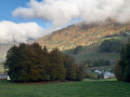
This walk combines a variety of points of interest, starting from Les Éléphants, Chambéry’s iconic monument, before heading towards the Charmettes neighbourhood, dear to Jean-Jacques Rousseau. Further up lies the Grande Montagne, which, whilst nothing like high mountains, nevertheless offers panoramic views of distant mountain ranges.
The first section follows theGR®96route.
Le Trelod via Dent de Pleuven
 6.70 mi
+4,544 ft
-3,638 ft
7h 00
 Very difficult
Departure from Doucy-en-Bauges (Savoie)
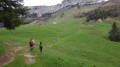
360° view of the Bauges Massif from the summit of Trélod.Arrange for a car at the finish point.
Nant Fourchu stream car park – Chalets de l’Eau Froide
8.13 mi
+4,140 ft
-2,103 ft
7h 20
Very difficult
Departure from École (Savoie)
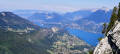
First day of a two-day route around the Pointe d’Arcalod, the highest point in the Bauges, crossing wild areas, valleys and rivers. The proposed route mainly follows the eastern section of the GR® de Pays Tour de l’Arcalod, marked in yellow and red. Spectacular views of the mountains and Lake Annecy. This wild and little-used route is situated mainly within a sensitive, regulated area.The terrain is good and presents no particular difficulties.
Le Reposoir - Refuge de la Combe
 3.14 mi
+1,719 ft
-436 ft
2h 55
Moderate
Departure from Bellecombe-en-Bauges (Savoie)
This hike can be done either:
- as a day trip,
- or as part of a longer hike (first stage of the circular route: Around Charbon Mountain). It was during this tour that it was completed.
From the Baraque de l'Abbaye to the Chalet de l'Alpettaz
 9.20 mi
+3,583 ft
-2,201 ft
7h 20
 Difficult
Departure from Seythenex (Haute-Savoie)
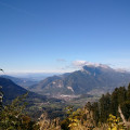
This hike takes you to the heart of the Faverges-Seythenex valley, following the Lac d'Annecy with the Torrent de Saint-Ruph, which is the lake's main source of water, ending with a view of Albertville and Mont Blanc at the Col de l'Alpettaz (alt. 1,580 m).