The Sologne mounds

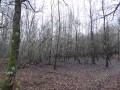
This route, which runs mainly through woodland, features some undulation – unusual for the Sologne region – including the site of an ancient, abandoned village perched on a ‘motte’, known as La Motte Bonneville. Walkers are sure to admire the châteaux and landscapes amidst the heather-covered moors typical of the Sologne, not to mention the section through the Forest of Boulogne.

Details

n°1095440
Creation:
Last update:
Last review:
  • Mountain biking
    Activity: Mountain biking
  • ↔
    Distance: 25.39 mi
  • ◔
    Duration according to the author: 3 hrs 
  • ▲
    Difficulty: Moderate

  • ⚐
    Back to start: Yes
  • ↗
    Ascent: + 295 ft
  • ↘
    Descent: - 295 ft

  • ▲
    Highest point: 427 ft
  • ▼
    Lowest point: 259 ft
  • ⚐ Country: France
  • ⚐
    Area: Sologne
  • ⚐ City: Neuvy (Loir-et-Cher) (41250)
  • ⚑
    Start/End: N 47.563472° / E 1.603127°
  • ❏
    IGN map(s): Ref. 2121SB, 2122SB

  • ◶
    Type of surface: Not specified
  • ⇧
    Bike carrying: Not specified
  • ▲
    Difficulty: Not specified
  • Hour-by-hour weather

Photos

Description of the route

The route starts from the car park opposite the Hôtel-Restaurant de la Cheminée in Neuvy.

(S/E) From the car park, turn left onto the street running alongside the embankment, then left again in front of the hotel to join the D18, then the D923 by turning right. Cross the two branches of the Beuvron.

(1) At the fork in the road, turn left, then left again onto a tarmac road which becomes a forest track.

(2) At the crossroads, carry on straight ahead, making sure to take in the view of the Manoir de l’Île on your left. Leave the gravel track at the first junction and take the dirt track that continues from it. Ignore the adjacent turnings.

(3) At the stabilised track coming from the right, keep left and then pass Villevaudran on your left.

(4) When you reach the D13 (take care), turn right and pass Château Villeneuve.

(5) Leave the D13 and take a grassy track on the left leading to the private estate ‘La Fosse’. Turn right in front of the estate entrance. At the stabilised track running parallel to the road coming from the right, keep to the left.

(6) At the crossroads, veer left onto the tarmac section, then cross the bridge over the Néant.

(7) In Damble, turn right, then take the left-hand track at the Fork in the road.

(8) At the high-voltage power line, turn left and cross the wooden bridge over the Beuvron. When you reach the D923 (take care), turn right.

(9) At Chemin du Thielay, turn left onto the “CR Thielay Montrieux”, then cut across the gravel track leading to Château du Chéreau, continuing straight ahead along the grassy path. This becomes a gravel track as you approach the houses.

(10) When you reach the tarmac road, turn left towards Montrieux. Cross the D22 and take Rue des Maudhuites opposite.

(11) Turn left before the water tower. Turn left onto the D104, then right onto the Route des Moulins, signposted “Sologne à vélo”. Continue straight ahead at the junction after the small bridge.

(12) Leave the tarmac road by turning right onto the CR “Les Pommeries” at the Fork in the road. The gravel track becomes a grassy path once past La Raoulière; this path may be flooded after heavy rain. Look out for the Château du Mesnil on your left as the path leads onto a gravel track.

(13) As the track becomes private, turn left onto the straight path. At the side track coming from the left, keep to the right before joining the D18 (take care), then turn right onto it.

(14) Turn left onto the gravel track signposted ‘Ferme de la Maltière’. Turn left at the end of the track, then right, following the signs for ‘L’Aunay’.

(15) At the Fork in the road, leave the gravel track – which becomes a private road – by keeping to the right. Join the D88 on the right.

(16) Do not take the first track on the left, but take the grassy track just after it: the CR21.

(17) Turn left just after the Étang des Binoches.

(18) At the four-way junction, continue along the CR22 (la Frelonnière), which crosses the CR41. At the end of the Fambron Pond embankment, turn left.

(19) At the junction, carry straight on along the CR25, which leads to the embankment of the Grand Étang de Rhuys, then, at the three-way junction, take the CR51 by keeping left.

(20) At the four-way junction, turn left onto the CR24.

(21) At the Fork in the road, head left, then right at the junction after crossing the ford, going round a barrier, onto theGR®3C(GRP® de Sologne). Continue along the gravel track, which becomes tarmac at “La Ronce”.

(22) Stay on the tarmac road signposted “Sologne à vélo”. Cross the D13 (take care) and go round the barrier.

(23) Turn right before the houses, then left as you cross the narrow passage. Go round the barrier after the Chaussée de l’Étang des Veillas.

(24) At the side road coming from the right, go round the barrier, keep left, then turn right at the Fork in the road, following theGR®3C. Go round another barrier, crossing the D22.

(25) At the crossroads, carry on straight ahead, going round the barrier and leaving theGR® (Allée de la Biche) to your right. Go through another barrier at Château de la Hardonnière.

(26) Cross the lovely, well-maintained track, passing through a gate.

(27) At the junction, carry on straight ahead, crossing some embankments, then cross the D18 (take care) and follow the tarmac road, the “Route de Neung-sur-Beuvron”, until you reach the D923; turn left onto it. At the fork in the road at the entrance to the village, take the right-hand track to return to the car park in front of the Hôtel de la Cheminée (S/E).

Waypoints

  1. S/E : mi 0 - alt. 272 ft - The route starts from the car park opposite the Hôtel de la Cheminée
  2. 1 : mi 0.34 - alt. 266 ft - Turn left, then left again
  3. 2 : mi 2.12 - alt. 276 ft - Straight on to the Manoir de l’Ile
  4. 3 : mi 3.33 - alt. 282 ft - Turn left, then pass through Villevaudran
  5. 4 : mi 3.98 - alt. 279 ft - Turn right, then pass Château Villeneuve
  6. 5 : mi 4.63 - alt. 305 ft - Turn left towards the private estate ‘La Fosse’
  7. 6 : mi 5.97 - alt. 289 ft - Keep left on the tarmac section
  8. 7 : mi 6.61 - alt. 289 ft - Turn right, then left at the Fork in the road
  9. 8 : mi 7.39 - alt. 292 ft - Turn left at the high-voltage power line - Beuvron (rivière)
  10. 9 : mi 8.56 - alt. 322 ft - Turn left onto the “CR Thielay Montrieux”
  11. 10 : mi 9.52 - alt. 331 ft - Turn left towards Montrieux
  12. 11 : mi 10.35 - alt. 384 ft - Turn left before the water tower
  13. 12 : mi 11.27 - alt. 325 ft - Turn right onto the CR ‘Les Pommeries’
  14. 13 : mi 13.35 - alt. 390 ft - Turn left onto the straight path
  15. 14 : mi 14.18 - alt. 423 ft - Turn left onto the compacted track
  16. 15 : mi 14.64 - alt. 387 ft - Keep to the right on the path
  17. 16 : mi 15.76 - alt. 374 ft - Second path on the left
  18. 17 : mi 16.79 - alt. 331 ft - Turn left just after the Étang des Binoches
  19. 18 : mi 17.42 - alt. 328 ft - Straight on along the CR 22
  20. 19 : mi 18.03 - alt. 299 ft - Straight on along the CR 25
  21. 20 : mi 18.58 - alt. 305 ft - Turn left onto the CR 24
  22. 21 : mi 18.93 - alt. 308 ft - Turn left, then right at the crossroads
  23. 22 : mi 19.5 - alt. 338 ft - Straight on along the ‘Sologne à vélo’ route
  24. 23 : mi 20.33 - alt. 341 ft - Turn right before the houses
  25. 24 : mi 21.22 - alt. 361 ft - Turn left, then right at the Fork in the road
  26. 25 : mi 22.73 - alt. 420 ft - Opposite, as you leave the GR
  27. 26 : mi 23.31 - alt. 400 ft - Opposite, when passing through a barrier
  28. 27 : mi 24.08 - alt. 302 ft - Opposite, when crossing the embankments
  29. S/E : mi 25.39 - alt. 272 ft - Return to the Hôtel de la Cheminée

Notes

Watch out for signs indicating private property. There are many of them and their placement is often confusing.

You can stop off at Montrieux en Sologne (bar, restaurant).

Some paths may be rutted by timber-hauling machinery or motor vehicles, with no regard for the environment, where access to the path is not restricted by a barrier.
Sometimes obstacles are used in place of barriers (mounds of earth, embankments).

The wide forest track between the waypoints (12) and (13) may be flooded after heavy rain, particularly as you approach the Château du Mesnil.

The lack of reliable signposting, even on theGR® andGRP® routes, means you should exercise caution.

Worth a visit

Places to see during the walk:

  • the Manoir de l’Île, built in the first half of the 16th century, surrounded by moats linked to the River Beuvron and comprising a main house, a chapel and outbuildings; it is said to have belonged to a favourite of François I. As it is private property, it can only be seen from the footpath,
  • after Damble, beautiful landscapes in the heather-covered moors typical of Sologne,
  • the magnificent Château du Mesnil, surrounded by a moat, set amidst lush greenery,
  • the stretch through the Boulogne State Forest.

Always be cautious and plan ahead when you're outdoors. Visorando and the author of this route cannot be held responsible for any accidents occurring on this route.

The GR® and PR® markings are the intellectual property of the Fédération Française de Randonnée Pédestre.

Reviews and comments

4.7 / 5
Based on 1 review

Reliability of the description
5 / 5
Ease of following the route
4 / 5
Route interest
5 / 5
albatach
albatach

Hello
Yes
After going through the course again, I know full well that you have to
turn right at number 21, not left

Kind regards
albatach

Machine-translated

Jean-Louis Pinault
Jean-Louis Pinault

Thank you for your comments.
Regarding the point (21), I can’t remember why I turned left at the Fork in the road rather than right to stay on the GR; it doesn’t make much difference, but perhaps that’s what confused you.
Have a good evening,
Jean-Louis

Machine-translated

albatach
albatach

Overall rating : 4.7 / 5

Date of your route : Sep 19, 2019
Reliability of the description : ★★★★★ Very good
Ease of following the route : ★★★★☆ Good
Route interest : ★★★★★ Very good

A lovely walk
We got it wrong at level 21 – either it was poorly explained or we misunderstood it
on our part (need further explanation?)
At number 11, just past the little bridge, there’s a handy table for a picnic
We’ll do it again

:

Machine-translated

For more walks, use our search engine .

The GPS track and description are the property of this route's author. Please do not copy them without permission.