


 Country:

 City:
City:


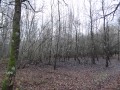

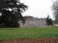

The walk starts from the car park at the Parc des Dolines de Limère, situated about a hundred metres from La Petite Mérie (in the commune of Saint-Cyr-en-Val). At the roundabout on the D2020, follow signs for “Parc départemental Les Dolines de Limère”.
(S/E) Take the hard-surfaced path which starts at the information sign for “Les Dolines de Limère”.
No signposting
(1) Leave the compacted track and take the first forest track on the left. Turn right when you come to a lovely cross-country forest path (under the power line) shortly after passing through the gate marking the park boundary. Continue straight ahead in a north-westerly direction, ignoring any side paths.
(2) Turn left at the Fork in the road (sign for military land). From this junction, the route presents no further difficulties until you reach the D168, provided you take care to follow the boundary of the military land, which is clearly marked on your right: where there is no fence, the path itself marks the boundary of the military land.
Continue straight on until you reach the Chemin des Bois de Sainte-Croix, which you take to the right, then leave by turning left after about a hundred metres. This path, which follows the boundary of the Villiers estate on your left, turns right where it meets the cross-path known as the “Fossé de Baule”, which you should follow westwards.
(3) Cross the D168 (Route d’Olivet) after a hairpin bend and take the tarmac road opposite. Go through the barrier, letting the road continue to the left. Follow the ‘Chemin des Ânes’, ignoring the various off-roads. An underpass takes you under the A71 motorway. The ‘Chemin des Ânes’ then crosses the D15 (take care) and heads mainly north-west until it reaches a junction.
Old yellow-red markings
(4) At the crossroads, turn left onto the ‘Chemin des Marnières’,the GR® de Pays ‘Sentier Historique de la Vallée des Rois’. This forest track heads initially south-west, then west, before turning left towards the village of Mézières-lez-Cléry.
(5) At the junction, the Chemin des Marnières is the path on the right. This path leads onto the Route de Cléry-Saint-André, which heads west. Pass the Château de Mézières on your left, then the church on your right.
(6) Turn left onto the wide, gravel-surfaced track, opposite Rue de Manthelon.
Signposted‘PR® Chemin des Vallées C3’
(7) At the crossroads, turn left onto the ‘Chemin du Tour des Bois’. Despite the various starting points, this path leads unambiguously to a road, which it joins further on.
(8) At the junction with the D215, take the path that starts at the boundary of the sawmill’s property, on the other side of the county road. This path leads to a crossroads with a central reservation, which you should cross to continue along the path, opposite the other side of the D15 (take care).
(9) This path leads to a forest track, protected by a chicane, which you should take to the right. The Chemin de Cléry crosses a private tarmac track and leads directly to the edge of the A71 motorway, which you should follow after turning left.
(10) At the Fork in the road, keep left before the quarry and continue along the track until you reach the Route d’Ardon, which you should take to the right. This quiet road joins the D168 after crossing the motorway.
No signposting
(11) Turn right and follow the D168 to the village of Ardon.
(12) Turn left onto the Route de Marcilly, then turn left just after the village pond onto the Route de Saint-Cyr, which leads to the car park at the Parc des Dolines (S/E)


 Visorando Member

 Easy
Easy 
