Country:

 City:


Signposted walk; follow the GT stickers.
Start from the car park at the Artemare boules ground, Rue du Stade, opposite the Salle Confluence.
(S/E) From the start, follow Rue du Stade towards the hamlet of Cerveyrieu. Take the first left, Rue du Vaugrais, after the bridge over the Groin.
(1) Turn left towards the Vaugrais campsite (at the end of the street) and turn left again after the bridge over the Séran opposite the campsite.
(2) Leave the Chemin du Vaugrais on your right and continue along the River Séran until you reach the foot of Les Carraz, then turn left again onto Rue de Lyon.
(3) Turn right at the road towards Fierloz. Walk along the right-hand verge of Rue de Lyon for 250 metres.
(4) Turn right onto the Chemin du Fierloz at the signposts for the walking route.
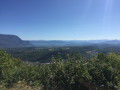
(5) Walk to the Vierge du Fierloz and back; the view is well worth the effort. Then return to the junction and continue to the right, staying on the main path. You’ll rejoin the Chemin du Vaugrais.
(6) Turn left, following the signs for Massignieu and Champdossin (shown on the signpost opposite). Carry on straight ahead twice after rejoining a tarmac road.
(7) At the end of the road, turn right and carry on straight ahead at the next junction towards the village. Keep right at the ferry crossing; a new signpost indicates the direction of Champdossin. Carry on straight ahead at the Stop sign.
(8) Leave the Rue du Flon path, head down to the right and continue along the tarmac road uphill towards Champdossin.
At the top of this climb along the Chemin de la Grollière, carry on straight ahead along Rue du Bovar and follow it to the end. The route continues straight on to the “Golet du Charbon” signpost.
(9) Turn right at the junction with the Golet du Charbon and follow this same path to Belmont.
(10) On reaching the village of Belmont, turn sharp left and head up the Chemin de Rajan for about fifty metres, then turn right onto a steep road (Chemin de Mazot). The yellow markings are clearly visible at this series of junctions.
(11) Continue along the path that starts opposite the road; a signpost, somewhat hidden by the vegetation, indicates the direction to follow. Follow this path to Vogland.
(12) Turn left when you reach the road, crossing the hamlet of Vogland along its main street.
(13) Turn right onto the road at the first junction, heading towards Samonod. Follow this road all the way to the end to reach Samonod.
(14) Cross straight ahead at the departmental road and carry on straight ahead (take care when crossing). Note for lovers of farmhouse cheeses that the producer’s shop (Les chèvres de Samonod) is located at this junction.
(15) Leave the tarmac road fairly soon at the next junction and turn left onto the downhill track.
(16) Make sure you take the path on the left at the Turignin cottage, then take the first right. This section follows the yellow and red markings of the GRP® Balcon du Valromey trail.
(17) Continue left along this track and take the first small path on the right, near the ENS (Sensitive Natural Area) sign for the Ain department, leading to the Thurignin Gorges.
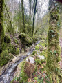
(18) Cross the River Séran above the gorges via this stone slab and turn right onto the path that runs downhill alongside the River Séran.
(19) Follow this track to the signpost for La Chaponnière, where you should turn right, continuing downhill.
(20) When you reach the departmental road, continue along the path opposite, on the other side of the road.
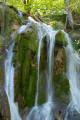
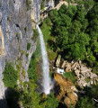
(21) When you reach the road, take a short detour to the viewpoint overlooking the Cerveyrieu waterfall by crossing the bridge and following the path that continues along the stream. Retracing your steps, carry on straight ahead along the road, uphill, until you reach the Stop sign, then turn right towards Chassin. Walk through Chassin until you see a sign on the right indicating the Chemin du Golet au Loup.
(22) Turn right and follow the path downhill to the Place du Four. In the hamlet of Cerveyrieu, continue downhill along the main road.
(23) At the ‘Give Way’ sign right at the bottom, turn left and follow the road straight on to the starting point (S/E).
 Visorando Member

 Tourist office
 Difficult
 Easy