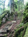
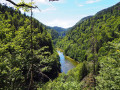
The Franches-Montagnes from La Goule

A walk enjoyed on a lovely autumn’s day in the Swiss Jura.
Please note there is a landslide on the postman’s path; expect to have to return via the same route.

Details

n°13363
Creation:
Last update:
Last review:
  • Walking
    Activity: Walking
  • ↔
    Distance: 5.96 mi
  • ◔
    Average duration: 4h 15 
  • ▲
    Difficulty: Moderate

  • ⚐
    Back to start: Yes
  • ↗
    Ascent: + 1,729 ft
  • ↘
    Descent: - 1,729 ft

  • ▲
    Highest point: 3,287 ft
  • ▼
    Lowest point: 1,768 ft

Photos

Description of the walk

Car route: At Damprichard, head towards Goumois, then Charmauvillers; turn right and drive down to La Goule (the road may be closed in winter); park after the bridge.

(S/E) From the car park, head towards Noiremont and follow the road for a few hundred metres.

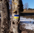
(1) Turn right. Follow the Swiss signposting (orange diamond). Head up through the forest along a narrow path. You’ll come to a forest track and then the road. Turn left, still following the signposting. A little further up, you’ll join the road coming from La Goule, which leads to Le Noiremont.

(2) Follow it for a few metres, then turn left off it; the path crosses a pasture. When you’re halfway across, turn right, head uphill and then cross the whole pasture.

(3) Go through the gate, then turn left onto the road, and then right. Leave the small road to enter a field, then keep as far to the right as possible and follow the edge of the woodland. Halfway along, you’ll find the signposts again. You’ll arrive at the “Saignes aux Femmes” farm.

(4) Turn right and head back down towards La Goule, still following the signposts and the postman’s path.
Pass by some rocks and descend via small ladders to reach the banks of the Doubs and the cars (S/E).

Waypoints

  1. S/E : mi 0 - alt. 1,791 ft - Car park by the bridge - Doubs (rivière)
  2. 1 : mi 0.22 - alt. 1,814 ft - To the right
  3. 2 : mi 1.26 - alt. 2,454 ft - Turn left onto the road
  4. 3 : mi 2.13 - alt. 3,048 ft - Barrier
  5. 4 : mi 2.68 - alt. 3,287 ft - Saignes aux Femmes Farm
  6. S/E : mi 5.96 - alt. 1,801 ft - Car park by the bridge

Reviews and comments

3 / 5
Based on 4 reviews

Reliability of the description
2.8 / 5
Ease of following the route
3.3 / 5
Route interest
3 / 5
Bluechris
Bluechris
• Edited:

Overall rating : 3.7 / 5

Date of your route : Jul 11, 2020
Reliability of the description : ★★★☆☆ Average
Ease of following the route : ★★★★☆ Good
Route interest : ★★★★☆ Good
Very busy route : No

A pleasant hike in fine weather in June.

Unfortunately, I'd give it a rather negative rating because the description in point 2 is not very clear and the author of this hike should mention that the sentier du Facteur is a marked White-Red-White path (mountain path) which requires good shoes and walking poles. The sentier du Facteur is not suitable for everyone and should be avoided in wet weather!

Machine-translated

Netra
Netra ★

Hello corna54, and thank you for your comments.

I'm sorry to read that you encountered difficulties following this route. The author of this hike has been informed, so let's wait for his reply.

Machine-translated

corna54
corna54

Overall rating : 3 / 5

Date of your route : Sep 01, 2019
Reliability of the description : ★★☆☆☆ Disappointing
Ease of following the route : ★★★★☆ Good
Route interest : ★★★☆☆ Average

We did 15 km instead of 9.59 km, from the start we took the wrong path (it is written on the description to take the direction Noiremont, follow the road).you have to take the direction of Goumois until the hiking signs and there take the direction Noiremont.At number 2 (it says follow the road to Noiremont for a few metres, then leave it on the left and the path crosses a pasture? go through the gate, which one? there are 2 gates on this path, and we found ourselves in Noiremont. The return journey was easier, the postman's path is once again passable.

Daniel

Machine-translated

bibi
bibi ★

Thanks for the warning, I've just put a note to draw attention to it in the introduction.
Sincerely

Machine-translated

Ziha
Ziha

Overall rating : 1 / 5

Date of your route : Apr 22, 2018
Reliability of the description : ★☆☆☆☆ Very disappointing
Ease of following the route : ★☆☆☆☆ Very disappointing
Route interest : ★☆☆☆☆ Very disappointing

ATTENTION: the last section of the walk after the last clearing, known locally as the "postman's path", is closed due to landslides.
We had not been informed of this beforehand, as we were taking a shortcut through a field for a picnic. As a result, the last part of the hike turned out to be dangerous. Avoid it!

The walk is very good overall, as are the route and the description. The "bad" reviews are there to draw attention.

Machine-translated

Marco25
Marco25

Overall rating : 4.3 / 5

Date of your route : May 10, 2017
Reliability of the description : ★★★★★ Very good
Ease of following the route : ★★★★☆ Good
Route interest : ★★★★☆ Good

A well-maintained trail, but not always easy, with a few tricky sections (in wet weather), but you need to be sure of your footing at the start of the climb, as the relatively steep gradient requires you to be confident. This is a very pleasant route with a southerly exposure, and the finish on the wooded plateau of NOIRMONT is a real pleasure, as is following the river DOUBS to the start and back.
It's easy to continue on the plateau to the remarkable Sommètres refuge and find the original path on the way back!

Machine-translated

Other walks in the area

For more walks, use our search engine .

The GPS track and description are the property of this route's author. Please do not copy them without permission.