Country:
 City:


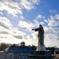
Park at Place de la Madeleine in Bréal-sous-Monfort.
Red signposting, unfortunately only partial.
(S/E) Leave the car park heading north-east via Impasse des Sports. Turn right and, after walking past the back of the sports grounds, turn right again onto Rue de Beauséjour.
(1) Turn left onto this street, cross Rue de l’Europe then Rue de l’Allemagne, and finally follow a path along the edge of a field which leads to a road.
(2) Turn left and, after 100 m, just past the cross, turn onto the path on the right. When you reach La Tenehais, turn left, then right after 50 m. Cross the Ruisseau de la Rousselais and immediately turn right. Pass through Trebermet, keeping to the right, until you reach a crossroads.
(3) Carry on straight ahead and climb to the top of the hill.
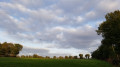
(4) Before the fork in the path, turn round and enjoy the panoramic view to the north. Carry on straight ahead and cross the D62 road. Continue straight on and follow the water on your right-hand side.
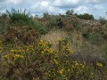
(5) At the junction, turn right, then, at the next crossroads, turn left. Then follow the main path as it winds: right, left, right, through meadows, moorland and woodland. After these three bends, continue left onto a path which, after 150 m, will turn right towards the west to reach a fork.
(6) Turn right, continue along the road to the right for 60 m and turn left to reach La Menuhais. Take the road to the left and turn right at the crossroads towards Le Tansement.
(7) Keep heading in the same direction downhill. Continue along a sunken track to the left and carry on left along the road until you approach La Haie Ouissais.
(8) Take a shaded path on the right. Keep to the right and join the D36 county road. Follow it to the left for a few hundred metres.
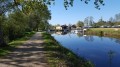
(9) At the end of the field, before crossing the Ruisseau de la Crublais, turn right. Continue along this path. It narrows before running alongside a pond on your left, eventually reaching the houses at Launay la Porte.
(10) Carry on straight ahead towards the north. At the junction, turn right, then left at the next junction.
(11) Cross the Ruisseau de la Chaise. Ignore thefirst road on the left towards La Blanchardais but take the next one on the left towards La Bouëxière. Cross the hill whilst admiring the 180° panorama.
(12) Head downhill, keeping to the right along a sunken track, and rejoin the road. Turn left onto it. Before La Folie, at the sign for the “Interpretive Trail”, continue downhill to the right, cross the Chaise via the footbridge and follow the river on the left until you reach another footbridge.
(13) Turn left and cross asecond footbridge. Walk between the N24 main road on your left and the Jardins de Brocéliande on your right. Continue along the road to the left. Go straight on at the roundabout. Follow the path on the right leading to Clos Couet.
(14) Turn right, go straight on at the junction and follow the footpath to the left, which leads to the church, passing a16th-century carved roofed cross.
No further signposting
(15) Leave Place Saint-Malo by turning right onto Rue de la Fontaine. Walk a few metres to the left to admire a17th-century schist and half-timbered house. Continue to the right along Rue de Beauséjoiur to reach the car park (S/E).

 Visorando Member
 Easy