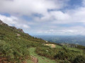
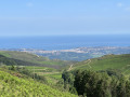
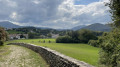
The foothills of the Rhune above Lehenbizkai

A lovely circular walk from Lehenbizkai, taking you up into the foothills of the Rhune.

Details

n°3180742
Creation:
Last update:
Last review:
  • Walking
    Activity: Walking
  • ↔
    Distance: 2.79 mi
  • ◔
    Average duration: 2h 30 
  • ▲
    Difficulty: Easy

  • ⚐
    Back to start: Yes
  • ↗
    Ascent: + 1,407 ft
  • ↘
    Descent: - 1,404 ft

  • ▲
    Highest point: 2,142 ft
  • ▼
    Lowest point: 735 ft

Photos

Description of the walk

Head to Sare and follow the signs for Vera (Bera) via the D406.
At Lehenbizkai, turn right onto a road signposted ‘no through road’.
Turn right at the first three-way junction, then right again at the second; the road passes through a cattle grid.
The start is 500 m away; park at the side of the road.

(S/E) The path starts on the south side of the road heading west; it runs alongside the road, overlooking a pumping station, and begins the ascent.

(1) At the first junction, continue climbing straight ahead. The path turns north-west and climbs to a junction near a fenced-in meadow.

(2) Turn left at the junction; the path makes a wide circular loop to the left, leading to a flat area north of the rounded summit of Le Fage.

(3) Take the path heading south-east to pass to the north of Le Fage and Le Fageko Harria.
The path descends to a building.

(4) Continue north-east, then east and finally north to return to the car park (S/E).

Waypoints

  1. S/E : mi 0 - alt. 735 ft - Parking along the road
  2. 1 : mi 0.86 - alt. 1,686 ft - Crossroads
  3. 2 : mi 1.21 - alt. 2,126 ft - Crossroads near a paddock
  4. 3 : mi 1.6 - alt. 1,850 ft - Flat area to the north of - Fage
  5. 4 : mi 2.16 - alt. 1,371 ft - Building below - Fageko Harria
  6. S/E : mi 2.79 - alt. 738 ft - Parking along the road

Notes

There are no water sources along the route.

Worth a visit

If you continue beyond point (2), you will find the remains of a menhir.

Reviews and comments

3.7 / 5
Based on 2 reviews

Reliability of the description
4 / 5
Ease of following the route
3 / 5
Route interest
4 / 5
User 25292372

Overall rating : 3.3 / 5

Date of your route : Jun 02, 2025
Reliability of the description : ★★★★☆ Good
Ease of following the route : ★★☆☆☆ Disappointing
Route interest : ★★★★☆ Good
Very busy route : No

Great hike, difficult to climb but the view is beautiful. The only downside is that the path isn't clearly marked, which I think is a shame because even with the app we had trouble finding it. There's very little shade on the hike, but otherwise I really enjoyed it.

Machine-translated

User 25292372

A brilliant hike – quite a tough climb, but the view is lovely. The only downside is that the path isn’t even signposted or anything; I think that’s a shame because even with the app we struggled to find our way. There’s very little shade along the route, though – but apart from that, I really enjoyed it.

Machine-translated

Oihanean
Oihanean

A lovely walk, but far from ‘easy’!
The climb is long and very steep, and in full sun in the morning…
Best avoided after heavy rain, but the views are superb.
For the more adventurous, you can carry on to La Rhune… (+ 3 hrs).

Machine-translated

Pl Carrillo
Pl Carrillo

Overall rating : 4 / 5

Date of your route : Jul 24, 2023
Reliability of the description : ★★★★☆ Good
Ease of following the route : ★★★★☆ Good
Route interest : ★★★★☆ Good
Very busy route : No

A lovely walk, though not that easy at first.
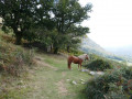
A lovely encounter with the pottoks
Take this route in the direction indicated, otherwise you’ll face a difficult and slippery descent.

Machine-translated

Other walks in the area

For more walks, use our search engine .

The GPS track and description are the property of this route's author. Please do not copy them without permission.