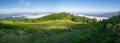
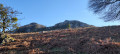
Around Monts Fage and Olhain

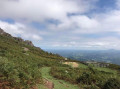
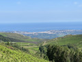
A lovely circular route that circles Mont Fage and Mont Olhain.

Details

n°4448618
Creation:
Last update:
Last review:
  • Walking
    Activity: Walking
  • ↔
    Distance: 3.68 mi
  • ◔
    Average duration: 2h 50 
  • ▲
    Difficulty: Moderate

  • ⚐
    Back to start: Yes
  • ↗
    Ascent: + 1,286 ft
  • ↘
    Descent: - 1,309 ft

  • ▲
    Highest point: 1,847 ft
  • ▼
    Lowest point: 735 ft

Photos

Description of the walk

Head to Sare and follow the signs for Vera (Bera) via the D 406. At Lehenbizkai, turn right onto a road signposted ‘dead end’. Turn right at the first three-way junction, then right again at the second; the road passes through a cattle grid. The start is 500 m away. Park at the side of the road.

(S/E) The path starts on the south side of the road, heading west, runs alongside the road overlooking a pumping station, and begins the ascent.

(1) At the first junction, continue climbing straight ahead. The path turns south, curving round Mont Fage. Carry on along the hillside on a dirt track until you reach a junction below the summit of Fageko Harria

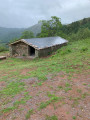
(2) Descend straight ahead, then skirt round Olhain, along the hillside, until you come to a sheepfold.

(3) Head back up to the left, facing the slope, with no real path, before continuing along the hillside on a dirt track to complete the circuit round Olhain until you reach a Y-junction.

(4) Head straight ahead, then take a sharp right-hand bend to join a track suitable for vehicles.

(5) Head down the track to return to the car park (A/D).

Waypoints

  1. S/E : mi 0 - alt. 758 ft - Parking along the road
  2. 1 : mi 0.89 - alt. 1,693 ft - Crossroads
  3. 2 : mi 1.84 - alt. 1,480 ft - Junction below - Fageko Harria
  4. 3 : mi 2.77 - alt. 810 ft - Sheepfolds at the foot of Mont - Olhain
  5. 4 : mi 3.28 - alt. 994 ft - Path on the right
  6. 5 : mi 3.54 - alt. 866 ft - Vehicle track
  7. S/E : mi 3.68 - alt. 758 ft - Parking along the road

Notes

No water sources along the route.

Reviews and comments

3.2 / 5
Based on 4 reviews

Reliability of the description
2.5 / 5
Ease of following the route
2.8 / 5
Route interest
4.3 / 5
Coco64
Coco64

Overall rating : 2.7 / 5

Date of your route : Jun 01, 2026
Reliability of the description : ★★☆☆☆ Disappointing
Ease of following the route : ★★★☆☆ Average
Route interest : ★★★☆☆ Average
Very busy route : No

Hello, I use Visorando for all my hikes and I’ve never been disappointed – it’s always been brilliant. However, on this particular hike, the climb up to the plateau was very good, with lovely scenery, but on the way down, once we reached point 3, there was nothing left – no path, nothing – just inaccessible areas full of brambles. We had to scramble up the mountain to find some sort of path, and it was lucky we’re from the area because, with the houses in the distance, we managed to find our way back to the car.A 3-hour hike – it took us 4½ hours.

Machine-translated

ayout
ayout
• Edited:

Overall rating : 3.7 / 5

Date of your route : Oct 02, 2023
Reliability of the description : ★★★★☆ Good
Ease of following the route : ★★★☆☆ Average
Route interest : ★★★★☆ Good
Very busy route : No

Hello! There’s a slight problem between points 3 and 4: the path is overgrown and has almost disappeared. At the 348-metre pass, it’s best to follow the purple trail, which avoids going round the hillock on which the former Olhain Chapel stands. Otherwise, it’s a lovely walk with beautiful views of the Rhune and the Ibantelli.

Machine-translated

-baban-
-baban-

Overall rating : 2.7 / 5

Date of your route : Oct 09, 2022
Reliability of the description : ★★☆☆☆ Disappointing
Ease of following the route : ★☆☆☆☆ Very disappointing
Route interest : ★★★★★ Very good
Very busy route : No

Hello.
First of all, thank you once again to everyone who takes the time to post walking routes.
As for this route, unfortunately it was disappointing, even frustrating, towards the end, despite the lovely views at the start.
There is indeed an issue at point 3, as mentioned in a previous review.
There’s no marked path or dirt track, of course, but it’s also very difficult to make your way down the hillside to reach a track. It was a huge let-down for us on that October day; it took us nearly an hour to get out of that ordeal, with all the thorns, brambles and ferns – it was a real struggle.
I’d suggest that, once you reach an old sheepfold between points 2 and 3, you turn left and follow the yellow markings for the ‘route des cols’.
Happy hiking to you all.

Machine-translated

Hervé Bignon
Hervé Bignon

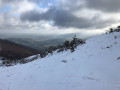
As you can see from the photos, we marked out the route in the snow; this makes it very difficult to see the paths clearly, but I’m delighted that you managed to complete the walk, which offers some lovely views.

Machine-translated

Castelet
Castelet

Overall rating : 3.7 / 5

Date of your route : Feb 02, 2021
Reliability of the description : ★★☆☆☆ Disappointing
Ease of following the route : ★★★★☆ Good
Route interest : ★★★★★ Very good
Very busy route : No

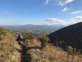
A lovely route offering beautiful views over the Sare plain.
The problem is at point No. 3! It says you have to go up to the left, but no path is clearly visible and there are no markings. We ventured roughly along the mountainside and, by chance, found much further on what looked like a ‘narrow track’, which turned out to be the right one.
It might be safer to do it the other way round...

Machine-translated

Other walks in the area

For more walks, use our search engine .

The GPS track and description are the property of this route's author. Please do not copy them without permission.