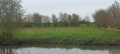
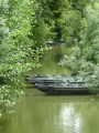
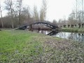
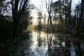
The storks of the Marais de Benet as seen from the Village de la Sèvre

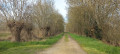
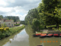
A pleasant and easy circular walk through the Marais de la Sèvre de Benet and along the Sèvre Niortaise. Between mid-February and late July/August, you can spot storks here. In 2025, there are at least thirteen nests along your route. Remember to take a pair of binoculars so you can watch them from a distance without disturbing them. You’ll walk along roads, grassy paths or gravel tracks, through landscapes typical of the Marais Poitevin. In winter, this route may be impassable due to flooding if there are long periods of continuous rain.

Details

71344083
Creation:
Last update:
Last review:
  • Walking
    Activity: Walking
  • ↔
    Distance: 5.09 mi
  • ◔
    Average duration: 2h 20 
  • ▲
    Difficulty: Easy

  • ⚐
    Back to start: Yes
  • ↗
    Ascent: + 7 ft
  • ↘
    Descent: - 7 ft

  • ▲
    Highest point: 16 ft
  • ▼
    Lowest point: 7 ft

Photos

Description of the walk

Park at the picnic area in the Village de la Sèvre (a hamlet in the commune of Le Mazeau).
To get there: from the centre of Le Mazeau, follow signs for “Embarcardère”. The first sign for “Village de la Sèvre” will be visible at the junction near the jetty.
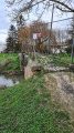
This picnic area is situated near the footbridge spanning the Sèvre Niortaise.

(S/E) Leave the picnic area and, facing the Sèvre Niortaise, turn left onto the Route des Cabannes (the sign is in the hedge).

(1) Ignore the Chemin des Hectares on the left and carry on straight ahead.

(2) At the next crossroads, turn left onto the Chemin du Lancier. After the bend, the road becomes a grassy track down the middle. You can see the first stork’s nest on the route in the fourth field on your right. 

(3) At the crossroads, carry on straight ahead. The ground may be muddy. About 200 m further on, look out for the second stork’s nest in a poplar tree lining the Chemin du Lancier.

(4) At the junction with the gravel path (Chemin du Pavillon) running alongside the ditch on the right bank, turn right. Do not follow the yellow signpost to the left, which marks another walking route. Continue straight on along this gravel path, ignoring the next path on your right, before joining the road. 

(5) Ignore the bridge on the left and the gravel path opposite marked ‘no entry for vehicles except local residents – 900 m’. Continue along the road, turning right. After the road bridge, immediately on the right you’ll see the third stork’s nest, then a fourth 200 m further on the left, just before the bend in the road. 
Once past the bend, at the end of this straight stretch, you’ll find the largest cluster of stork nests – there are nine in total, two more than in 2024. 

(6) Carry on along the road and, at the next junction, head towards the Sèvre de Benet.

(7) Ignore the dead end on the left and carry on along the Route des Cabanes, turning right.

(2) Carry on straight ahead and, following the route in reverse to the one taken on the way there, head for the picnic area (S/E).

Waypoints

  1. S/E : mi 0 - alt. 13 ft - Picnic area
  2. 1 : mi 0.65 - alt. 13 ft - Common junction (out and back) - Sèvre Niortaise (fleuve)
  3. 2 : mi 0.76 - alt. 13 ft - Junction on the circular loop - Sèvre Niortaise (fleuve)
  4. 3 : mi 1.27 - alt. 10 ft - junction
  5. 4 : mi 1.97 - alt. 10 ft - Chemin du Pavillon
  6. 5 : mi 2.53 - alt. 16 ft - Junction of road and path
  7. 6 : mi 3.94 - alt. 10 ft - Towards La Sèvre de Benet
  8. 7 : mi 4.15 - alt. 13 ft - Route des Cabanes - Sèvre Niortaise (fleuve)
  9. S/E : mi 5.09 - alt. 13 ft - Picnic area

Notes

This walk across varied terrain requires suitable footwear.
This route, which presents no navigational difficulties, is not signposted, but may cross other signposted routes. Consequently, it is advisable to follow the instructions in the route description and on the map, whilst also paying attention to the landscape. Distance indications from the starting point, or even the GPS coordinates of waypoints (including the start), can also help the walker find their way.
Hike completed by the author on 20 March 2025.

Worth a visit

Benet.
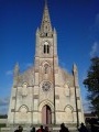
The Church of Saint Eulalie: a masterpiece of Romanesque and later Poitevin Gothic art.

The ‘Circuit des Peux’: a charming walking route lasting around an hour, following the ‘peux’ (a local expression meaning ‘path leading up to’) from the Place du Champ de Foire. Thanks to the information boards dotted along the route, you’ll learn about the history of this small town, with its medieval garden, the remains of the 12th-century castle and the Church of Saint Eulalie.

Reviews and comments

4.5 / 5
Based on 2 reviews

Reliability of the description
5 / 5
Ease of following the route
4.5 / 5
Route interest
4 / 5
User 19377492

Overall rating : 4.7 / 5

Date of your route : Aug 06, 2026
Reliability of the description : ★★★★★ Very good
Ease of following the route : ★★★★★ Very good
Route interest : ★★★★☆ Good
Very busy route : No

An easy walk; the first half is very pleasant, the second half a little less so as it’s mainly along a road
Best done early in the morning if you hope to spot some wildlife and birds

Machine-translated

Marie50
Marie50

Overall rating : 4.3 / 5

Date of your route : Jun 02, 2025
Reliability of the description : ★★★★★ Very good
Ease of following the route : ★★★★☆ Good
Route interest : ★★★★☆ Good
Very busy route : Yes

Interesting circuit up to point 5. After the modified circuit I continued on the farm track instead of taking the road, continuing along the canal and turning left onto the cycle path and after about 800m a short grassy path to rejoin the road and resume the circuit at point 6. We didn't start at the picnic area but parked along the river Sevre before the sentier du lancier.

Machine-translated

Other walks in the area

For more walks, use our search engine .

The GPS track and description are the property of this route's author. Please do not copy them without permission.