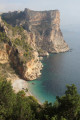
The coves of Benitatxell, from Cala Moraig to Cala Llebeig

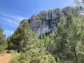
This itinerary combines sightseeing with a walk. Sightseeing because these magnificent coves at the foot of impressive cliffs are very popular with swimmers. A walk because the route described here follows a path halfway up the cliffs, between two of the region’s most famous coves.
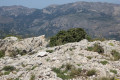
The suggested route leads from the very popular Cala del Moraig to the almost inaccessible Cala Llebeig. The views along the entire route are extraordinary, taking in both the sea and the cliffs.

Details

n°42726255
Creation:
Last update:
Last review:
  • Walking
    Activity: Walking
  • ↔
    Distance: 2.72 mi
  • ◔
    Average duration: 3h 50 
  • ▲
    Difficulty: Easy

  • ⚐
    Back to start: Yes
  • ↗
    Ascent: + 2,976 ft
  • ↘
    Descent: - 2,995 ft

  • ▲
    Highest point: 528 ft
  • ▼
    Lowest point: 0 ft

Photos

Description of the walk

Please note: this is a very popular tourist destination, so much so that Benitatxell Council has decided to restrict access to the beach and the car park. Parking reservations are compulsory from 1 April to 15 October, from 9 am to 7 pm. Without a prior reservation, you will not be allowed in. Reservations can be made on the website www.calamoraig.es and cost €12 per car (2023 figure). There is a bus service running from Benitatxell to Cala Moraig, but the number of services is very limited.
As a hiker, it is therefore strongly advised to avoid this period.

The starting point for this walk is the car park at Cala Moraig in Benitatxell.
To get to this starting point by car, see the ‘Practical Information’ section below.

(S/E) From the car park, walk up the street to the clearly visible information sign and turn left.

(1) Before setting off on the walk proper, take a moment to admire Cala Moraig at your feet – a cove surrounded by cliffs. There is a 300-metre-long beach with gravelly sand.

(2) Turn back.

(1) Then head towards the sign pointing towards Cala Lleiberg, which is the starting point of the walking trail. In fact, there is only one possible route, as you are on the cliff face, so it is impossible to get lost. Follow the white and green markings of the local SL-CV50 trail.
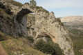
Along the trail, you’ll come across various cave shelters that were once occupied by the village’s fishermen and/or farmers, as well as by smugglers. These caves are built of stone and set against the rock face. They date from the late 19th and early 20th centuries. These caves retain the names of their owners. You will therefore come across, in turn, Cova les Morettes, Cova Domingo de l’Abiar, Cova Pepet del Morret, Cova Toni el Senyalat and Cova del Morro del Bou.

(3) From here, there is a superb view of Cala Llebeig. Up to this point, the path has been pleasant and almost flat. However, from here on, the descent is very steep and over terrain with small, loose stones: you must therefore take care on this section of the route.

(4) At the signpost, turn left.

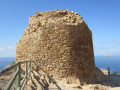
(5) You arrive at Cala Llebeig. There are a few buildings here, including an old police hut used to monitor the smuggling of tobacco, sugar, coffee and weapons.
Take the opportunity to go for a swim.

Return to the starting point by following the same path in the opposite direction (S/E).

Waypoints

  1. S/E : mi 0 - alt. 302 ft - Cala Moraig car park
  2. 1 : mi 0.13 - alt. 276 ft - T-junction. Return to the viewpoint
  3. 2 : mi 0.15 - alt. 259 ft - Viewpoint
  4. 3 : mi 1.26 - alt. 75 ft - Viewpoint
  5. 4 : mi 1.35 - alt. 46 ft - Signpost
  6. 5 : mi 1.39 - alt. 36 ft - Cala Llebeig
  7. S/E : mi 2.72 - alt. 282 ft - Cala Moraig car park

Notes

To drive to the starting point of the walk.
- From Alicante city centre, take the A31 motorway (from Calle Mexico) towards Madrid and, shortly afterwards, take exit 236A towards Benidorm and Valencia.
Continue on the A7 then onto the AP7.
- Take exit 63 towards the N332 Benissa / Teulada / Gata de Gorgos
At the roundabout, take the3rd exit onto the N332 towards Teulada / Gata de Gorgos
At the roundabout, take thefirst exit onto the CV-740 towards Teulada / Moraira / Benitatxell.
At the roundabout, take the2nd exit (in fact, go straight ahead) towards Teulada / CV-740 Benitatxell.
You’ll pass under a bridge and, at the roundabout, take the3rd exit towards Centre Urbà / Benitatxell (CV-740), then immediately take the2nd exit towards Benitatxell (CV-740), Moraira (CV-740) and CV-743. Follow this route on the CV-740 towards Benitatxell.
You’ll enter Benitatxell. Carry on.
Then follow the signs for Cala Moraig.
You’ll eventually arrive at Tra Playa, where there are parking spaces.

Please note: parking reservations are compulsory from 1 April to 15 October, from 9.00 am to 7.00 pm. Without a reservation, you will not be allowed through.

For your information: by car from Alicante, the journey is approximately 95 kilometres and takes around 1 hour 15 minutes.

Worth a visit

Although the walk is relatively easy, it’s best to bring hiking gear, including good walking shoes, and don’t forget your swimming costume.
Be aware of the risk of sunstroke, as the path is always in the open and in direct sunlight. You should therefore carry plenty of water with you.

Reviews and comments

5 / 5
Based on 1 review

Reliability of the description
5 / 5
Ease of following the route
5 / 5
Route interest
5 / 5
rospat
rospat

Overall rating : 5 / 5

Date of your route : Jun 10, 2025
Reliability of the description : ★★★★★ Very good
Ease of following the route : ★★★★★ Very good
Route interest : ★★★★★ Very good
Very busy route : No

Great hike through woods, fields and around ponds.

Machine-translated

Other walks in the area

For more walks, use our search engine .

The GPS track and description are the property of this route's author. Please do not copy them without permission.