The vineyard huts around Vauchrétien

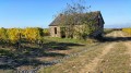
There are many vineyard huts in this region. The interiors are simple, with whitewashed walls and earthen floors. The fireplace was used for roasting chestnuts. The huts also housed the winegrowers’ tools, and in summer the winegrowers would take a nap there (known as a ‘marienne’ in Anjou). There are several vineyard huts along the route.

Details

396648
Creation:
Last update:
Last review:
  • Walking
    Activity: Walking
  • ↔
    Distance: 3.69 mi
  • ◔
    Average duration: 1h 45 
  • ▲
    Difficulty: Easy

  • ⚐
    Back to start: Yes
  • ↗
    Ascent: + 98 ft
  • ↘
    Descent: - 102 ft

  • ▲
    Highest point: 249 ft
  • ▼
    Lowest point: 157 ft
  • ⚐ Country: France
  • ⚐ City: Vauchrétien (49320)
  • ⚑
    Start/End: N 47.334156° / W 0.474864°
  • ❏
    IGN map(s): Ref. 1522ET, 1523SB
  • Hour-by-hour weather

Photos

Description of the walk

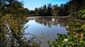
Park in the car park on Route de Brissac, near a pond.

(S/E) Walk alongside the first pond, turn right to pass between the two ponds and walk alongside the next one. Then turn right onto Chemin des Forges.

(1) A little further up, turn left onto Chemin de Bois Renault. Follow this path through the vineyards. In the distance, you’ll catch a glimpse of Brissac Castle. Pass through Bois Renault and continue along this path.

(2) Head slightly to the left to descend towards the valley floor, ignoring the paths on either side
When you reach the D55, you can take a small tarmac path on the right (for cyclists) which means you don’t have to walk on the road.

(3) Further up, cross the road to enter the woods heading towards Parc Martineau. At the edge of the woods, turn right towards Martignolles and join the D130. Turn left. Here too, a path allows you to avoid walking on the road. Simply follow the vineyards.

(4) You’ll spot a charming vineyard hut on your left. Take a short detour to have a closer look. Retrace your steps and follow the D130 to the left.

(5) When the road bends, leave it on the left. Walk alongside an old stone wall enclosing the vineyards. You’ll then rejoin the road at the 71-metre elevation point. Follow it for 3 or 400 metres before reaching a crossroads.

(6) Follow the wide dirt track to the left, which will take you back to the starting point (S/E).

Waypoints

  1. S/E : mi 0 - alt. 217 ft - Car park near the pond
  2. 1 : mi 0.35 - alt. 249 ft - Turn left towards Bois Renault
  3. 2 : mi 0.89 - alt. 226 ft - Turn left into the vineyard
  4. 3 : mi 1.63 - alt. 217 ft - Crossing the D55
  5. 4 : mi 2.13 - alt. 223 ft - Round trip to see the vineyard hut
  6. 5 : mi 2.37 - alt. 233 ft - Old stone wall
  7. 6 : mi 3.15 - alt. 236 ft - Dirt track to the left
  8. S/E : mi 3.69 - alt. 217 ft - Car park near the pond

Notes

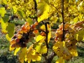
This walk can be done all year round but is particularly recommended in autumn, when the vines take on magnificent russet hues.

Worth a visit

Reviews and comments

3.6 / 5
Based on 4 reviews

Reliability of the description
3.5 / 5
Ease of following the route
3.3 / 5
Route interest
4 / 5
Kamdel
Kamdel

Overall rating : 1.7 / 5

Date of your route : Jul 22, 2024
Reliability of the description : ★☆☆☆☆ Very disappointing
Ease of following the route : ★☆☆☆☆ Very disappointing
Route interest : ★★★☆☆ Average
Very busy route : No

It’s impossible not to get lost with these directions!

Machine-translated

amerisier
amerisier

Overall rating : 4.3 / 5

Date of your route : Jul 31, 2021
Reliability of the description : ★★★★☆ Good
Ease of following the route : ★★★★☆ Good
Route interest : ★★★★★ Very good
Very busy route : No

All went well up to point 5. There are several stone walls running alongside the vineyards, so we ended up making several unnecessary trips back and forth as we walked past two others before finding the right one. Perhaps you could specify in point 5 that the wall should be on your left and that you’re heading away from the D130. That would avoid any confusion. I would also have pointed out that you rejoin the road by heading left at the ‘Cabane de la Jambe au Moine’ to have a more visual landmark than the 71-metre elevation point.

Machine-translated

caleides49
caleides49

Overall rating : 3.7 / 5

Date of your route : May 18, 2020
Reliability of the description : ★★★★☆ Good
Ease of following the route : ★★★☆☆ Average
Route interest : ★★★★☆ Good
Very busy route : No

Disappointed by the signposting at the end of the route; too much uncertainty and a lack of reliable directions

Machine-translated

lau bry
lau bry

Brilliant! Thanks!

Machine-translated

henri57
henri57 ★

Hello,

nothing to do with the 400 metres mentioned

Problem sorted.

See you soon

Machine-translated

lau bry
lau bry

I was looking for a hike not far from home with some elevation gain, so this one seemed just the ticket, but after downloading the GPX track onto my Garmin, it showed 33 metres of elevation gain!!! That’s nothing like the 400 metres advertised...

Machine-translated

oural4902
oural4902
• Edited:

Overall rating : 4.7 / 5

Date of your route : Aug 21, 2017
Reliability of the description : ★★★★★ Very good
Ease of following the route : ★★★★★ Very good
Route interest : ★★★★☆ Good

This walk is pleasant; the section through the vineyards is interesting, although the route along the D55 – even on the tarmac cycle path – isn’t ideal. However, the distance is short, and there are plenty of picturesque vineyard huts. Please note that the starting point is at the Courtilliers car park and the ponds of the same name.

Machine-translated

Other walks in the area

For more walks, use our search engine .

The GPS track and description are the property of this route's author. Please do not copy them without permission.