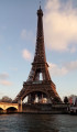
The banks and quays of the Seine in Paris

A journey across Paris from east to west and then from west to east along the Seine, almost entirely on cycle paths or lanes. Both banks offer complementary views and numerous vantage points over the capital’s main monuments.

Details

14578786
Creation:
Last update:
Last review:
  • Touring/Gravel
    Activity: Touring/Gravel
  • ↔
    Distance: 16.83 mi
  • ◔
    Duration according to the author: 1.5 hrs 
  • ▲
    Difficulty: Easy

  • ⚐
    Back to start: Yes
  • ↗
    Ascent: + 66 ft
  • ↘
    Descent: - 69 ft

  • ▲
    Highest point: 121 ft
  • ▼
    Lowest point: 85 ft
  • ⚐ Country: France
  • ⚐ City: Paris (75000)
  • ⚑
    Start/End: N 48.844258° / E 2.364854°
  • ❏
    IGN map(s): Ref. 2314OT

  • ◶
    Type of surface:
  •  
     100% Road
  • Hour-by-hour weather

Photos

Description of the route

Start at the Pont d’Austerlitz, on the left bank (Place Valhubert). See access options and other possible starting points in the practical information section.

(S/E) Cross the square, keeping the bridge on your right, and walk briefly along the Quai Claude Bernard. Cross a slip road, then turn right and head downhill towards the Odéon. Make your way to the banks of the Seine and wind your way through the Jardin Tino Rossi.

(1) Keep to the right, as close to the Seine as possible, and pass under the Pont de Sully, then under the Pont de la Tournelle (statue of Sainte-Geneviève).

(2) Just before the Pont de l’Archevêché, turn left, leave the riverbank, and climb the ramp leading to the Quai de la Tournelle.

(3) Turn right onto a cycle path that is physically separated from the Quai de la Tournelle on the left-hand side. Go straight on at the successive junctions near the Pont de l’Archevêché, the Pont au Double and the Petit Pont.

(4) At the junction by the Pont Saint-Michel (note the fountain on the left), go straight on. Continue along the clearly marked cycle path, passing the Pont Neuf, the Pont du Carrousel and the Pont Royal in turn.

(5) At the corner of the Musée d’Orsay, leave the quayside and head down the ramp on the right to the banks of the Seine. Follow the river and pass under several bridges or footbridges in turn: Léopold Sédar-Senghor, Concorde, Alexandre III, Invalides and Alma (statue of the Zouave on the opposite pier).

(6) Just after the Pont de l’Alma, opposite the entrance to the Port de la Bourdonnais (closed to the public), turn left and head back up to the level of the Quai Branly. Take the marked cycle path along the edge of the quayside and pass under the Pont d’Iéna (Eiffel Tower). Return to the level of the quayside and continue to the Pont de Bir-Hakeim.

(7) Carry on straight ahead along the cycle path. Pass the Pont de Grenelle and then the Pont Mirabeau (Javel station). Continue straight ahead along the Quai de Javel.

(8) Opposite the entrance to Parc André Citroën (no cycling allowed), turn left onto the street and then immediately right into Rue de la Montagne d’Espérou (cycle lane marked on the ground). Ride alongside Parc André Citroën.

(9) You’ll come out onto Rue Balard; follow it to the right for about 50 metres. At the traffic lights, turn left then right onto a cycle lane, and wind your way along the foot of the blocks of flats.

(10) Cross Rue Saint-Charles and continue straight ahead along the marked cycle lane into Rue Varet. Turn left, then right along this street.

(11) At the end, turn right onto Rue de Lourmel. At the junction, turn left, still staying on Rue de Lourmel. Cross Rue Vasco de Gama and carry on straight ahead.

(12) At the end, cross Rue Leblanc and turn left onto the cycle path running parallel to it. After about fifty metres, turn right and go under the bridge of the old Petite Ceinture railway line. Cross Boulevard Victor and the tram tracks, then turn left onto the cycle lane running parallel to the boulevard.

(13) At the traffic lights, turn right and cycle along Rue de la Porte d’Issy (still on the cycle lane). Pass under the Boulevard Périphérique and immediately turn right onto the cycle lane on the right-hand pavement of Rue Louis Armand.

(14) At the traffic lights, turn left to cross the road and the tram tracks. Then turn right and cycle alongside a swimming centre to go round the junction on the left.

(15) At the far end of the junction, cross Rue Henry Farman then take the narrow, clearly marked cycle path between this street and the tram tracks. Pass a sign indicating the exit from Paris.

(16) Cross Rue Bara on the right-hand side and continue straight on along Rue Camille Desmoulins (the cycle path runs on the left-hand side before returning to the right-hand side shortly afterwards). Cross Boulevard Gallieni and rejoin the cycle lane on the right-hand side. At the traffic lights, turn right towards Issy-Val-de-Seine station.

(17) Carry on straight ahead, passing under the RER bridge and then under the tram bridge. At the traffic lights, cross Quai du Président Roosevelt and take the cycle lane on the right-hand pavement of the Pont d’Issy.

(18) As you come off the bridge, turn right, head downhill and keep to the right towards Paris city centre. At the bottom, you’ll find a clearly marked cycle path on the right-hand side. At the traffic lights, go straight on and pass under the Boulevard Périphérique bridge.

(19) After about 500 m, turn right onto the Voie Georges Pompidou, towards the Concorde, and pass under the Garigliano Bridge. Stay on the cycle path, as close as possible to the Seine, and pass successively under the Mirabeau Bridge, the Grenelle Bridge and a railway bridge.

(20) Pass under the Pont de Bir-Hakeim and head back up to the level of the quayside. The cycle lane is now on the right-hand pavement. Pass the Pont d’Iéna, the Passerelle Debilly and the Pont de l’Alma in turn. Continue along the cycle lane alongside the Cours AlbertIer. Pass the equestrian statue of AlbertI and turn right to reach the Pont de la Concorde.

(21) Turn left towards the Place de la Concorde, then immediately right towards the corner of the Jardin des Tuileries. Take what used to be the left-hand lane of the Quai des Tuileries, now clearly separated from motor traffic. Cycle alongside the Jardin des Tuileries on your left.

(22) Enter the Tunnel des Tuileries, a former road tunnel now reserved for cyclists and pedestrians (remember to switch on your lights). Cycle through the tunnel for about 900 m.

(23) Exit the tunnel (remember to switch off your lights) and continue along the banks of the Seine on a wide tarmac path (the former riverside track). Pass under numerous bridges and note, on your right, the Île de la Cité with Notre-Dame, followed by the Île Saint-Louis.

(24) Take the Henri IV Tunnel, which is much shorter than the Tuileries Tunnel. Then head back up to the level of the quayside and continue along a clearly marked cycle path. Go downhill to pass under the Pont d’Austerlitz (road bridge), go back up on the other side and pass under the Viaduc d’Austerlitz (railway viaduct).

(25) Immediately afterwards, turn right to go under the Charles de Gaulle Bridge. Continue along the Seine (Port de la Rapée) and head back up to the level of the Bercy Bridge. Cross at the traffic lights using the cycle lane and continue along the Quai de Bercy (on the higher level; the Port de Bercy is not accessible). Go under the Simone de Beauvoir Footbridge.

(26) Take the Pont de Tolbiac on the right to cross the Seine. As you come off the bridge, turn right onto Quai François Mauriac. After about a hundred metres, turn right and head down towards the banks of the Seine. Pass under the Simone de Beauvoir Footbridge again. After the Joséphine Baker swimming pool, turn right to stay as close as possible to the Seine.

(27) Pass under the Pont de Bercy. Further on, the riverbank becomes covered. Pass under the Pont Charles de Gaulle and then under the Viaduc d’Austerlitz.

(28) After about a hundred metres and before the Pont d’Austeritz, turn sharply left and climb the ramp leading to the Quai d’Austerlitz. Follow the quay to the right to quickly reach Place Valhubert and the Pont d’Austerlitz (S/E).

Waypoints

  1. S/E : mi 0 - alt. 121 ft - Place Valhubert - Pont d'Austerlitz
  2. 1 : mi 0.44 - alt. 98 ft - Fork in the road towards the - Pont de Sully (Paris)
  3. 2 : mi 0.77 - alt. 95 ft - Junction before the - Pont de l'Archevêché
  4. 3 : mi 0.83 - alt. 112 ft - Quai de la Tournelle – Cycle path
  5. 4 : mi 1.29 - alt. 115 ft - Pont Saint-Michel
  6. 5 : mi 2.16 - alt. 112 ft - Musée d'Orsay
  7. 6 : mi 3.45 - alt. 98 ft - Pont de l'Alma
  8. 7 : mi 4.27 - alt. 121 ft - Left bank - Pont de Bir-Hakeim
  9. 8 : mi 5.29 - alt. 105 ft - Parc André Citroën
  10. 9 : mi 5.56 - alt. 105 ft - Rue Balard
  11. 10 : mi 5.69 - alt. 105 ft - Rue Varet
  12. 11 : mi 5.88 - alt. 102 ft - Rue de Lourmel
  13. 12 : mi 6.15 - alt. 102 ft - Cycle path – Former Petite Ceinture railway line
  14. 13 : mi 6.39 - alt. 108 ft - Porte d’Issy
  15. 14 : mi 6.75 - alt. 105 ft - Crossroads
  16. 15 : mi 6.83 - alt. 105 ft - Cycle path – Rue Henry Farman
  17. 16 : mi 7.25 - alt. 98 ft - Rue Henry Farman x Rue Bara
  18. 17 : mi 7.6 - alt. 102 ft - Gare d'Issy-Val de Seine
  19. 18 : mi 7.86 - alt. 115 ft - Right bank - Pont d'Issy
  20. 19 : mi 8.47 - alt. 105 ft - Voie Georges Pompidou - Seine [la]
  21. 20 : mi 10.06 - alt. 92 ft - Right bank - Pont de Bir-Hakeim
  22. 21 : mi 11.83 - alt. 112 ft - Right bank - Pont de la Concorde
  23. 22 : mi 12.3 - alt. 102 ft - Introduction - Tunnel des Tuileries
  24. 23 : mi 12.84 - alt. 98 ft - Ride - Tunnel des Tuileries
  25. 24 : mi 14.09 - alt. 102 ft - Henri IV Tunnel
  26. 25 : mi 14.58 - alt. 105 ft - Viaduc d'Austerlitz
  27. 26 : mi 15.53 - alt. 118 ft - Pont de Tolbiac
  28. 27 : mi 16.11 - alt. 105 ft - Pont de Bercy
  29. 28 : mi 16.7 - alt. 102 ft - Junction
  30. S/E : mi 16.83 - alt. 121 ft - Place Valhubert - Pont d'Austerlitz

Notes

Possible starting points:
The suggested starting point is the Pont d’Austerlitz. Other starting points are, of course, possible, depending on where you live. In particular, it is easy to join the route at any point along the quays that are elevated above the Seine. However, on the riverbanks at river level, access by bike (without stairs) is only possible at certain points: (S/E), (5), (19), (21) and (27).

Access:
For those who do not live near the route, access is possible via the RER C line, which runs through Paris along the left bank of the Seine. In particular, at either end of the route are Austerlitz station (S/E) and Issy-Val-de-Seine station (17). The stations in between can also be used. N.B. From Monday to Friday, you are only permitted to take a bicycle on the RER during the following times: before 06.30, between 09.30 and 16.30, and after 19.30.

Alternatives:
The numerous bridges crossing the Seine in Paris allow you to take shortcuts and create circular routes of varying lengths. Please note, however, that several bridges are not suitable for this as the route passes underneath them. There are two bridges in particular that allow you to take shortcuts at the western and eastern ends of the route, respectively:
- Bir-Hakeim Bridge, from the left bank (7) to the right bank (20).
- Charles de Gaulle Bridge, from the right bank, shortly afterwards (25), to the left bank (then follow the Quai d’Austerlitz to the right, without returning to the riverbank).

Type of routes used:
The route follows almost exclusively cycle paths or cycle lanes, which are marked and designated as such on site:
- Cycle paths physically separated from motor traffic and footpaths.
- Cycle lanes running alongside motor traffic, which motorists are expected to respect. Some of these routes run along a one-way street closed to motor traffic and therefore go against the flow of traffic. In all cases, caution is advised.
- Cycle lanes on pavements or along the banks of the Seine, alongside footpaths, which cyclists are expected to use.
The surface, which is always hard-surfaced, is suitable for all types of bicycle.

Bars, restaurants and shops can be found at various points along the route.

A detailed map is useful (at the very least, the one accompanying this description).

A cycle route, parts of which the author has cycled several times, and which was completed in its entirety on 8 September 2021.

Worth a visit

Throughout the route, there is a pleasant ride along the Seine with views of many of Paris’s monuments.

From the Pont d’Austerlitz (S/E) to the Pont Saint-Michel (4):
- The Jardin des Plantes, which is part of the National Museum of Natural History.
- The Jardin Tino Rossi, featuring modern sculptures.
- Notre-Dame Cathedral, currently undergoing restoration following the fire in April 2019.

From the Pont Saint-Michel (4) to the Pont de l’Alma (6):
- The Louvre Museum.
- Musée d’Orsay (the former Orléans railway station).
- Grand Palais.
- The Zouave on the Pont de l’Alma (one of the four statues that once adorned the piers of the original bridge).

From the Pont de l’Alma (6) to the Parc André Citroën (8):
- Trocadéro Palace.
- Eiffel Tower.
- Replica of the Statue of Liberty.

From Parc André Citroën (8) to the Pont d’Issy (18):
- André Citroën Park (get off the bike to explore).
- Suzanne Lenglen Park (15).

From the Pont d’Issy (18) to the Pont de la Concorde (21):
- Views of the Front de Seine towers and the Eiffel Tower on the opposite bank.
- Trocédéro Palace.
- Cours AlbertIer.
- Grand Palais.

From the Pont de la Concorde (21) to the Viaduc d’Austerlitz (25):
- The Obelisk of the Concorde (13th century BC) (25), a gift from Egypt to France in the early 19th century. Standing 23 metres tall, its hieroglyphs celebrate the pharaoh Ramses II.
- The Tuileries Gardens, between (21) and (22).
- Views of the Île de la Cité and the Île Saint-Louis, between (23) and (24).

From the Austerlitz Viaduct (25) to the Pont d’Austerlitz (S/E):
- Bercy Park.
- François Mitterrand Library.

Reviews and comments

5 / 5
Based on 2 reviews

Reliability of the description
5 / 5
Ease of following the route
5 / 5
Route interest
5 / 5
gaston16
gaston16

Overall rating : 5 / 5

Date of your route : Nov 30, 2024
Reliability of the description : ★★★★★ Very good
Ease of following the route : ★★★★★ Very good
Route interest : ★★★★★ Very good
Very busy route : Yes

A great way to explore Paris. I highly recommend it.

Machine-translated

jornell
jornell

Overall rating : 5 / 5

Date of your route : Aug 21, 2023
Reliability of the description : ★★★★★ Very good
Ease of following the route : ★★★★★ Very good
Route interest : ★★★★★ Very good
Very busy route : Yes

A well-written description that’s easy to follow.
Had a lovely day.

Machine-translated

Other walks in the area

For more walks, use our search engine .

The GPS track and description are the property of this route's author. Please do not copy them without permission.