Les Belles Vues

A lovely little walk to enjoy with the family and the dog.
Moderator’s note added on 3 October 2021: the walk is currently unavailable due to a private property issue

Details

601345
Creation:
Last update:
Last review:
  • Walking
    Activity: Walking
  • ↔
    Distance: 3.94 mi
  • ◔
    Average duration: 2h 05 
  • ▲
    Difficulty: Easy

  • ⚐
    Back to start: Yes
  • ↗
    Ascent: + 341 ft
  • ↘
    Descent: - 338 ft

  • ▲
    Highest point: 469 ft
  • ▼
    Lowest point: 184 ft
  • ⚐ Country: France
  • ⚐ City: Crouy (02880)
  • ⚑
    Start/End: N 49.400655° / E 3.368203°
  • ❏
    IGN map(s): Ref. 2611O
  • Hour-by-hour weather

Description of the walk

Park your car at the start of the path or in the car park at Crouy cemetery, just before the bridge.

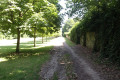
(S/E) Take the path through the gardens.

(1) Take the path branching off to the right, as if you carry on straight ahead you’ll reach a dead end (Mur des Corbeaux). As you climb up to your right, you’ll see the Beauchamps sugar factory.

(2) Turn left onto the path that climbs for no more than 1 km. Just before the old mast, head into the forest, where you’ll see a large pit where, in the past, beetroot was transported to the sugar factory by minecarts. If you go a little further, you’ll see the remains of an old staircase that led down to the village. Retrace your steps.

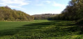
(3) After the climb, turn onto the path on your right which runs between the woodland and the field.

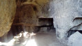
(4) You should spot an old building, which was actually a changing room for a football ground in days gone by. Even more surprisingly, there used to be some rather old-fashioned houses here. Take the path that goes round the ruined house to reach a crossroads. Take the path that goes uphill. Take the time to head off to your left towards the cliff; just before the descent, there’s a cave used during the war (when I went on this walk, there was a burnt-out car inside the cave). Don’t go inside as there’s a risk of rockfalls, but you can see the inscriptions.

(5) After the descent, you’ll come to a small spring. If you enjoyed the first cave, cross to the other side of the stream. Just to the right of the small building, follow a narrow path through the trees to reach a second cave. Retrace your steps.
Take the path opposite if you’re returning from the cave, or turn right if you’re continuing the descent.

(6) You’ll arrive at the foot of the church in Bucy-le-Long. Take the path leading down to your right; there’s a railing to hold on to if it’s slippery. Walk through the grass and, when you reach the end, take the path leading uphill to your right. Carry on until you reach a telecoms mast.

(7) Once you reach the mast, head down towards the road. Turn right towards Crouy. If you look out for them before the descent towards Crouy, there are two small concrete blocks on the left-hand side of the road; these are the famous posts that were used for the system of transporting sugar beet to the sugar factory (S/E).


Waypoints

  1. S/E : mi 0 - alt. 197 ft - Car park at the start
  2. 1 : mi 0.11 - alt. 210 ft - Crossroads
  3. 2 : mi 0.26 - alt. 292 ft - Crossroads
  4. 3 : mi 0.65 - alt. 459 ft - Crossroads
  5. 4 : mi 0.94 - alt. 449 ft - Ruined house
  6. 5 : mi 1.89 - alt. 364 ft - Source
  7. 6 : mi 2.54 - alt. 246 ft - Church
  8. 7 : mi 3.03 - alt. 276 ft - Antenna
  9. S/E : mi 3.94 - alt. 197 ft - Car park at the finish

Notes

Most of the route is under the cover of trees, except for the final section, so do take a bottle of water with you. The spring water is not safe to drink.

Wear sturdy shoes or a good pair of trainers.

There is a discrepancy between the IGN route and this route in the Belles Vues section. This route is correct; the IGN map is incorrect.

Worth a visit

You can visit Bucy-Le-Long, which is a rather unusual village.

Reviews and comments

3.4 / 5
Based on 5 reviews

Reliability of the description
3.4 / 5
Ease of following the route
3.4 / 5
Route interest
3.5 / 5
User 25329542

Overall rating : 3.7 / 5

Date of your route : May 19, 2025
Reliability of the description : ★★★★☆ Good
Ease of following the route : ★★★☆☆ Average
Route interest : ★★★★☆ Good
Very busy route : No

At first, the signposting leaves something to be desired

Machine-translated

Nath02
Nath02

Overall rating : 3 / 5

Date of your route : Oct 03, 2021
Reliability of the description : ★★★★☆ Good
Ease of following the route : ★★★★☆ Good
Route interest : ★☆☆☆☆ Very disappointing
Very busy route : No

A walk we’ve done before with our dogs. Unfortunately, today we came across the landowner (shortly after point 4 and up to point 6). It came as a surprise, as we didn’t realise we’d be crossing private property. The landowner was furious, so we headed back along the road. So be warned: this is a walk where you’re not welcome!

Machine-translated

Chachadefleury
Chachadefleury

Overall rating : 3.7 / 5

Date of your route : May 15, 2020
Reliability of the description : ★★★☆☆ Average
Ease of following the route : ★★★★☆ Good
Route interest : ★★★★☆ Good
Very busy route : No

We only managed to walk 2 km. There were loads of trees lying on the ground and we had to turn back because the path was completely blocked and flooded. Yet it hasn’t rained for over a month. We also heard several gunshots. Probably a cannon to scare the crows away. But for the dog, it was a nightmare.
Otherwise, we relied on previous comments to make sure we didn’t take the wrong path, because it’s true that it’s not easy to work out where to go just from the description.

Machine-translated

houang
houang

Overall rating : 4.3 / 5

Date of your route : Jun 11, 2018
Reliability of the description : ★★★★☆ Good
Ease of following the route : ★★★★☆ Good
Route interest : ★★★★★ Very good

Hello,

Thank you for organising the walk on 10 June. We enjoyed discovering some lovely spots along the way.
Please note at the start that you need to go under the road bridge when you’re parked opposite the cemetery.
At the remains of the stadium changing rooms, the sign says to go round, which is confusing as the path goes uphill.
It takes a fair while to reach the cave.
A pleasant return journey via Bucy-le-Long

Thank you

Machine-translated

gazok54
gazok54 ★

Thank you, 74230rando
Although the map clearly shows the location of the cemetery and the path on the other side of the RN2, it would be helpful to indicate where you’re coming from. Let’s ask the author to provide a few more details about this starting point, as it’s essential to pinpoint its exact location in order to fully enjoy the walk.
As for the distances, if you look closely at the route description and the map, you’ll see that numbered waypoints (WPTs) are marked on it and the distances between each one are clearly indicated.
Enjoy your future hikes.

Machine-translated

74230rando
74230rando

Overall rating : 2 / 5

Date of your route : Feb 18, 2018
Reliability of the description : ★★☆☆☆ Disappointing
Ease of following the route : ★★☆☆☆ Disappointing
Route interest : Not used / Not applicable

Unfortunately, the start of the description is inadequate. For a start, the instruction to ‘park before the bridge’ is ambiguous! It depends on whether you’re coming from Crouy or Laon! It’s difficult to find the first path ‘on the left’… Some approximate distances would be helpful. As a result, we only managed to complete parts of this route.

Machine-translated

Other walks in the area

For more walks, use our search engine .

The GPS track and description are the property of this route's author. Please do not copy them without permission.