


Refine your search for walks in Le Voua Bénit
Le Voua Bénit walks


 Les Vouas du Lyaud
 Visorando Member
 2.89 mi
 +187 ft
 -187 ft
 1h 30
 Easy
 Departure from Lyaud (Haute-Savoie)
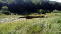
The vouas are ponds that formed in depressions created by the retreat of the Rhône glacier at the end of the last ice age (around 10,000 years ago). This short hike takes you to two of these ponds and through some undergrowth. The route includes several circular loops, offering a number of possible variations.
Walks near Le Voua Bénit
From Bernex to Les Chalets de Bise
8.24 mi
+4,633 ft
-2,795 ft
7h 50
 Very difficult
Departure from Bernex (Haute-Savoie)
After a climb through the forest to wake up our muscles, we leave the mountain pastures of the Bas-Chablais Pre-Alps behind us. The route runs alongside several lakes and offers panoramic views stretching from the Jura mountains to the Mont Blanc massif before plunging down below the Cornettes de Bise.
From Lugrin to Meillerie via the hamlet of Les Combes
 4.50 mi
+1,115 ft
-1,112 ft
3h 00
 Moderate
Departure from Lugrin (Haute-Savoie)
A linear hike, which requires careful planning, connecting two landing stages on Lake Geneva at a higher altitude. An often shaded route that nevertheless offers beautiful views of the lake. Oratories, chapels and churches are also along the way.
Léman footbridge from Nernier to the port of Tougues in Chens-sur-Léman
 3.94 mi
+10 ft
-10 ft
1h 50
Moderate
Departure from Nernier (Haute-Savoie)
A public footpath along the lake shore, the Léman footpath winds its way between beaches, reed beds, boat launches and small ports on one side and summer villas on the other, offering beautiful lake views and the chance to discover these dream homes. It can also be done in the opposite direction (from the Port of Tougues). Please note some guidelines for proper use in the practical information section.
Moderator's note added on 18/10/2021 A section of the trail is closed (temporarily?). See the notices at the bottom of this page.
Graydon from the cable car
 Tourist office4.58 mi
+171 ft
-2,018 ft
2h 15
Moderate
Departure from Saint-Jean-d'Aulps (Haute-Savoie)
Reach the Graydon mountain pasture and its chapel by first taking the Roc d'Enfer cable car. You will then find yourself in a peaceful environment, surrounded by gentians and grazing cows, with Mont Blanc as a backdrop... The Graydon mountain pasture stretches out at the foot of the majestic Roc d'Enfer, where cows and goats graze peacefully on the lush grass around the small chapel surrounded by a magnificent valley.
From Bise to Lake Fontaine via Ubine
5.35 mi
+1,742 ft
-2,293 ft
4h 00
Moderate
Departure from La Chapelle-d'Abondance (Haute-Savoie)
If you want to discover the mountains in all their forms, both mineral and human, take this challenging route.
You are in a protected area! See the regulations in the practical information section.
From the Chalets de Bise to the Trébentaz Refuge
 8.20 mi
+3,924 ft
-2,740 ft
7h 10
 Difficult
Departure from La Chapelle-d'Abondance (Haute-Savoie)
This second stage continues the traverse of the Chablais. The route winds through the beautiful Abondance valley amidst magnificent, tranquil scenery. From the Chalet de Bise, there is a steep climb up to the Pas de la Bosse. From the pass, the path descends to the chalets of Chevenne, then follows the Sechet stream, continuing the descent along the right bank to the Chapelle d’Abondance. It runs alongside the Thoules stream and then the Dranse, which it leaves at the hamlet of Le Moulin, before climbing towards Sur Bayard to the Chalet des Crottes. From there, it is best to leave the main GR®5 route and, via a western path, follow the detour leading to the Refuge de Trébentaz, as the Refuge de la Haute Bise – shown on the IGN map – no longer offers accommodation.