Country:

 City:


Access by car:
- from Colmar: take the D83 towards Thann. Turn right at the first roundabout. After 1 km, take the first departmental road on the left. At the roundabout, go straight ahead. Drive past the secondary school and then the police station; at the bend, carry on straight ahead, ignoring the main road branching off to the right. Drive past the Rote Rain memorial and park in the Gros Chête car park.
- From Mulhouse: take the D430 towards Guebwiller. Take exit No. 3 and turn left towards Soultz. Pass under the D83 and turn left at the end of the street, then take the first right. Carry on to the roundabout. Pass the secondary school and then the police station; at the bend, carry on straight ahead, ignoring the main road branching off to the right. Pass the Rote Rain memorial and park in the Gros Chête car park.
No signposting
Blue Cross signposting
(S/E) From the car park, take the track starting to the left of the access road to a hotel. Ignore all junctions with the fitness trail and other paths until you reach the second bend in the track. After the second bend, continue along this track. Ignore a path leading uphill to the right and then two others to the left to reach a crossroads at a pass.
(1) Carry straight on, ignoring a track leading down to the left, until you reach another junction.
Yellow Disc markings
(2) Turn left onto a downhill path. Turn left again onto a path which then veers right towards the road. Ignore the grassy track heading straight ahead and reach the road.
(3) Take the path leading downhill at the bend. Cross several streams and rejoin the same road further down.
(4) Head right, then take the first track on the left at the Zimmermann Cross. Ignore a path on the left leading too early to the Vieil Armand and stay on the track until the next junction.
(5) Turn right towards the Abri Baratin. Begin a steep climb up to the shelter. Cross a forest track, then turn left at the next junction. During the climb, enjoy the superb views of the Vieil Armand and the Alsatian plain. Reach the Abri Baratin after a good, strenuous climb.
(6) Continue along the path to the forest track. Go straight on and turn left at the next junction to reach the Sicurani Chapel.
(7) Take in the views, then turn right towards Col Amic and carry on to the next junction.
Blue Triangle signposting
Take the path leading uphill to the right. When you reach the track, first turn left then right to rejoin the path and reach the ridge. Once on the ridge, turn left to reach a track.
Yellow Triangle markings
(8) Carry on straight ahead. Further on, ignore a grassy track branching off to the left and stay on the ridge until you reach the path leading down to the road.
(9) Keep to the left. Continue to the junction at Freundstein Castle. Then turn right towards the castle up a steep slope.
(10) Reach the castle. Take care when climbing the ruins to enjoy a magnificent view of the surrounding area. Walk past the foot of the ruins to join a path.
Yellow Ring markings
Turn left onto this path to reach a pass.
Red Disc markings
(11) Turn left onto the track, then continue straight on along it until you reach a Y-junction.
(12) Ignore a track coming from the right. Then carry on straight ahead at the next junction until you reach a crossroads.
(13) Continue along the path down to the left to quickly reach a second junction.
Blue Disc markings
Keep to the right and begin the ascent to Vieil Armand. Continue to La Roche Fendue and its viewpoint.
(14) From the viewpoint, take the path to the left. After a flat section, start the climb via a series of hairpin bends up to the Roche Mégard junction.
Blue Ring Markings
(15) Take the path on the left and, at the next junction, turn left towards the Roche Sermet.
Red Ring markings
(16) Then head straight on at the next five junctions until you reach the summit cross.
(17) From the cross, take the path that descends eastwards and slightly to the left, with a view over the plain opposite. Continue straight on at the first junction. Turn left at the next three junctions, then right at the fourth, passing close to a shelter. From here, stay on the descending path all the way to the cross and its viewpoint.
Take the path that goes round the viewpoint to the right. You’ll come to a war memorial.
Signpost: White Rectangle crossed out
(18) Continue down the path. Keep to the right straight away to reach a star-shaped junction.
(19) Take the second path on the left and continue to the second junction.
No signposting
(20) Head straight on and then continue straight ahead at every junction until you reach the forest road. Turn right onto this road to reach the Cantine Zeller.
Signposted with a white-barred rectangle
(21) Turn sharply left. Immediately afterwards, ignore a track coming from the right. Take the next path on the right to reach a second track.
(22) Cut across this track. Do the same for the next one by taking the path opposite. Further on, the path turns into a wide track. At the junction with the next track, cut across the bend using a shortcut.
(23) Carry on straight ahead along the signposted path. From here, continue straight on along the path, going downhill, until you reach the cross on the left.
(24) Carry on straight ahead to Hueheim and the stream crossing. Take the first junction on the right to quickly reach a second one.
Unmarked
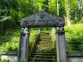
(25) Turn left towards the Rote Rain Memorial.
(26) Take a moment to enjoy the site, then turn left onto the road back to the starting point (S/E).

 Visorando Member

 Easy


 Moderate
 Tourist office