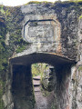
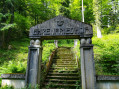
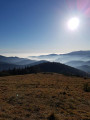
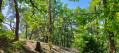
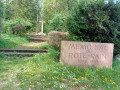
The remains of Vieil Armand as seen from the Gros Chêne

A long walk with a relatively gentle gradient, but one that is nevertheless recommended for
hikers who are reasonably experienced walkers. History enthusiasts will be delighted by the walk across the Vieil Armand or Hartmannswillerkopf battlefield and by discovering the many monuments linked to the history of the First World War.

Details

45563503
Creation:
Last update:
Last review:
  • Walking
    Activity: Walking
  • ↔
    Distance: 10.13 mi
  • ◔
    Average duration: 6h 40 
  • ▲
    Difficulty: Moderate

  • ⚐
    Back to start: Yes
  • ↗
    Ascent: + 2,310 ft
  • ↘
    Descent: - 2,333 ft

  • ▲
    Highest point: 3,136 ft
  • ▼
    Lowest point: 1,152 ft

Photos

Description of the walk

Parking: Gros Chêne car park – Route du Col Amic

(S/E) From the Gros Chêne car park (400 m from the Club Vosgien Soultz shelter, with the Gros Chêne opposite), follow the forest path known as the Chemin des Pèlerins (Thierenbach – Wattwiller) to the left.

(1) Ignore a path on the right, then another on the left, and continue to the wayside cross.

(2) Take the forest track to the right, marked with a Red Rectangle crossed by a White Rectangle, then turn left at the 380-metre mark. You are now on the Grillenpfad, which runs alongside the Serpentine Road, the main military road that supplied the Vieil Armand front. At the crossroads, carry straight on and head towards a bend in the track. Head straight ahead to follow the path which crosses two other tracks. At the end of the path, turn left. After a steep climb, you’ll soon reach the Zeller canteen (662 m).

(3) Head right-hand way up and follow the German ruins and shelters marked with a Red Rectangle crossed out in white. Turn left, then right, and then left again to reach the ridge. Continue along the second path on the right. Keep climbing to reach the cross (956 m) overlooking the famous 15/2 monument, where the ‘Red Devils’ fought valiantly to capture this ridge, offering a magnificent view over the Alsace plain.''

(4) Continue to follow the path opposite until you reach the summit cross.

(5) Turn sharply left to follow the front lines, where the trenches and shelters have been uncovered. On the descent towards the Silberloch cemetery, cross the lightly fortified French lines. Keep to the right at the first junction, then carry on straight ahead to the cemetery and the memorial. Go round it to the right and head back to the car park.

(6) At Silberloch, at the far end of the car park, heading towards the Grand Ballon, follow theGR® 5 Red Rectangle long-distance hiking trail, which leads to the Col du Freundstein.

(7) Turn right onto the forest track marked with a Red Disc and Green Triangle to head downhill. Take the first track on the left and follow the switchbacks down until you rejoin the track marked with a Green Triangle. Follow this to the left and head back up the Yellow Disc path leading to the Sicurani Chapel.

(8) Carry on straight ahead, then turn right onto the path marked with a Yellow Disc. Cross a track to reach Fort-Abri Baratin.

(9) Continue downhill. At the forest junction, carry on straight ahead, then turn left towards the Zimmerman Cross. Follow the road to the next junction.

(10) The forest path marked with a Red Triangle runs alongside the Kaltenbach Stream. At the two junctions, stay on the path alongside the stream, then cross the stream and continue to the right, then right again to join the Chemin des Pèlerins.

(1) Turn left and, following the path in the opposite direction to the way out, head towards the Gros Chêne (S/E).

Waypoints

  1. S/E : mi 0 - alt. 1,276 ft - Car park - Gros Chêne (Forêt reculée de Soultz)
  2. 1 : mi 0.21 - alt. 1,158 ft - Junction of the circular loop - Le Wuenheim (ruisseau) - Affluent du Lohback
  3. 2 : mi 0.33 - alt. 1,184 ft - Calvary
  4. 3 : mi 1.82 - alt. 2,178 ft - Cantine Zeller
  5. 4 : mi 2.96 - alt. 2,995 ft - Cross, viewpoint
  6. 5 : mi 3.21 - alt. 3,133 ft - Cross of the - Vieil Armand (Hartmannswillerkopf)
  7. 6 : mi 4.04 - alt. 2,966 ft - Vieil Armand Memorial
  8. 7 : mi 5.65 - alt. 2,818 ft - Pass - Guttenbachrunz (ruisseau) - Affluent du Ruisseau de Wuenheim
  9. 8 : mi 7.04 - alt. 2,365 ft - Chapelle Sicurani
  10. 9 : mi 7.54 - alt. 2,146 ft - Baratin Shelter
  11. 10 : mi 8.39 - alt. 1,490 ft - Crossroads after - Le Wuenheim (ruisseau) - Affluent du Lohback
  12. S/E : mi 10.13 - alt. 1,276 ft - Finish

Worth a visit

Always be cautious and plan ahead when you're outdoors. Visorando and the author of this route cannot be held responsible for any accidents occurring on this route.

The GR® and PR® markings are the intellectual property of the Fédération Française de Randonnée Pédestre.

Reviews and comments

4.7 / 5
Based on 3 reviews

Reliability of the description
5 / 5
Ease of following the route
4 / 5
Route interest
5 / 5
Templars68
Templars68
• Edited:

Overall rating : 4.3 / 5

Date of your route : Oct 27, 2025
Reliability of the description : ★★★★★ Very good
Ease of following the route : ★★★☆☆ Average
Route interest : ★★★★★ Very good
Very busy route : Yes

A versatile 18- to 19-kilometre hike combining climbs, rocks, plains, forests and rivers, with an immersion in the history of the First World War, including explanatory plaques, visits to bunkers, trenches, cemeteries and a museum. Points 4, 5 and 7 are not always easy to spot, so we recommend using your phone's GPS via the Visorando app to help you find your way. Allow extra time for visits and breaks.

Machine-translated

Nature57
Nature57

Overall rating : 4.7 / 5

Date of your route : May 13, 2024
Reliability of the description : ★★★★★ Very good
Ease of following the route : ★★★★☆ Good
Route interest : ★★★★★ Very good
Very busy route : No

A lovely walk that offers a particularly interesting opportunity to discover and understand the battles that took place at Vieil Armand during the First World War. Please note that at point 7, it can be tricky to find the path marked with a Green Triangle, which leads to the very pretty Sicurani Chapel.

Machine-translated

WILY68
WILY68

Overall rating : 5 / 5

Date of your route : May 06, 2024
Reliability of the description : ★★★★★ Very good
Ease of following the route : ★★★★★ Very good
Route interest : ★★★★★ Very good
Very busy route : No

A lovely route – a bit longer and with a bit more elevation gain than stated, but a really lovely and interesting walk

Machine-translated

Other walks in the area

For more walks, use our search engine .

The GPS track and description are the property of this route's author. Please do not copy them without permission.