Country:

 City:
City:


The starting point and car park are located opposite the cemetery on the outskirts of the village, as there is no parking available in the village centre. To get there from Brioude via the D588, turn left; it is signposted ‘cimetière’ after the former restaurant ‘Le Relais du Doulon’.
(S/E) With your back to the cemetery, head left onto the road, ignore the path on the left and head towards Le Mas.
(1) Around the middle of the hamlet, take the path on the right before a house and join the D588.
(2) Cross it carefully and continue straight ahead to another road. Follow it to the left until you reach a path on the right.
(3) Leave the road and follow the path, which joins another. Turn right onto a small road.
(4) Follow it to the left, passing Le Doulon and Moulin de Diat, and arrive at the hamlet of Le Cros.
(5) On leaving the hamlet, leave the road and enter the woods by taking the path on the right. At the junction of the forest tracks, turn 90° to the right and head uphill through the forest. Cross the hamlet of La Chassagne and continue to the junction with a road.
(6) Turn left onto the tarmac road. After passing through the hamlet of Le Soleil, the tarmac road ends. Take a sharp right onto a north-facing track and emerge onto another track.
(7) Turn left, then immediately right onto a track that descends steeply to join the D588 at a place called Le Jaladif.
(8) Follow the road to the right with care for about a hundred metres, then take a path on the left which cuts across a bend in the road. Continue left on the D588, crossing the bridge over the Doulon. Leave the D588 and turn left, passing the Moulin du Vialard and arriving at another road.
(9) Turn right onto this road, pass through the hamlets of Le Vialard and then La Frissonnède, and rejoin the D588 at a bend.
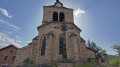
(9) Follow it to the left, cross the Ruisseau de la Planchette, leave the road and take the street leading to the church. From the church square, rejoin the D588, pass the former Relais du Doulon and, on the left, take the street leading to the car park in front of the cemetery (S/E).
 Visorando Member
 Easy
Easy