Le Val, starting from Touffreville-la-Cable

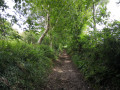
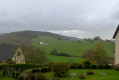
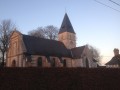
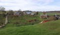
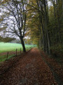
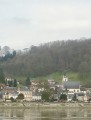
A pleasant walk offering beautiful views over the valleys of Touffreville-la-Cable.

Details

n°5825170
Creation:
Last update:
–
Last review:
  • Walking
    Activity: Walking
  • ↔
    Distance: 4.69 mi
  • ◔
    Average duration: 2h 25 
  • ▲
    Difficulty: Easy

  • ⚐
    Back to start: Yes
  • ↗
    Ascent: + 295 ft
  • ↘
    Descent: - 325 ft

  • ▲
    Highest point: 476 ft
  • ▼
    Lowest point: 184 ft

Photos

Description of the walk

Park in the school car park on Rue du Relais in Touffreville-la-Cable.

(S/E) Follow Rue du Relais with your back to the church, then turn right onto Rue des Chênes and follow the signs towards the equestrian centre. Turn right at Rue de Péromare.

(1) Ignore the path on the right – this will be the return route – and continue along the tarmac road, which curves slightly to the left. Continue until you reach the point where the road forms a right angle to the left and where you can see an inviting tarmac path on the right.

(2) Do not take this path on the right, but carry on left along the road. Continue straight on, passing the equestrian centre and keeping in the same direction.

(3) Take thefirst road on the right after the farmhouse running alongside the road.

(4) At the Fork in the road at a place called Le Chesnot, turn onto the tarmac road furthest to the left and do not follow the signs for Le Chesnot. Walk down into the valley.

(5) Further down, turn right onto the tarmac road and walk for about 200 metres.

(6) At the Fork in the road, turn right onto Chemin Cybèle. Continue along this path, keeping straight ahead.

(7) At the junction, head straight ahead, walk past the sewage treatment plant on your right, then emerge from the woods. Shortly afterwards, the path turns at a right angle and joins Rue de Péromare.

(1) Carry on left along this street, then turn left at the junction to return to the starting point at the school car park (S/E).

Waypoints

  1. S/E : mi 0 - alt. 476 ft - School car park – Touffreville-la-Câble
  2. 1 : mi 0.16 - alt. 472 ft - Junction of the circular loop
  3. 2 : mi 0.7 - alt. 384 ft - Crossroads with a path leading downhill – turn left
  4. 3 : mi 1.6 - alt. 449 ft - After the farmstead – on the right
  5. 4 : mi 1.85 - alt. 404 ft - Chesnot – turn left
  6. 5 : mi 2.41 - alt. 184 ft - En bas du Val – on the right
  7. 6 : mi 2.55 - alt. 194 ft - Fork in the road Cybèle – turn right
  8. 7 : mi 3.74 - alt. 322 ft - Junction, straight ahead
  9. S/E : mi 4.69 - alt. 476 ft - School car park – Touffreville-la-Câble

Reviews and comments

4.2 / 5
Based on 2 reviews

Reliability of the description
4 / 5
Ease of following the route
4.5 / 5
Route interest
4 / 5
sauter123
sauter123

Overall rating : 4.7 / 5

Date of your route : Jun 06, 2021
Reliability of the description : ★★★★★ Very good
Ease of following the route : ★★★★★ Very good
Route interest : ★★★★☆ Good
Very busy route : No

A very clear and precise plan and description.

Machine-translated

lebouvier Didier
lebouvier Didier

Overall rating : 3.7 / 5

Date of your route : Apr 28, 2021
Reliability of the description : ★★★☆☆ Average
Ease of following the route : ★★★★☆ Good
Route interest : ★★★★☆ Good
Very busy route : No

A lovely walk in the countryside.
Although the signposting isn’t worth mentioning, it is still the most practical and effective feature on a walking route. So it’s a shame there aren’t any – even just markers such as 1, 2, 3, etc., placed at changes of direction, or perhaps, between these points, distance markers that could be included in the route description. On the other hand, there is pink signposting on the final section of the route; the description could simply specify that you should follow it right to the finish.

Machine-translated

Other walks in the area

For more walks, use our search engine .

The GPS track and description are the property of this route's author. Please do not copy them without permission.