


Refine your search for walks in Le Tacon (affluent de la Bienne)
Le Tacon (affluent de la Bienne) walks


 The Couloirs circuit starting from Les Bouchoux
 Association / Club / Walk leader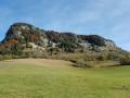
 4.75 mi
 +1,486 ft
 -1,506 ft
 3h 30
3h 30
 Moderate
 Departure from Les Bouchoux (Jura)
A short hike from the village of Les Bouchoux, which allows you to gain some height to see the surrounding area and take a short detour to a superb waterfall.
Queue de Cheval Waterfall
 Visorando Member
 3.14 mi
+482 ft
-482 ft
1h 50
3.14 mi
+482 ft
-482 ft
1h 50
 Easy
Departure from Saint-Claude (Jura)
Easy
Departure from Saint-Claude (Jura)
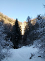
A pleasant little outing to discover this waterfall, which cascades down a sixty-metre drop in two stages. These drops, each around thirty metres high, are spectacular when it has rained. This is therefore an outing to do after a period of rain if you want to enjoy the scenery offered by one of the most beautiful waterfalls in the Haut-Jura.
Route of Mont Bayard starting from Saint-Claude
 4.18 mi
+1,680 ft
-1,667 ft
3h 25
4.18 mi
+1,680 ft
-1,667 ft
3h 25
 Difficult
Departure from Saint-Claude (Jura)
Difficult
Departure from Saint-Claude (Jura)
Starting from Saint-Claude, this is a short hike in terms of distance but quite challenging during the climb up Mont Bayard. Walking poles are recommended in wet conditions.
L'Échappée Jurassienne
 193.43 mi
+24,944 ft
-24,242 ft
16 days
Difficult
Departure from Dole (Jura)
193.43 mi
+24,944 ft
-24,242 ft
16 days
Difficult
Departure from Dole (Jura)
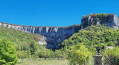
The Échappée Jurassienne is an invitation to discover, step by step, the striking diversity of the Jura Mountains. This 15-day itinerary links the west to the east, from the plains to the mountains, crossing the unspoilt landscapes of the Haut-Jura Regional Nature Park, far from the borders and close to the essentials.
From the peaceful canals of Dole, the trail winds its way through the most iconic sites of the Jura: the Cirque de Baume, lakes, remote valleys, viewpoints and deep forests, before ending majestically in Saint-Claude, a town nestled in the heart of the mountains.
Over the course of these 311 km, this itinerary becomes much more than a hike: it is a true distillation of the most exceptional things the Jura has to offer. The richness of the landscapes, the contrasts in altitude and the authenticity of the villages you encounter allow everyone to surpass themselves, immerse themselves fully in the wild beauty and reconnect with the essentials.
From Le Manon to Saint-Claude
 10.81 mi
+1,076 ft
-3,428 ft
5h 55
Moderate
Departure from Septmoncel (Jura)
10.81 mi
+1,076 ft
-3,428 ft
5h 55
Moderate
Departure from Septmoncel (Jura)
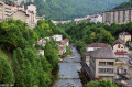
Sixteenth stage of the Échappée Jurassienne. For this last stage, you will reach Septmoncel before beginning a long descent along the Chemin des Moines to the Gorges du Flumen. Walking along the Flumen, Grosdar and Tacon rivers, you will arrive at Saint-Claude, nestled in the Jura Mountains at the confluence of the Bienne and Tacon rivers.
Saint-Claude is not only the capital of briar pipes: heir to a long tradition of craftsmanship, the town has built a reputation for woodturning and diamond and gemstone cutting. Tucked away at the bottom of its valley, the town stands out for its rugged natural environment and unique heritage attractions, such as Saint-Pierre Cathedral, the Pipe and Diamond Museum, Le Monde des Automates and the Abbey Museum, a hub for lovers of modern art.
Walks near Le Tacon (affluent de la Bienne)
Grande Traversée du Jura: from La Borne au Lion to Culoz
 Tourist office62.98 mi
+11,985 ft
-15,436 ft
6 days
Tourist office62.98 mi
+11,985 ft
-15,436 ft
6 days
 Very difficult
Departure from La Pesse (Jura)
Very difficult
Departure from La Pesse (Jura)
The GTJ runs through the Jura Mountains from Mandeure (Doubs) to Culoz (Ain), crossing the Haut-Jura Regional Nature Park and offering a detour into Switzerland. The route suggested here covers the second half of the itinerary.
Opened in 2004, the GTJ follows the GR®5, GR®9 and GR® de Pays trails for 400 km. Winding along ridges, skirting lakes and emerging from forests, this is a route accessible to most people, with no particular difficulty. It can be tackled as a 2–3-day trip for families, or as the full 15–20-day route.
The route winds through the heart of the Haut-Jura Regional Nature Park and the Haute Chaîne du Jura National Nature Reserve: a protected area to be explored with respect.
La Borne au Lion - Refuge de la Loge
6.86 mi
+2,060 ft
-1,617 ft
4h 55
Moderate
Departure from La Pesse (Jura)
Open from 1 April to 30 November (subject to there being no snow)
First stage of the Grande Traversée du Jura walking route: from La Borne au Lion to Culoz, in 6 days.
The GTJ links Mandeure (Doubs) to Culoz (Ain) in 15 to 20 days, crossing the Jura Mountains and the Haut-Jura Regional Nature Park. The route proposed here corresponds to the second half of the itinerary.
The route winds through the heart of the Haut-Jura Regional Nature Park and the Haute Chaîne du Jura National Nature Reserve: a protected area to be explored with respect.
Part of the route passes through the Haute Chaîne du Jura National Nature Reserve.
Dogs and tent camping are prohibited.
Please respect these rules to help preserve this exceptional environment.
Giron - Lélex
 12.38 mi
+1,588 ft
-1,995 ft
7h 05
Very difficult
Departure from Giron (Ain)
12.38 mi
+1,588 ft
-1,995 ft
7h 05
Very difficult
Departure from Giron (Ain)
Open from 1 April to 30 November – subject to there being no snow.
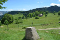
Third stage of the GRP® de la Valserine. From the Roche Fauconnière viewpoint and its panoramic view of the Cirque d'Orvaz, the trail leads to the Lion marker, a historic landmark of the Franco-Comtois border in the 17th century and a key site of the Resistance. It is here that the GR® de Pays crosses the Grande Traversée du Jura and the GR® 5, before a long, gentle descent towards Lélex, a ski resort nestled in the Valserine valley.
Chézery-Forens - Lélex
10.72 mi
+3,478 ft
-2,444 ft
7h 55
Difficult
Departure from Chézery-Forens (Ain)
Open from1 April to 30 November – subject to there being no snow.
Second stage of the “La petite boucle de la Valserine” circular walking route, from Chézery to Lélex.
This stage, starting from Chézery, will take you through a beautiful variety of landscapes, including wild rivers, lush forests, panoramic viewpoints and Jura valleys. Make the most of this stage to take in the stunning views.
Les Moussières - Lélex
 12.33 mi
+1,467 ft
-2,303 ft
6h 55
Moderate
Departure from Les Moussières (Jura)
12.33 mi
+1,467 ft
-2,303 ft
6h 55
Moderate
Departure from Les Moussières (Jura)
Open from 1 April to 30 November, subject to snow conditions
The third and final stage of the 3-day, 2-night Crêts en combes hiking tour.
Starting from Lélex, this circular route combines the main GTJ route with the suggested alternative via Mijoux and the Col de la Faucille.
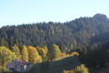
The crossing of the Hautes-Combes jurassiennes, the Valserine valley and the ridges of the Haute Chaine du Jura promise breathtaking landscapes. On one side, the view overlooks the ridges, on the other, it overlooks Lake Geneva and the Alps. In the heart of the Haut-Jura Regional Nature Park and partly in the Haute Chaîne Nature Reserve, the hike takes place in a preserved natural area.
The trail is marked with GR® (red and white) signs.
Bellecombe - Mijoux
9.06 mi
+666 ft
-1,552 ft
4h 45
Difficult
Departure from Bellecombe (Jura)
Open from 1 April to 30 November – subject to snow conditions.
From Bellecombe to Mijoux via the Haute Chaîne: the second stage of the four-day walking tour “La Valserine enchanteresse”.
La Valserine is no fairy, but she enchants with every step. Her magical valley guides us between the high plateaus and ridges of the Jura, offering breathtaking views of the Alps. A journey through wild nature and poetry.
Le Gralet - Chézery-Forens
 8.12 mi
+449 ft
-3,232 ft
4h 05
Difficult
Departure from Péron (Ain)
8.12 mi
+449 ft
-3,232 ft
4h 05
Difficult
Departure from Péron (Ain)
Open from 1 April to 30 November, subject to snow conditions.
The third stage of the hiking tour: from Mijoux to Chézery-Forens via the Haute Chaîne du Jura.
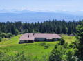
Set off on a crossing of the Haut-Jura between Mijoux and Chézery-Forens, through varied landscapes of valleys, peaks and forests. Over three days, you will walk along the Jura ridges, passing by the Grand Mont Rond, the Crêt de la Neige and the Reculet, with magnificent views of Mont Blanc and the Alps. This crossing takes you to the heart of the Haute Chaîne du Jura, for an authentic experience in the heart of nature. As you will need to carry your own food, remember to bring supplies so you can enjoy this adventure to the full.
La Poutouille Refuge - Lancrans
10.44 mi
+1,893 ft
-5,092 ft
6h 25
Difficult
Departure from Péron (Ain)
Open from 1 April to 30 November ( subject to there being no snow)
Third stage of the Grande Traversée du Jura walking route: from La Borne au Lion to Culoz, in 6 days.
The GTJ links Mandeure (Doubs) to Culoz (Ain) in 15 to 20 days, crossing the Jura Mountains and the Haut-Jura Regional Nature Park. The route proposed here corresponds to the second half of the itinerary.
The route winds through the heart of the Haut-Jura Regional Nature Park and the Haute Chaîne du Jura National Nature Reserve: a protected area to be explored with respect.
Part of the route crosses the Haute Chaîne du Jura National Nature Reserve.
Dogs arenot permitted, even on a lead, and camping in tents is prohibited
Please respect these rules to preserve this exceptional environment.
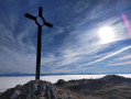
La Poutouille - Lancrans
 10.55 mi
+1,900 ft
-5,092 ft
6h 30
Very difficult
Departure from Péron (Ain)
10.55 mi
+1,900 ft
-5,092 ft
6h 30
Very difficult
Departure from Péron (Ain)
Open from1 April to 30 November – subject to there being no snow.
The section between La Poutouille and Lancrans is the third stage of the six-day walking tour, “The GTJ from Mijoux”.
The GR®9 enters the Ain department via Mijoux, before following the spectacular ridges of the Monts-Jura, passing through the Crêt de la Neige, the highest point of the massif. It then descends towards Bellegarde-sur-Valserine, crosses the Retord plateau, and then crosses the Grand Colombier. The trail continues its route to Culoz and the Rhône Valley, before leaving the Ain to reach Savoie and continuing southwards.
Part of the route passes through the Haute Chaîne du Jura National Nature Reserve, which is subject to specific regulations:Dogs are not permitted, even on a lead, and camping in tents is also prohibited.
Please respect these rules to preserve the richness of this exceptional environment.
Lélex - Menthières
 13.56 mi
+3,904 ft
-3,317 ft
9h 40
Very difficult
Departure from Lélex (Ain)
13.56 mi
+3,904 ft
-3,317 ft
9h 40
Very difficult
Departure from Lélex (Ain)
Open from 1 April to 30 November – subject to there being no snow.
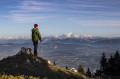
Fourth stage of the GRP® de la Valserine. From Lélex, the trail climbs through the forest to the Chalet de la Loge, the gateway to the nature reserve. The ascent then eases off through clearings and woodland to the ridges, where an exceptional panorama opens up over Lake Geneva, the Alps and Mont Blanc. The route crosses the massif’s two highest points: the Crêt de la Neige (1,720 m) and the Reculet (1,718 m), before skirting the Roche Franche cirque. After the Chalet du Gralet, the forest accompanies you for the final few kilometres to Menthières.
Protected area: dogs and tent camping are prohibited in the Haute Chaîne du Jura National Nature Reserve.