Country:

 City:
City:


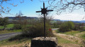
(S/E) Car park in front of the Montrodat village hall
(1) Opposite the village hall, turn right and follow the main road. Head towards the church square and cross it. Continue straight on along the road that winds down between the houses.
(2) At a stone cross, turn right. Walk down for about 100 metres and turn right again. After the last house, the street becomes a footpath. Take the steep descent to the Devèze stream. Cross it via the footbridge and head uphill opposite, ignoring the paths on the left. After a series of hairpin bends, you’ll come out onto a small road; follow it to the right. Walk alongside a fenced-off property.
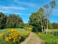
(3) Turn left onto a stony track, then turn right onto the grassy path which narrows into a footpath and climbs slightly. Enter a small field, follow its right-hand edge to the D999; cross it. Take the footpath opposite, which leads onto a wide track. Head left for about 200 m.
(4) Leave the track and take a path on the right, between the fields. Further on, take a track that bends to the right and leads onto a small road; follow it to the right for a few metres.
(5) Turn left onto a track leading to a farm building. Continue along a path leading to the Siffleur cross. Cross the D999 and take the wide path opposite which descends to the Devèze stream; cross it via a bridge, then climb up the opposite slope. Reach the first houses of Inosse, then head down through the hamlet to a road. Take a narrow pavement on the right to reach Rue du Four, 30 metres below.
(6) Follow it to the end. Turn into the narrow lane between two houses. Head down to the right over the stones. The path winds between old walls through a pine forest. At the first house in a housing estate, you’ll rejoin the tarmac. Continue straight down to a road. Cross it and, opposite, slightly to the left, go round a small hillock and take a shaded path that leads down to the road at the entrance to Montrodat; follow it to the left for 600 m. At the school, cross the road to return to the starting point. (S/E)

 Tourist office
 Moderate
 Visorando Member
 Difficult