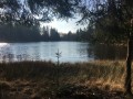
The Salabert, left bank and right bank

Starting from Saint-Martial-de-Gimel, this is a lovely walk offering views of the Château du Puy de Val and a short journey along the Salabert, enhanced by the discovery of its waterfall.

Details

n°20145924
Creation:
Last update:
Last review:
  • Walking
    Activity: Walking
  • ↔
    Distance: 5.08 mi
  • ◔
    Average duration: 2h 55 
  • ▲
    Difficulty: Easy

  • ⚐
    Back to start: Yes
  • ↗
    Ascent: + 689 ft
  • ↘
    Descent: - 715 ft

  • ▲
    Highest point: 1,627 ft
  • ▼
    Lowest point: 1,030 ft

Description of the walk

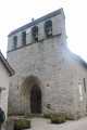
Park near the church at Saint-Martial-de-Gimel.

(S/E) With your back to the church, head towards the cemetery and walk alongside it.

(1) At the Fork in the road, take the path straight ahead and continue until you reach the D26E1.

(2) Follow the road to the right, pass under a power line and carry on to the hamlet known as Le Châtaignier.

(3) Take the Passage du Châtaignier on the left and walk down between the houses until you reach a road.

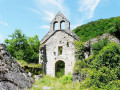
(4) Cross over and continue along the path; after about a hundred metres, you’ll see the Château du Puy de Val on your left. A path on the left, not shown on the map, can take you close to the château, which is private property and not open to visitors. When you reach a road, continue to the right until you come to a crossroad.

(5) Turn right onto it, then continue straight ahead along the path which crosses the Salabert towards the hamlet of Charlu, then take the path on the right. Continue straight on until the next junction (see Practical Information).

(6) Turn onto the path on the right and head towards the Salabert stream. Discover its waterfall, approach the stream and follow it along.

(7) Head uphill to the left, away from the stream, and pass under the high-voltage power line. Continue along the path, heading due north, without taking the path that leads back down to the stream, until you reach a road at the hamlet of
Chanteloube.

(8) Turn right for a few metres, then continue along the path on the right which, after a short while, turns sharply right to reach the junction near the cemetery.

(1) Turn left and follow the road to the church (S/E).

Waypoints

  1. S/E : mi 0 - alt. 1,604 ft - Car park
  2. 1 : mi 0.15 - alt. 1,568 ft - Junction of the circular loop
  3. 2 : mi 0.68 - alt. 1,601 ft - D26E1 road
  4. 3 : mi 1.33 - alt. 1,493 ft - Passage du Châtaignier
  5. 4 : mi 1.56 - alt. 1,362 ft - Path below the castle
  6. 5 : mi 2.24 - alt. 1,037 ft - Confolens - Saint-Bonnette (rivière) - Affluent de la Corrèze
  7. 6 : mi 2.76 - alt. 1,132 ft - Junction
  8. 7 : mi 3.39 - alt. 1,375 ft - Ascent - Salabert (rivière) - Affluent du Lot
  9. 8 : mi 4.33 - alt. 1,621 ft - Route de Chanteloube
  10. S/E : mi 5.08 - alt. 1,604 ft - Car park

Notes

Between (6) and beyond (7), the path does not appear on the IGN map; it is a route plotted based on the terrain and the “Visorando” track; it is marked with fluorescent paint “markers” (several “paths” exist on the ground – perhaps traces of motorbike tracks?).

Worth a visit

The village of Saint-Martial-de-Gimel and its church.
Puy de Val Castle (private property).
Waterfall and the course of the Salabert.

Reviews and comments

3.7 / 5
Based on 2 reviews

Reliability of the description
4 / 5
Ease of following the route
3.5 / 5
Route interest
3.5 / 5
Faure Philippe
Faure Philippe

Overall rating : 4 / 5

Date of your route : Apr 29, 2024
Reliability of the description : ★★★★☆ Good
Ease of following the route : ★★★★☆ Good
Route interest : ★★★★☆ Good
Very busy route : No

An easy route to follow to get closer to the waterfall

Machine-translated

Dodie1109
Dodie1109

Overall rating : 3.3 / 5

Date of your route : Aug 13, 2023
Reliability of the description : ★★★★☆ Good
Ease of following the route : ★★★☆☆ Average
Route interest : ★★★☆☆ Average
Very busy route : No

It’s nice, but it’s sometimes hard to know where to go.
And the view isn’t great at times...

Machine-translated

Other walks in the area

For more walks, use our search engine .

The GPS track and description are the property of this route's author. Please do not copy them without permission.