Country:
 City:


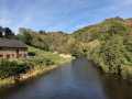
Car park at Saillant de Voutezac, just after the bridge over the Vézère, on the Voutezac side. There are also a few spaces on the other side of the bridge, on the Allassac side.
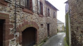
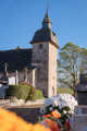
(S/E) Follow the road for a few metres until you reach the crossroads by the church (chapel), heading towards La Bontat campsite. Leave the road that turns right towards La Bontat; continue straight on, passing under a porch, towards the Old Cemetery (no longer in use) and, after about 300 m, you’ll reach a Fork in the road.
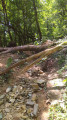
(1) Follow the path on the right, which winds uphill. It becomes stony and steep and leads to a Fork in the road.
(2) Follow the path uphill. Ignore the path on the left and continue to a T-junction.
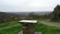
(3) Turn right. The orientation board is 200 m away. Continue along the road which climbs up to the left.
(4) At the top of the climb, at the next T-junction, turn left onto the Route des Nénuphars to head back down to the village of Vertougit.
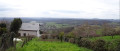
(5) Head out via the Route du Bois Chalot and continue downhill until the road bends to the right, facing the superb panoramic view. Carry on along this road to the hamlet known as La Côte. Magnificent views stretching southwards.
(6) In La Côte, walk past the houses and take the second street on the right, for about 200 metres.
(7) Turn onto the path on the left that leads downhill: signposted “Chemin du Vieux Cimetière”. It is a bit stony. At the bottom, rejoin the path you started on.
(1) Carry on straight ahead and, following the route in reverse to the one taken on the way there, head for the bridge over the Vézère (S/E).

 Visorando Member

 Moderate