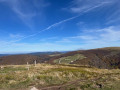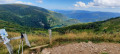
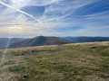
The Rainkopf as seen from the Col de Bramont

This walk offers a chance to see a range of the Vosges’ attractions: fine examples of fir trees, views over Lake Kruth and the Vosges peaks, scree slopes, a spring, a passage over a summit at an altitude of 1,305 metres, and a peat bog in a protected nature reserve.

Two shelters or chalets along the route

This route passes through the Machais peat bog; dogs are not permitted, even on a lead (see ‘Practical Information’ section).

Details

n°110826866
Creation:
Last update:
Last review:
–
  • Walking
    Activity: Walking
  • ↔
    Distance: 7.16 mi
  • ◔
    Average duration: 4h 50 
  • ▲
    Difficulty: Difficult

  • ⚐
    Back to start: Yes
  • ↗
    Ascent: + 1,759 ft
  • ↘
    Descent: - 1,739 ft

  • ▲
    Highest point: 4,281 ft
  • ▼
    Lowest point: 3,136 ft

Photos

Description of the walk

Head to the Col de Bramont between La Bresse (88) and Wildenstein (68) via the RD34 on the Vosges side or the RD13B on the Alsace side. Park in the car park.

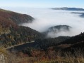
(S/E) Walk up to the pass, take the GR®531, marked with Blue Rectangles, towards Col de l’Étang (Sattelsee). Follow this good path, which turns into a rocky track and crosses a small stream. A few fine specimens of silver fir line the path, with impressive diameters of over 1.25 m. After the climb, followed by a short descent, just before a left-hand bend, you’ll reach a beautiful viewpoint overlooking Lake Kruth and the village of Wildenhein.

(1) Continue downhill to the Col de l’Étang, where you can make use of the open shelter.

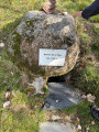
(2) Carry on along the GR® 531 Blue Rectangle, heading towards Rainkopf, which starts just to the left of the shelter. The path climbs in tight hairpin bends, with views over scree slopes, to reach the boundary between the Haut-Rhin and Vosges departments, marked by boundary stones engraved with the letters D and F and a few remains of dry-stone walls that once marked the border established after the defeat of 1870. Here is boundary stone no. 2809. (The path will follow this borderline to the summit of Rainkopf, boundary marker no. 2790). (A) see section ‘Places of interest’.

(3) Walk along the Rothenbach hilltop, covered with blueberry bushes . Carefully cross the D34A departmental road, known as the Route des Américains (B). Opposite, take the path uphill, which leads to a junction after about a hundred metres.

(4) Turn right towards the Source de la Thur – markedwith a Green Cross sign– with another view over the valley.

(5) There’s a bench where you can take a break and enjoy the view. Turn back to the previous junction.

(4) Resume the climb to the right on the GR® 531 towards Rainkopf. The route resembles a 110-metre hurdle race, such are the heights of the steps. Cross the Route de Crêtes (D430) with care , noting its oversized boundary marker – likely due to the heavy snowfall in this mountain range. Reach the junction with a variant of the GR®5 (Red Rectangle & White Rectangle).

(6) Cut across the GR® to reach the summit of the Rainkopf. (C)

(7) Retrace your steps to the junction at the Source de la Thur.

(4) Turn right (Green Cross markings) to follow the path known as the ‘des Marchands’. At the next junction, turn slightly to the right – Yellow Cross markings – and continue for about thirty metres.

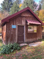
(8) Turn left onto the path known as the ‘Chemin du Génie’ to rejoin the Green Cross signposting. This forest track descends gently and enters the Machais peat bog nature reserve , where restrictions apply and dogs are not permitted, even on a lead. The path gradually turns south and leads onto the Route des Américains, where there is a car park and a large, rather austere wooden chalet – handy in case of bad weather.

(9) At the roadside, follow the path branching off to the left, marked with a Red Triangle signposting ‘Étang de Machais’, and initially walk alongside the road, using wooden duckboards to cross a slightly damp area. Join the road.

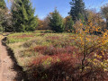
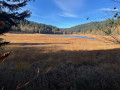
(10) Cross the road and continue straight ahead, then turn left onto the Chemin du Tour de Mâchais, still signposted with a Red Triangle. Walk along the edge of the peat bog on the left, with a few clearings offering views of the marshy area. (D)
You’ll come to a junction at the eastern end of the peat bog.

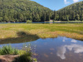
(11) Stay on the path on the right for about two hundred metres, keeping as close as possible to the peat bog to enjoy some lovely views of the site.

(12) Return to the previous junction.

(11) Head up the forest track to the right, following the signs for “Point de vue sur l’Étang” (marked with a Red Triangle), (though you’ll never actually find this viewpoint). Reach the junction with the path marked with a Yellow Cross (Chemin Vaxelaire).

(13) Continuing the climb along this forest track is rather tedious, apart from a few small clearings offering partial views of the peat bog. The path veers to the left and, on a gentle descent, reaches the Col de Bramont (S/E).

Waypoints

  1. S/E : mi 0 - alt. 3,143 ft - Car park at the - Col de Bramont
  2. 1 : mi 0.95 - alt. 3,570 ft - Viewpoint over Lake Kruth
  3. 2 : mi 1.48 - alt. 3,350 ft - Shelter at the - Abri Col de l'Etang
  4. 3 : mi 1.92 - alt. 3,747 ft - Former border from 1870 (Marker 2790)
  5. 4 : mi 2.07 - alt. 3,875 ft - Crossroads at the source of the Thur
  6. 5 : mi 2.17 - alt. 3,914 ft - Source de la Thur
  7. 6 : mi 2.43 - alt. 4,062 ft - Crosses the GR5
  8. 7 : mi 2.76 - alt. 4,272 ft - Rainkopf
  9. 8 : mi 3.74 - alt. 3,691 ft - Crossroads – Chemin du Génie
  10. 9 : mi 4.75 - alt. 3,182 ft - Route des Américains - Chalet de Machey
  11. 10 : mi 4.9 - alt. 3,235 ft - Crossing the D34a (Routes des Américains)
  12. 11 : mi 5.37 - alt. 3,251 ft - Crossroads
  13. 12 : mi 5.51 - alt. 3,278 ft - Viewpoint over the Machais Peat Bog
  14. 13 : mi 5.77 - alt. 3,330 ft - Crossroads – Chemin Vaxelaire – Crois Jaune
  15. S/E : mi 7.16 - alt. 3,143 ft - Col de Bramont

Notes

Club Vosgien signposting

Regulation prohibiting dogs in the Machais Peat Bog Nature Reserve (see Article 18).

Mountain hike: ensure you have suitable equipment (good walking boots, walking poles, and don’t forget a windbreaker)

Please note: this walk passes through a protected area where dogs are prohibited, even when kept on a lead (Machais Peat Bog Nature Reserve).

No water points or mountain huts.

Two shelters (Col de l’Étang: open shelter with table, bench and fireplace; and Machais car park: chalet with stove, tables and benches).

This route passes through a protected area, which may be subject to special regulations:

Worth a visit

(A) The Franco-German border from 1871 to 1918

Following its defeat by Germany during the War of 1870, France was forced to cede Alsace and Lorraine. In accordance with the Treaty of Frankfurt of 1871, a demarcation line ran from the north-western border of the canton of Cattenom (Moselle) to the Swiss border near Réchésy. The boundary was marked by rectangular cut-stone boundary stones, each bearing a number and the letter ‘D’ on the German side and ‘F’ on the French side. They were linked together by a low dry-stone wall. After the victory of 1918, this boundary became obsolete but nevertheless coincided with municipal and departmental boundaries.

(B) The Americans’ Road

The Route des Américains (a track at the time) was built by the Americans around 1917 to supply the soldiers fighting on the Vosges ridges. An American detachment had set up two mobile sawmills in La Bresse, one of which was at a place known as ‘La Ténine’

(C) The Rainkopf

At an altitude of 1,305 metres, the Rainkopf is one of the major peaks of the Vosges mountains. This peak, situated not far from the Route des Crêtes, is characterised by its rounded shape, with its green scree slopes and magnificent views over the surrounding region. At the summit, the wind can blow strongly, making it an even more memorable experience for hikers. (I can confirm this)

(D) Machais Peat Bog

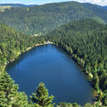
No water retention, no drainage. The small hanging valley of Machais has preserved one of the finest floating peat bogs in France, now the last intact one in the Vosges massif. The history and natural functioning of this peat bog are unique and complex. On the edges of the glacial over-excavation, surrounded by beech and fir forests, sphagnum mosses have spread across the surface towards the central open water, forming a floating bog. Pieces of peat break away, forming rafts that drift with the wind and sometimes capsize. Unique in more ways than one, the lacustrine peat bog is a floating raised bog.

Information found on site or on the website

Always be cautious and plan ahead when you're outdoors. Visorando and the author of this route cannot be held responsible for any accidents occurring on this route.

The GR® and PR® markings are the intellectual property of the Fédération Française de Randonnée Pédestre.

Other walks in the area

For more walks, use our search engine .

The GPS track and description are the property of this route's author. Please do not copy them without permission.