The Menat Bridge

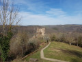
An enjoyable walk exploring the Sioule and the Rochocol meander. This route also offers the chance to see fine examples of traditional architecture (houses with stepped roofs) and provides beautiful views of the Sioule and its meander, as well as the Puy de Dôme.

Details

24333576
Creation:
Last update:
Last review:
  • Walking
    Activity: Walking
  • ↔
    Distance: 5.97 mi
  • ◔
    Average duration: 3h 30 
  • ▲
    Difficulty: Moderate

  • ⚐
    Back to start: Yes
  • ↗
    Ascent: + 833 ft
  • ↘
    Descent: - 833 ft

  • ▲
    Highest point: 1,883 ft
  • ▼
    Lowest point: 1,155 ft

Description of the walk

Access: Head to Le Pont de Menat, situated 56 km north-north-west of Clermont-Ferrand, and follow signs for “Camping des Tarteaux”. At the entrance, follow the road to the right for 80 m. The start sign and car park are nearby.
Yellow markings.

(S/E) Leave the car park heading towards the Sioule, turn right and pass between the left bank and the tennis court. Take the path that runs alongside the river and passes the campsite on your right. Continue along the Sioule. The path enters a wooded area and winds its way along the bend in the Sioule, known as the Rochocol bend. Pass three ‘escabaux’.

(1) At a meadow, the path veers to the right and climbs the hillside towards Biesse. Look back to see the Château Rocher site on the opposite bank of the Sioule (see the ‘During the walk’ section). You’ll reach the crossroads at the entrance to Biesse.

(2) Continue straight on until you reach a small road just above (a ‘T’ junction). Turn left. A little further on, turn right onto a path which quickly veers to the left near the last houses in Biesse.

(3) At the next crossroads, take the left-hand path, which leads straight on to the edge of a wood on your right. The relatively flat path heads south before skirting a small wooded spur and climbing up it towards Vendoges. You’ll reach a T-junction to the north-east of Vendoges.

(4) Turn left. There’s a lovely view of the Puy de Dôme. Walk straight through the hamlet to the final junction. As you pass through, you’ll see houses with stepped roofs (see the ‘During the walk’ section).

(5) Continue straight ahead along the path heading north-west. Pass under the high-voltage power line and, at the next three-way junction, take the path on the right.

(6) At the crossroads where there is a Green Cross at the foot of a tree, take the small road straight ahead heading north-east towards Bougedal; you’ll reach a three-way junction.

(7) Continue along the small road on the right towards Navorat. The road passes under the high-voltage power line again before skirting slightly past Navoira. There is a lovely view of the village of Meynat on the left, beyond Navoira. At this point, on the right-hand side, there is an orientation table on a small hillock with steps.

(8) Take a short round trip to enjoy the panoramic view of the Rochocol meander.
Carry on straight ahead along the small road which enters a wooded area and descends quite steeply to the road leading to the Camping des Tarteaux.

(9) Turn right onto the road leading to the Tarteaux campsite and continue along it until you reach the car park.
You can visit the Romanesque bridge over the Sioulme by continuing along the small road for about 250 m (see the ‘During the walk’ section) (S/E).

Waypoints

  1. S/E : mi 0 - alt. 1,158 ft - Car park next to the Tarteaux campsite
  2. 1 : mi 0.93 - alt. 1,165 ft - Right-angle bend - Sioule (la)
  3. 2 : mi 1.54 - alt. 1,411 ft - Crossroads in Biesse
  4. 3 : mi 1.82 - alt. 1,522 ft - Y-junction
  5. 4 : mi 2.89 - alt. 1,824 ft - T-junction
  6. 5 : mi 3.08 - alt. 1,837 ft - Crossroads to the west of Vendoges
  7. 6 : mi 3.81 - alt. 1,877 ft - Road junction with a Green Cross
  8. 7 : mi 4.1 - alt. 1,860 ft - Y-junction
  9. 8 : mi 4.93 - alt. 1,663 ft - Return to the orientation table
  10. 9 : mi 5.62 - alt. 1,289 ft - Road junction
  11. S/E : mi 5.97 - alt. 1,158 ft - Car park next to the Tarteaux campsite

Notes

The car park is situated 80 metres east of the entrance to the Camping des Tarteaux in Pont de Menat.

This walk across varied terrain requires suitable footwear.

This walk does not present any real navigational difficulties and follows the “Le Pont de Menat” route, updated and published by the Puy-de-Dôme Departmental Council and the Combrailles Tourist Office. In addition, it is advisable to follow the instructions in the route description and on the map, whilst paying close attention to the landscape. The waypoints (with their GPS coordinates and the distance from the starting point) serve as aids for walkers exploring the route for the first time.

Dogs must be kept on a lead at all times due to the presence of livestock.

Worth a visit

The Menat Bridge
The Menat Bridge is a medieval bridge listed as a historic monument, situated on the border between the communes of Menat and Saint-Rémy-de-Blot
History
The bridge was built in the 12th century on the road linking Ébreuil and Châteauneuf-les-Bains, most likely on the ancient Roman route connecting Augustonemetum (Clermont-Ferrand) to Aquae Nerii (Néris-les-Bains). As the only crossing point over the Sioule for many years, the bridge was of strategic importance and was the subject of disputes between local lords and the clergy.
One span of the bridge was swept away by a flood in the 17th century and was not rebuilt until the early 20th century
Description
The medieval bridge, which spans the River Sioule, is a vaulted bridge – also known as a ‘donkey-back’ bridge – and consists of four spans. The spans measure 11.14 m, 12.58 m, 10.28 m and 7.80 m respectively. As a road bridge, the carriageway is 3. m wide. Due to its narrow width, the piers once supported shelters for pedestrians
Source: Wikipedia (excerpts)

Château Rocher
In the Middle Ages, the Sioule valley served as a route between Auvergne and Bourbonnais, and was therefore of great strategic importance. Château Rocher was built in the 12th century by a Lord of Bourbon. It defended the old Menat Bridge, the only crossing over the Sioule between Châteauneuf and Ebreuil.
Abandoned at the end of the 18th century, Château Rocher has suffered the ravages of time. Since 1964, the Association Rempart, followed by a local association and now the Communauté de Pays du Canton de Menat, have been working to restore the site.
Source: Au fil de l'Eau...vergnat (excerpts)

House with stepped gables
A stepped gable (or ‘redans’ gable), also known as a crenellated or ‘pas de moineaux’ gable, is a projecting gable whose slopes are cut into steps.
In rural architecture, the stepped sections are generally covered with flat stones which protect them from the rain, prevent water from seeping into the load-bearing wall and allow the roofer or chimney sweep to rest their tools on them. These stones are often (but not always) sloped downwards to allow rainwater to run off.
Source: Wikipedia (excerpts)

Reviews and comments

4.7 / 5
Based on 3 reviews

Reliability of the description
4.7 / 5
Ease of following the route
4.7 / 5
Route interest
4.7 / 5
bruno labruyère
bruno labruyère
• Edited:

Overall rating : 5 / 5

Date of your route : Aug 05, 2024
Reliability of the description : ★★★★★ Very good
Ease of following the route : ★★★★★ Very good
Route interest : ★★★★★ Very good
Very busy route : No

A varied route, starting along the Sioule river before heading onto the plateau, offering lovely views of the Sioule valley, Château-Rocher and the village of Menat

Machine-translated

gerlandais
gerlandais
• Edited:

Overall rating : 4 / 5

Date of your route : Jul 08, 2023
Reliability of the description : ★★★★☆ Good
Ease of following the route : ★★★★☆ Good
Route interest : ★★★★☆ Good
Very busy route : No

A bit too much tarmac. In the route description, please mention – before the waypoint (1) – a relatively well-maintained path with four rope-assisted sections, branching off to the right, which is not marked with a Yellow Cross. This is a path created by the local council; it is very steep and leads directly to the Navirat waypoint (8).
The list of nearby points of interest is well compiled.

Machine-translated

Casene
Casene

Overall rating : 5 / 5

Date of your route : Aug 13, 2022
Reliability of the description : ★★★★★ Very good
Ease of following the route : ★★★★★ Very good
Route interest : ★★★★★ Very good
Very busy route : No

A lovely walk.
The signposting was fine.
The first section is a bit of a workout along the Sioule.
Tarmac on the way back, but magnificent views and the rocky outcrop of the castle.
Cross and viewpoint at Navoirat.
In short, a real treat. Thank you for the signposting.

Machine-translated

Other walks in the area

For more walks, use our search engine .

The GPS track and description are the property of this route's author. Please do not copy them without permission.