The Point de Partage in Grignon

Follow the very last few kilometres of the Rigole de Courpalet. Discover the Grignon locks on the Canal d’Orléans.

Details

n°28869507
Creation:
Last update:
Last review:
  • Walking
    Activity: Walking
  • ↔
    Distance: 4.99 mi
  • ◔
    Average duration: 2h 20 
  • ▲
    Difficulty: Easy

  • ⚐
    Back to start: Yes
  • ↗
    Ascent: + 26 ft
  • ↘
    Descent: - 26 ft

  • ▲
    Highest point: 417 ft
  • ▼
    Lowest point: 367 ft

Photos

Description of the walk

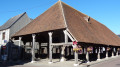
The start is in the car park of the Vielles-Maisons-sur-Joudry community hall.

(S/E) With your back to the hall, head slightly to the left. At the Stop sign, take the Route de Grignon on the right, then, at the bend, turn left onto the Route de la Petite Forêt.

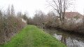
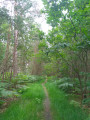
(1) Turn right and stay on the Rigole de Courpalet, which flows on your left, until it joins the Canal d’Orléans at the Point de Partage.

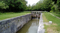
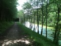
(2) Turn right and follow the canal on your left. Pass the lock at Point de Partage. Continue along the road between the canal and the Étang du Gué des Cens.

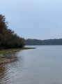
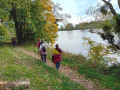
(3) Leave the road and take the path that follows the canal. Pass the two locks that form a waterfall and take the steps back up to the road. Head to the right and walk down towards the pond and the car park where the ‘Belle de Grignon’ is located.

(4) Retrace your steps and cross the bridge, then turn right onto the path. Walk alongside the third lock at Grignon. Continue by taking the road on the right. Then turn right twice.

(5) At the Fork in the road, carry on straight ahead along the road and, 300 metres further on, follow the Rigole de Courpalet on the left once more.

(6) Turn right at the first junction, then left onto the road. You will then return to the starting point (S/E).

Waypoints

  1. S/E : mi 0 - alt. 394 ft - Vielles-Maisons-sur-Joudry community hall
  2. 1 : mi 0.4 - alt. 410 ft - The Rigole de Courpalet
  3. 2 : mi 2.73 - alt. 410 ft - Canal d'Orléans
  4. 3 : mi 3.24 - alt. 397 ft - Leave the road and take the path that follows the - Canal d'Orléans
  5. 4 : mi 3.74 - alt. 381 ft - La Belle de Grignon, near the - Joudry (ruisseau) - Affluent du Canal d'Orléans
  6. 5 : mi 4.35 - alt. 410 ft - Road junction
  7. 6 : mi 4.78 - alt. 404 ft - Crossroads
  8. S/E : mi 4.99 - alt. 394 ft - Vielles-Maisons-sur-Joudry community hall

Worth a visit

Reviews and comments

3.7 / 5
Based on 2 reviews

Reliability of the description
3.5 / 5
Ease of following the route
3.5 / 5
Route interest
4 / 5
Nathalie GUERIN
Nathalie GUERIN

Magnificent! Idyllic! A dream location! With little rivers and woodland! A harbour and locks, hundred-year-old plane trees… And a farm-to-table restaurant that’s incredibly affordable and delicious… “Le Relais des Trois Écluses”! In Vieilles Maisons-sur-Joudry in the Loiret!

Nathalie G

Machine-translated

Jeffkey
Jeffkey

Overall rating : 4 / 5

Date of your route : Oct 08, 2024
Reliability of the description : ★★★★☆ Good
Ease of following the route : ★★★★☆ Good
Route interest : ★★★★☆ Good
Very busy route : No

A lovely stroll along the canal.

Machine-translated

Nathalie GUERIN
Nathalie GUERIN
• Edited:

Overall rating : 3.3 / 5

Date of your route : Sep 18, 2023
Reliability of the description : ★★★☆☆ Average
Ease of following the route : ★★★☆☆ Average
Route interest : ★★★★☆ Good
Very busy route : No

-

Machine-translated

Other walks in the area

For more walks, use our search engine .

The GPS track and description are the property of this route's author. Please do not copy them without permission.