


 Country:

 City:


Access: From Lourdes, take the D821 expressway towards Cauterets. After the 110 km/h speed limit sign, you’ll reach a roundabout. Turn right towards Cauterets on the D821a. Continue on the D921. Pass through Pierrefitte-Nestalas. At the end of the village, at a recently built roundabout, turn right towards Cauterets onto a road that climbs steeply (D920). At the entrance to Cauterets (852m), turn left towards Cancéru. This is a cul-de-sac. At the junction, turn left and park as soon as possible.
(S/E) Walk up the street towards the far end of the village, due east. The street curves to the left. You’ll come to a sign pointing to Concé and Hourmigous.
(1) Leave the road and follow the start of the yellow markings. Turn left onto the path which descends slightly and goes round the houses. At the next fork, turn right uphill, heading due east. Cross the Billou stream. Climb through the forest, following the steep, wide path and taking all the hairpin bends. Do not cut across. Pass the altitude of 1083m. Continue climbing steeply through the forest.
(2) Caution! At around 1,200m, the path no longer matches the IGN map. A massive landslide occurred in 2013. The path no longer winds in hairpin bends. It climbs steeply, straight up the slope. You must follow the cairns.
(3) You’ll reach the old fork at an altitude of 1,297m. Turn immediately left, following a path that is still very well marked. Do not head off to the right. This path avoids the landslide area. Follow the very well-marked path carefully.
Pass through a damp area with a spring. Continue climbing along this path. You’ll reach an altitude of 1371m, in a mountain pasture area, facing two barns in poor condition.
(4) Granges d’Hourmigous. Head off to the right, due south. One of the barns can be used as a shelter. Climb up, keeping the stone wall on your left. Look for the path above the forest. There are still some yellow markings.
Please note: you are walking in the opposite direction to the old markings; you will come across signs and arrows pointing in the opposite direction to the way you are going.
Go round Le Couyéou Bielh, keeping it on your left. The path remains almost flat. Head for the end of the mountain pasture, staying on the edge of the forest.
(5) At the bottom of the mountain pasture, re-enter the forest heading due south, along a path that remains clearly marked. At the edge of the forest, a signpost which I have labelled ‘Bazerque’ will confirm you are on the right track. The path continues along the hillside (contour line 1360m). Cross the Bazerque stream. Simply follow the path, which continues along a ledge whilst descending slightly. Pass the altitude of 1,304 m. Cross some small streams, the Paloazo ravine and the Coume Grande.
(6) Fork in the path. Turn left and head uphill for 300m. You’ll reach a crossroads with tracks and paths.
(7) Crossroads of tracks (1250m). Turn left, heading north-east, for 50m. Fork in the path. Turn right-hand side, heading due south-west. Follow the sign for “Lisey”. You must now climb up this wide, steep track.
(8) Fork in the track. Caution! At an altitude of 1,330m, make sure you follow the sign for “Lisey”. Head due south along this steeply ascending track. You’ll reach a clearing. There is a lot of fallen timber on the ground due to a storm. Pass the gate on your left. Descend slightly towards the two forestry buildings.
Walk past these two buildings on your left and continue towards the Lisey stream, following a well-marked path. Do not cross the stream. Turn left and stay on the right bank of the stream, continuing to follow this path. Carry on a little further, turning left.
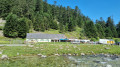
(9) Lisey hut. You are in a very large summer pasture area that is still in use, featuring an old enclosure made of upright stones. In the distance, due south-east, lies the Col du Lisey (2,086 m). You can just make out the facilities of the Luz-Ardiden ski resort at Soum de Picot (2,141 m). It’s a lovely spot for a break.
It’s time to think about the return journey. Turn round and head back along the same path to the crossroads of tracks (1,250 m).
(7) Turn left and head down the track, heading due south-west for 50 metres.
Fork in the path. Turn right onto a path that descends steeply. The path bends to the right. Continue downhill. Near a barn on your right, in a summer pasture area, the path bends to the left, heading due north-west.
The path descends steeply. Pass close to a tapped and developed spring. Follow this path, ignoring all other adjacent paths. Join the road just before the junction (1). Turn left onto this road and return to the starting point (S/E).

 Visorando Member
 Very difficult

 Moderate
 Easy

