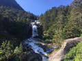
Walk around Cauterets

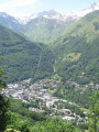
Whilst Cauterets is often synonymous with skiing, it is also a charming village typical of the Hautes-Pyrénées. Steeped in history, it reveals its secrets to walkers willing to leave the slopes behind and explore its narrow streets. It is precisely to find out a little more about the village that this easy and enjoyable walk takes in its main points of interest. It’s a great way to stretch your legs before a day on the slopes in winter or on your return from a hike in summer.

Details

n°46116898
Creation:
Last update:
Last review:
  • Walking
    Activity: Walking
  • ↔
    Distance: 0.85 mi
  • ◔
    Average duration: 0h 25 
  • ▲
    Difficulty: Easy

  • ⚐
    Back to start: Yes
  • ↗
    Ascent: + 66 ft
  • ↘
    Descent: - 75 ft

  • ▲
    Highest point: 3,087 ft
  • ▼
    Lowest point: 2,989 ft

Description of the walk

Start at the forecourt of Cauterets Town Hall.

(S/E) Take Avenue du Général Leclerc, which runs up to the right of the building. Follow it to the end. Cross Rue du Pont Neuf, then continue straight ahead into the car park. On the left is the building of the former Cauterets railway station. Turn right and head for the junction with Route de Pierrefitte.

(1) Cross at the pedestrian crossing and immediately turn left onto the tarmac road leading to the Lys cable car. Take the steps and continue to the top of the hill, which leads to the cemetery.

(2) Turn right onto Avenue du Docteur Domer, which runs past the thermal baths and leads to a three-way junction. Keep left onto Rue du Maréchal Joffre for 50 metres.

(3) Turn right onto Rue du Général Castelnau and walk past the church to head down into the old town. Continue to the end and cross the bridge over the Gave de Cauterets to reach the Esplanade des Œufs, opposite the cinema.

(4) Walk along the Esplanade des Œufs on the right, turn right and head back to the town hall forecourt, which was your starting point (S/E).

Waypoints

  1. S/E : mi 0 - alt. 3,025 ft - Cauterets Town Hall
  2. 1 : mi 0.22 - alt. 2,999 ft - Junction with the Route de Pierrefitte - Gare de Cauterets
  3. 2 : mi 0.33 - alt. 3,045 ft - Avenue du Docteur Domer
  4. 3 : mi 0.61 - alt. 3,087 ft - Rue du Général Castelnau
  5. 4 : mi 0.72 - alt. 3,045 ft - Esplanade des Œufs - Gave de Cauterets (rivière)
  6. S/E : mi 0.85 - alt. 3,025 ft - Cauterets Town Hall

Notes

A family walk; no equipment required.
Please take care in cold weather, as the ground may be slippery.

Worth a visit

Cauterets

Cauterets Town Hall.
Cauterets Market Hall.
Old railway station.
Le Rocher Thermal Baths.
Cauterets Thermal Baths.
Church.
Gave de Cauterets.
Esplanade.

Nearby: Pont d’Espagne

Reviews and comments

4.7 / 5
Based on 1 review

Reliability of the description
5 / 5
Ease of following the route
5 / 5
Route interest
4 / 5
Al49
Al49

Overall rating : 4.7 / 5

Date of your route : Jul 29, 2024
Reliability of the description : ★★★★★ Very good
Ease of following the route : ★★★★★ Very good
Route interest : ★★★★☆ Good
Very busy route : Yes

Thank you for this short route to discover Cauterets, which we did on the first day of our holiday. It’s well worth the price of admission to the cinema.

Machine-translated

Other walks in the area

For more walks, use our search engine .

The GPS track and description are the property of this route's author. Please do not copy them without permission.