The Vertain Mill via the Paris–Roubaix cobbled path

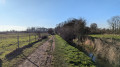
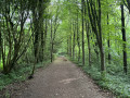
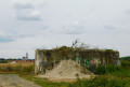
An easy walk that alternates between the banks of the Marque, woodland and fields, passing by the Vertain Mill via a cobbled path used by the Paris–Roubaix race.

Details

n°5549282
Creation:
Last update:
Last review:
  • Walking
    Activity: Walking
  • ↔
    Distance: 5.96 mi
  • ◔
    Average duration: 2h 45 
  • ▲
    Difficulty: Easy

  • ⚐
    Back to start: Yes
  • ↗
    Ascent: + 39 ft
  • ↘
    Descent: - 39 ft

  • ▲
    Highest point: 131 ft
  • ▼
    Lowest point: 85 ft
  • ⚐ Country: France
  • ⚐ City: Fretin (59273)
  • ⚑
    Start/End: N 50.552913° / E 3.140868°
  • ❏
    IGN map(s): Ref. 2505E
  • Hour-by-hour weather

Description of the walk

Start from the car park on Rue Maréchal Foch in Fretin.

(S/E) Take the path running alongside the road, towards Templeuve. Take the footbridge over the Marque, and continue straight on.
Turn left onto the path which joins a quiet tarmac road (Rue Verte).

(1) At the junction, ignore the return route on the right and carry on straight ahead.

(2) After the level crossing at Ennevelin station, take the path on the left. After a right-angle bend to the right, continue along the same path until you reach another tarmac road.

(3) Follow this road (Rue de Bonnance) for 50 metres to the right, then cross over to take the path opposite, between fields and woodland. When you reach a hamlet, turn right and join a tarmac road.

(4) Follow this road for 50 metres to the left, then take the path on the left.

(5) At the junction with Rue de Wachemy, turn right and, after less than 200 metres, take the cobbled path on the left. Follow this cobbled path up to the Moulin de Vertain.

(6) Turn right onto Rue de Péronne, and follow it for 50 metres to the left. Then take Rue de l’Epinette on the right.

(7) Go under the railway line, then follow Rue les Rues. At the roundabout, take the first right (D145).

(8) Then turn into Rue du Paradis on the right, and 100 metres further on, take the path on the left. Continue along this path, which runs alongside a stud farm (on the left).

(9) Carry on straight ahead, passing a market garden (on the right). When you reach a tarmac road (Rue Verte), turn right, then return to the junction you passed at the start of the walk.

(1) Turn left and follow the route back in the opposite direction to return to the car park (S/E).

Waypoints

  1. S/E : mi 0 - alt. 92 ft - Car park on Rue Maréchal Foch. Towards the - Marque (rivière)-à finaliser
  2. 1 : mi 0.52 - alt. 92 ft - Junction of the circular loop
  3. 2 : mi 1.05 - alt. 92 ft - After the level crossing
  4. 3 : mi 1.62 - alt. 92 ft - Rue de Bonnance
  5. 4 : mi 2.43 - alt. 102 ft - Rue de la Rive
  6. 5 : mi 3.04 - alt. 102 ft - Rue de Wachemy
  7. 6 : mi 3.5 - alt. 131 ft - Vertain Mill
  8. 7 : mi 3.93 - alt. 108 ft - Under the railway line
  9. 8 : mi 4.38 - alt. 102 ft - Rue du Paradis
  10. 9 : mi 5.01 - alt. 98 ft - Junction
  11. S/E : mi 5.96 - alt. 92 ft - Car park on Rue Maréchal Foch

Notes

This walk crosses or follows roads that are generally quiet. Do take care, however, when crossing at point (3); visibility is good but cars can approach quickly.

Worth a visit

Vertain Mill in Templeuve, the cobbled Paris–Roubaix route, children’s playground on Rue Foch in Fretin

Reviews and comments

4.7 / 5
Based on 1 review

Reliability of the description
5 / 5
Ease of following the route
5 / 5
Route interest
4 / 5
Simon Delaporte
Simon Delaporte

Overall rating : 4.7 / 5

Date of your route : Jul 20, 2026
Reliability of the description : ★★★★★ Very good
Ease of following the route : ★★★★★ Very good
Route interest : ★★★★☆ Good
Very busy route : No

I did this hike as training for an upcoming 50 km race. The route is quite varied, with sections through woodland (which aren’t well maintained), cobbled sections (Moulin de Vertain, but not only there) and small roads with pedestrian crossings. For what I was looking for, it was perfect, but I wouldn’t recommend this route for a leisurely stroll or to explore the area.

Machine-translated

Other walks in the area

For more walks, use our search engine .

The GPS track and description are the property of this route's author. Please do not copy them without permission.