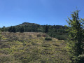
Mont Mézenc and the area around Les Estables

A short walk involving the ascent of Mont Mézenc to admire the view from the summit, then on towards the Croix des Boutières to take in the views of the cirque of the same name. The route passes through the village of Les Estables and takes a short detour towards Rechausseyre.

Details

n°39840165
Creation:
Last update:
Last review:
  • Horse riding
    Activity: Horse riding
  • ↔
    Distance: 11.36 mi
  • ◔
    Duration according to the author: 4 hrs 
  • ▲
    Difficulty: Easy

  • ⚐
    Back to start: Yes
  • ↗
    Ascent: + 2,126 ft
  • ↘
    Descent: - 2,136 ft

  • ▲
    Highest point: 5,748 ft
  • ▼
    Lowest point: 4,298 ft

Photos

Description of the walk

Car park opposite the Maison Forestière and the Estables Nordic Ski Centre.

(S/E) Cross the road towards the Maison Forestière and the Nordic Ski Centre.

(1) Turn right onto theGR® path running alongside the D274 towards the Croix de Peccata and walk for about 600 m.

(2) Carry on straight ahead to reach the Croix de Peccata car park.

(3) Cross the road, then the car park, and follow theGR® towards Mont Mézenc. At the next junction, the path becomes a trail still markedGR®; follow it and begin the ascent until you reach a fork.

(4) Continue climbing Mont Mézenc, letting theGR® branch off to the right towards the Croix de Boutières, which you’ll take on the way back. At the next junction, theGR® splits.

(5) Keep left to reach the summit.

(6) Turn right. Carry straight on at the junction (elevation 1727) to reach the orientation table.

(7) Turn right, return to the junction at elevation 1727, then turn left to rejoin the fork you passed on the way up.

(5) Head left until you reach the fork you passed on the way there.

(4) Turn left to follow theGR® towards the Croix de Boutières. Reach the car park.

(8) Cross the road to rejoin theGR® opposite. Follow it for about 600 m to discover first one, then a second viewpoint over the Cirque des Boutières.

(9) Turn back to return to the Croix de Boutières car park.

(8) Take theGR® to the left on the other side of the road, which leads back towards Les Estables.
TheGR® follows a lovely path which, once out of the woods, runs along the edge of the woodland and offers a beautiful panoramic view of Les Estables. Follow it until you return to the D274. Cross the road carefully and you’ll come to a junction you passed on the way out.

(2) Turn left onto the forest track that runs alongside the D274, which you took on the way there. Continue for about 100 metres, then turn right off the track to return to the Nordic Centre and the Forest House without retracing the entireGR® route you followed on the way there.

(10) Turn left in front of the Maison Forestière, cross the road and return to the original junction.

(1) Turn right onto theGR® towards Les Estables. Follow it straight on until the nextGR® junction, about 950 m away.

(11) Keep left towards Les Estables, which you’ll reach via Rue du Pouzolin.

(12) Turn left, walk past the town hall and join the D36.

(13) Cross the departmental road with care and turn immediately left, following theGR® signposts towards Rocher Tourte. Leave the village behind and, a little further on, pass a picnic area on your left. You’ll come to a fork in the road.

(14) Leave the road and take theGR® on the right, following the signs for “Tour du Rocher Tourte”. Follow it and enter the forest.

(15) Turn left and go round the Rechausseyre rock from the east. Reach the edge of the forest.

(16) Leave theGR® which branches off to the right and take the path at right angles to the left, which runs along the edge of the woodland and pastures: oldGR® tracks are visible on both sides. The path then winds through the meadows to rejoin the tarmac road you left earlier.

(17) Turn left towards Les Estables until you reach the previous junction.

(14) Follow the path you took on the way there in the opposite direction to reach the Nordic Ski Centre.

(1) Turn right and return to the car park (S/E).

Waypoints

  1. S/E : mi 0 - alt. 4,944 ft - Car park
  2. 1 : mi 0.1 - alt. 4,954 ft - GR junction. Crossroads of the circular loop
  3. 2 : mi 0.48 - alt. 5,092 ft - Junction with the Mont Mézenc circular loop
  4. 3 : mi 0.62 - alt. 5,148 ft - Croix de Peccata car park
  5. 4 : mi 1.34 - alt. 5,482 ft - Junction with the GR°°®°°
  6. 5 : mi 1.43 - alt. 5,577 ft - Common junction. Return route - Mont Mézenc
  7. 6 : mi 1.56 - alt. 5,692 ft - Mont Mézenc
  8. 7 : mi 1.89 - alt. 5,712 ft - Orientation table
  9. 8 : mi 3.34 - alt. 4,948 ft - Col de la Croix de Boutières (1502m)
  10. 9 : mi 3.75 - alt. 5,144 ft - Cirque des Boutières
  11. 10 : mi 5.96 - alt. 4,977 ft - Forest House
  12. 11 : mi 6.62 - alt. 4,662 ft - Junction with the GR°°®°°
  13. 12 : mi 7 - alt. 4,423 ft - Les Estables, on the left
  14. 13 : mi 7.15 - alt. 4,383 ft - D36
  15. 14 : mi 7.58 - alt. 4,334 ft - Junction with the Rechausseyre circular loop
  16. 15 : mi 8.27 - alt. 4,390 ft - Junction: turn left
  17. 16 : mi 8.9 - alt. 4,583 ft - Edge of the woodland, on the left
  18. 17 : mi 9.25 - alt. 4,482 ft - Return via the tarmac road
  19. S/E : mi 11.36 - alt. 4,944 ft - Car park

Notes

Several drinking fountains accessible to horses in Les Estables.
Large car park opposite the Forest Ranger’s House and the Nordic Ski Centre.
Plenty of shops in the village during opening hours.
The access path to Mont Mezenc is currently being upgraded; please follow the signposting carefully.
Please note that as the path is narrow and very busy in summer, take care around pedestrians (stones being kicked up by horses’ hooves, jostling, and children running or playing on the route).
Sensitive areas on Mont Mezenc – no off-trail walking.
The route is easy to follow; an IGN map is sufficient.
There are no particular difficulties along the route.

Worth a visit

Ascent of Mont Mézenc: a must-do to discover the magnificent panoramic views from the summit
Croix de Boutières and the views over its cirque.
Nearby, Mont d’Alambre (we climbed it last year along with Mont Mézenc and Chaudeyrolles)
Nearby, the Rocher Tourte (allow an extra 8 km): we could have included it in the walk but it was our last day of hiking and we had a 3-hour drive home, so we had to stick to a circular route.

Always be cautious and plan ahead when you're outdoors. Visorando and the author of this route cannot be held responsible for any accidents occurring on this route.

The GR® and PR® markings are the intellectual property of the Fédération Française de Randonnée Pédestre.

Reviews and comments

5 / 5
Based on 1 review

Reliability of the description
5 / 5
Ease of following the route
5 / 5
Route interest
5 / 5
Visiorandonneur 79
Visiorandonneur 79

Overall rating : 5 / 5

Date of your route : Jun 17, 2025
Reliability of the description : ★★★★★ Very good
Ease of following the route : ★★★★★ Very good
Route interest : ★★★★★ Very good
Very busy route : No

We walked around Mont Mézenc and added the climb from the pass above Les Boutieres. There were a few people at the summit.
A beautiful, sunny and very pleasant hike.

Machine-translated

Other walks in the area

For more walks, use our search engine .

The GPS track and description are the property of this route's author. Please do not copy them without permission.