Country:
 City:


Starting point and access: Chatou-Croissy station.
- RER – Line A, on the section between Paris and Saint-Germain-en-Laye.
Take Exit 1, Rue Paul Flament (a few steps where you’ll need to carry your bike; a gate suitable for bikes and wheelchairs at the exit).
Signs for ‘La Seine à vélo’ (green on a white background with a silhouette of a cyclist) are visible at intervals.
(S/E) On leaving the station, turn right onto Rue Paul Flament. At the end of the street, turn right towards the swimming pool and head downhill.
(1) At the traffic lights, turn left, cross the perpendicular avenue and immediately join the right-hand pavement at the pedestrian crossing.
(2) Turn sharply right towards Saint-Germain-en-Laye, go through a small barrier, take the tarmac road and go under the railway bridge. Carry on straight ahead along the Seine and ignore all the turnings on the right.
(3) Go under a road bridge and continue straight on along the Quai de l’Écluse.
(4) Pass through a metal barrier and carry on straight ahead along a gravel path. Stay close to the banks of the Seine, with sports grounds on your right, followed by the green fence of a drinking water treatment plant.
(5) At the corner by the fence, carry on straight ahead along the cycle path which runs alongside the Boulevard de la Libération on your right. Cross a small park (metal sculpture, ‘Barnes Way’ sign) and continue along the Quai de l’Orme de Sully.
(6) Go under a road bridge and continue along the cycle path.
(7) Pass under a railway bridge, briefly returning to the road (caution! Narrow passage – obey the traffic lights and remember to keep to the right). You’ll soon rejoin the cycle path alongside a boulevard.
(8) When the boulevard ends in a dead end, continue along the gravel path through a wooded area. Go straight on, ignoring all turn-offs to the right.
(9) Pass under the A14 motorway bridge, then follow the fence of the Parc de la Boucle on your right. Further on, you’ll pass alongside a wetland area. Take a footbridge over a stream and continue straight ahead along the path.
(10) When you reach the tarmac, take the cycle path situated between a footpath (on the left) and Quai Georges Sand (on the right).
(11) Pass under the Sartrouville railway bridge and continue along the cycle path. Pass under a road bridge and continue along the cycle path.
(12) At the traffic lights just past a bus stop, turn right and leave the cycle path (which ends in a dead end at a secondary school). Ride alongside Place de la Fête on your right and head slightly uphill.
(13) At the roundabout, on the corner of a secondary school, turn left towards La Frette. At the ‘Stop’ sign, carry straight on along Rue de La Frette. Pass the Val d’Oise department sign.
(14) Pass the sign marking the entrance to Cormeilles-en-Parisis. Continue straight ahead along a road with roadworks on either side. Enter La Frette-sur-Seine and continue along the road.
(15) At the foot of La Frette church, carry on straight ahead along the Quai de la Seine.
(16) At the ‘Stop’ sign, carry on straight ahead along the quayside towards Herblay.
(17) Pass a ferry terminal and carry on straight ahead along the Quai du Génie.
(18) Pass through a metal barrier and continue along a cycle path.
(19) Pass another metal barrier and carry on straight ahead.
(20) Pass under a high-voltage power line and enter Conflans-Sainte-Honorine. At the ‘Stop’ signs that follow, go straight on. Follow the Quai de Gaillon and then the Quai des Martyrs de la Résistance.
(21) Cross the square diagonally to the left and take the Promenade François Mitterrand, keeping as close to the Seine as possible.
(22) Go under the Pont de Conflans and stay along the banks of the Seine.
(23) At the foot of the railway bridge, go up the ramp on the right. Cross the quay at the pedestrian crossing and follow it to the left.
(24) At the roundabout, take thethird exit(the main one) and follow the cycle lane onto the bridge spanning the Oise. Go down the other side.
(25) At the bottom, turn sharply right and follow the Passage de Smeth to the banks of the Oise.
(26) Turn right, go under the road bridge and follow the river, which soon joins the Seine. Follow the river on your left along Avenue du Général de Gaulle.
(27) At the Stop sign, turn slightly left and pass the Andrésy town hall. Then pass the church (on the right) and the market halls (on the left).
(28) Then take the cycle lane closest to the Seine. You’ll soon reach the Quai de Seine and continue along the river.
(29) Go under a footbridge and follow the Écluse de la Dérivation. After about 500 m, when the road bends to the right, carry on straight ahead along a path.
(30) Go under the Pont de Poissy. After about 150 m, turn right, cross a wooden footbridge over a wetland area and pass by the foot of some small blocks of flats.
(31) At the end of the lane, turn right. Turn left with the road, then right. At the traffic lights, follow a wide avenue to the right towards Poissy.
(30) Cross the bridge over the Seine.
(32) Atthe first set of traffic lights, turn right and go under a footbridge. Turn right again into Rue du Bac.
(33) At the next junction, turn left onto Rue du Port and follow the Seine. At the crossroads, veer right and you’ll reach the remains of the Old Poissy Bridge.
(34) Carry on straight ahead along the Cours du 14 Juillet. Turn left, ignore a road on the right, follow Avenue Meissonier and go under the railway bridge.
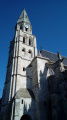
(35) Cross Rue Jacob-Courant and, at the next junction (traffic lights), go straight on. Then turn left onto Rue de l’Église and you’ll soon reach the entrance to the Collegiate Church of Poissy.
(36) Carry on straight ahead along Rue de l’Église, then Rue au Pain. Cross Avenue du Cep, then Rue du Général de Gaulle. Pass Rue Notre-Dame on your left and, at the next junction, turn left onto Boulevard Victor Hugo. At the end, turn right and you’ll very soon see Poissy station on your left (E).
To get back home:
- RER – Line A, towards Paris.
- Transilien – Line J, towards Paris-Saint-Lazare or Mantes-la-Jolie.

 Tourism professional
 Easy
 Visorando Member