Country:
 City:


Start at Place du Fresne.
(S/E) Turn right onto Rue de la Maison Rouge and take a zigzag turn to find Rue du Terratu (between Rue du Fresne and Rue de Monchy). Follow it for 600 metres, then continue straight on along the path for 700 metres.
(1) At the end of the path, turn left. Enter the forest and continue straight on for 1,200 metres until you reach the Isabelle signpost.
(2) Take the path on the left and, after about 200 metres, follow the path to the right.
Carry on along the path, pass the junction and continue for about 1 km, passing the Chêne Louise.
(3) At the junction, carry on straight ahead. After 400m, ignore the path on the left and carry on to the right along the path that bends to the right. Walk for 400m, carry on straight ahead, ignore the path coming from the left and continue for 500m to return to the junction near the Chêne Louise.
(3) Take the path opposite for about 50 metres, then turn onto the path leading left along the ridge. Follow the path for 400 metres and head down to the right (signpost) to see the Quesne à Leu.
(4) Continue along the path on the left which climbs up to the Pierre Bise. Carry on along the path and follow the signposted route to reach the Siège Madame.
(5) On reaching the Siège Madame, take the road to the right (ignore the botanical trail branching off diagonally to the immediate right). Carry on straight ahead, ignore the first junction and continue past the Gallo-Roman site; the road curves to the left.
500 metres further on, on the right, is the Allée des Princes; a sign marks the spot (see photo – you can carry on along the road if you wish).
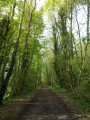
(6) Take the path between the beech trees which leads into the forest and then runs more or less alongside the road.
After 400 metres, the path disappears; cut across to the left for 50 metres, and you’ll reach the ‘gamekeeper’s’ cottage.
Take the path on the left which joins the road, then follow the road to the right for 400 metres.
(7) At the junction by the entrance to the Ferme de Beaumont, take the path on the left for 500 metres.
When you reach the Route de Saint-Pierre, continue left for 50 metres.
(8) Take the path on the left which runs along the hillside. After 100 metres, take the path on the right which runs alongside the gardens. Follow this path and, at the junction, carry on straight ahead. Follow Rue de Babeau for 400 metres; it descends to the right towards the end to join Rue de la Forêt.
(9) Turn left, then right after 20 metres to rejoin Rue du Bas. 100 metres after the right-hand bend, turn left onto Rue de la Poterie; after 60 metres, the road curves in an S-shape.
(10) At the circular bend to the right, take the path on the left. Follow it for 500 metres, then return to Rue de la Forêt.
(11) Turn right. Follow the road for 500 metres; do not turn left at the junction, but carry on for a further 50 metres.
(12) Take a path on the right which runs along the edge of the forest. Follow the path as it winds along the edge of the forest to the end of the path; at the junction, turn right to return to the crossroads you passed on the way there.
(1) Turn right again and follow the path to Place de le Fresne (S/E).
 Visorando Member

 Moderate