The scree, starting from Saint-Symphorien-de-Mahun

Set off to explore the ruins of Mahun Castle and the famous scree.
Do bear in mind, however, that the first part of the walk is quite strenuous.

Details

20362065
Creation:
Last update:
Last review:
  • Walking
    Activity: Walking
  • ↔
    Distance: 4.71 mi
  • ◔
    Average duration: 3h 10 
  • ▲
    Difficulty: Moderate

  • ⚐
    Back to start: Yes
  • ↗
    Ascent: + 1,158 ft
  • ↘
    Descent: - 1,158 ft

  • ▲
    Highest point: 3,658 ft
  • ▼
    Lowest point: 2,500 ft

Photos

Description of the walk

You can park in the large car park on the left as you enter the village of Saint-Symphorien-de-Mahun.

(S/E) Walk eastwards through the village, then head north onto Route de Gaspard. Continue on, enter the forest, then turn right to reach the hamlet of Gonnet.

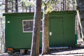
(1) Turn left at thefirst house and turn left again after the last house. Continue uphill and, a few hundred metres further on, you’ll see the ruins of Mahun Castle. Carry on along a wide bend to the right and pass a green caravan.

(2) You’ll come out onto a wider track; follow it to the left and walk along a very gentle incline. You’ll reach the Croix du Knoll crossroads.

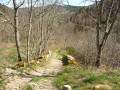
(3) Ignore the paths to the right and left and take the one just to the right of the cross. Continue uphill along this very stony path, which climbs steadily. From here on, the path will only go uphill.
At the Chirat Blanc signpost, you can turn right to admire the view, but make sure you retrace your steps. Continue downhill, ignoring the paths to the right and left, until you reach a wide track at the Croix de Sigolle.

(4) Turn left and follow the road, then head towards a path junction at a left-hand bend.

(5) Take the small path on the right. Be careful, as it isn’t very visible, so you’ll need to look carefully. Follow it and ignore thefirst junction you come to. You’ll reach asecond junction.

(6) Turn left and carry on. As you head downhill, you should see a meadow on your right, as well as a large stone house in Mialier. You will then come to another road.

(7) Cross it and take a very narrow path opposite. Then walk alongside some stone walls until you reach the road again. Follow it to the right until you join another road.

(8) Turn left onto it and continue along this road. Cross a stream and you’ll reach Saint-Symphorien-de-Mahun and the car park (S/E).

Waypoints

  1. S/E : mi 0 - alt. 2,500 ft - Saint-Symphorien-de-Mahun car park
  2. 1 : mi 0.51 - alt. 2,654 ft - Gonnet hamlet
  3. 2 : mi 1.39 - alt. 3,255 ft - Roulotte Verte crossroads
  4. 3 : mi 2.38 - alt. 3,386 ft - Croix du Knoll
  5. 4 : mi 3.05 - alt. 3,409 ft - Signolle Cross
  6. 5 : mi 3.5 - alt. 3,281 ft - Road junction
  7. 6 : mi 3.69 - alt. 3,058 ft - Crossroads
  8. 7 : mi 3.96 - alt. 2,858 ft - Mialier crossroads
  9. 8 : mi 4.2 - alt. 2,628 ft - Road junction
  10. S/E : mi 4.71 - alt. 2,500 ft - Saint-Symphorien-de-Mahun car park

Notes

I recommend this walk before the hot weather sets in, as the terrain is ideal for tall grass, stones and, consequently, snakes and other reptiles.
Make sure you wear sturdy shoes and long trousers if possible.

Worth a visit

Between (1) and (2), you can visit the ruins at Château de Mahun, with the added bonus of a magnificent view of the neighbouring mountains.
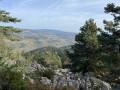
Between (3) and (4), you can climb to the summit of the Chirat Blanc to admire an unrivalled panorama.

Reviews and comments

4.6 / 5
Based on 3 reviews

Reliability of the description
5 / 5
Ease of following the route
4 / 5
Route interest
4.7 / 5
User 26486891

Overall rating : 4.7 / 5

Date of your route : Apr 06, 2026
Reliability of the description : ★★★★★ Very good
Ease of following the route : ★★★★☆ Good
Route interest : ★★★★★ Very good
Very busy route : No

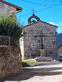
This walk is absolutely lovely, especially in early spring; we didn’t see a soul apart from two or three mountain bikers. The route starts on a small road, which you soon leave behind to head onto the footpaths. The detour to the top of the oppidum offers a stunning view of the surrounding valleys; and at the end of the walk, do take the time to visit the village and its church.

Machine-translated

TOULAUD'RANDO
TOULAUD'RANDO

Overall rating : 4 / 5

Date of your route : Oct 28, 2024
Reliability of the description : ★★★★★ Very good
Ease of following the route : ★★★☆☆ Average
Route interest : ★★★★☆ Good
Very busy route : No

The signposting needs to be redone; the colours are very, very faint.
A lovely walk amongst the chestnut trees.
A lovely walk with very little elevation gain.

Machine-translated

hittite
hittite

Overall rating : 5 / 5

Date of your route : Sep 28, 2023
Reliability of the description : ★★★★★ Very good
Ease of following the route : ★★★★★ Very good
Route interest : ★★★★★ Very good
Very busy route : No

A lovely walk, with no difficulty at all.

Machine-translated

Other walks in the area

For more walks, use our search engine .

The GPS track and description are the property of this route's author. Please do not copy them without permission.