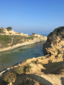
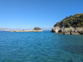
Cap Drastis via the hills

A walk suitable for everyone on long, wide paths. Beautiful views and scenery await.

Details

n°64118799
Creation:
Last update:
Last review:
  • Walking
    Activity: Walking
  • ↔
    Distance: 4.26 mi
  • ◔
    Average duration: 2h 30 
  • ▲
    Difficulty: Easy

  • ⚐
    Back to start: Yes
  • ↗
    Ascent: + 646 ft
  • ↘
    Descent: - 653 ft

  • ▲
    Highest point: 344 ft
  • ▼
    Lowest point: 13 ft

Photos

Description of the walk

You can park along the road on the grass verges.

(S/E) Head north-east: the start of the wide path is very easy to spot on the left just past where you’ve parked. You’ll soon reach a three-way junction.

(1) Turn left. Ignore the first path on the right, then a second on the left, and continue to a third junction.

(2) Turn right and walk down to the sea.

(3) Turn left and enjoy the view. Keep walking straight ahead.

(4) Leave the path on your right – the one you’ll take back after visiting the headland – and carry on straight ahead to the car park. Then turn right to reach the viewpoint.

(5) Carry on in the same direction, rounding two hairpin bends, then turn your back on the headland as you follow the path.

(6) After admiring Cap Drastis from above, turn left to walk down and see it from below. Follow the wide path to the end.

(7) Turn round and head back to the junction.

(6) Follow the small path in front of you as you climb; you can’t miss it. Join the path you took on the way there.

(4) Turn left and retrace your steps.

(3) Carry on straight ahead.

(8) Ignore the path on the right and carry on straight ahead. The path then curves to the right and eventually rejoins the original junction.

(1) Head diagonally to the left, join the road, then turn right to return to where you parked (S/E).

Waypoints

  1. S/E : mi 0 - alt. 30 ft - Roadside parking
  2. 1 : mi 0.14 - alt. 30 ft - Junction with the circular loop
  3. 2 : mi 0.73 - alt. 207 ft - Junction
  4. 3 : mi 1.05 - alt. 292 ft - Common junction for outbound and return routes
  5. 4 : mi 1.65 - alt. 295 ft - Circular loop junction
  6. 5 : mi 1.84 - alt. 207 ft - Viewpoint
  7. 6 : mi 2.19 - alt. 115 ft - Junction
  8. 7 : mi 2.31 - alt. 30 ft - View of the cape
  9. 8 : mi 3.61 - alt. 249 ft - Junction
  10. S/E : mi 4.26 - alt. 16 ft - Roadside parking

Notes

There are no water sources along the path, so make sure you bring enough water.

Reviews and comments

5 / 5
Based on 1 review

Reliability of the description
5 / 5
Ease of following the route
5 / 5
Route interest
5 / 5
Yvonus
Yvonus

Overall rating : 5 / 5

Date of your route : May 23, 2025
Reliability of the description : ★★★★★ Very good
Ease of following the route : ★★★★★ Very good
Route interest : ★★★★★ Very good
Very busy route : No

I love this sort of walk that takes you to a tourist attraction on foot, with the joy of discovery and that ‘wow’ moment when you finally see the place.
It really is a different experience to just driving up to a car park.
Many thanks for this extremely precise route, with added touches such as a waypoint marking an intersection for information purposes only.

Machine-translated

Other walks in the area

For more walks, use our search engine .

The GPS track and description are the property of this route's author. Please do not copy them without permission.