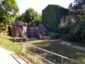
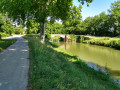
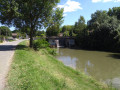
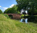
The Canal du Midi from the Castanet Tolosan lock to the Ayguesvives lock

A lovely round trip along the Canal du Midi.
On foot or by bike.
Suitable for families – you can adjust the length and duration as required (you can turn back whenever you like).

Details

3288360
Creation:
Last update:
Last review:
  • Walking
    Activity: Walking
  • ↔
    Distance: 15.59 mi
  • ◔
    Average duration: 7h 10 
  • ▲
    Difficulty: Difficult

  • ⚐
    Back to start: Yes
  • ↗
    Ascent: + 43 ft
  • ↘
    Descent: - 43 ft

  • ▲
    Highest point: 531 ft
  • ▼
    Lowest point: 489 ft

Photos

Description of the walk

Access via Castanet-Tolosan. Start from the car park near the Castanet lock.

The route follows only the Canal du Midi towpath.

(S/E) With your back to the car park, head right towards the lock and the canal.

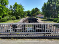
(1) At the Castanet Lock, cross the canal and immediately turn right onto the towpath.

(2) At the Vic Lock, cross the road carefully and continue straight ahead.

(3) At Deyme Bridge (D94), cross the road with care and continue along the towpath.

(4) At Donneville Bridge (D95), cross the road carefully and continue straight ahead. Near Montgiscard, also cross the D31 carefully and follow the tarmac section opposite for a few metres.

(5) At the Montgiscard Lock, leave the road and follow the towpath straight ahead.

(6) At the Chemin des Romains, cross the road and continue along the canal bank.

(7) The Ayguesvives Lock marks the end of the route. To return to the Castanet Lock, follow the same route back to the (S/E).

Waypoints

  1. S/E : mi 0 - alt. 489 ft - Car park near the Castanet lock
  2. 1 : mi 0.06 - alt. 492 ft - Castanet Lock - Canal du Midi
  3. 2 : mi 1.15 - alt. 502 ft - Vic Lock
  4. 3 : mi 2.62 - alt. 512 ft - Deyme Bridge
  5. 4 : mi 4.39 - alt. 512 ft - Donneville Bridge
  6. 5 : mi 5.79 - alt. 512 ft - Montgiscard Lock
  7. 6 : mi 7.01 - alt. 525 ft - Chemin des Romains
  8. 7 : mi 7.79 - alt. 531 ft - Ayguesvives Lock - Canal du Midi
  9. S/E : mi 15.59 - alt. 489 ft - Car park near the Castanet lock

Notes

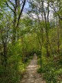
The route is completely flat and mostly shaded.

This walk is classified as ‘Difficult’ due to its length. 5 hours 40 minutes without a break.

To work out the total distance based on the waypoint where you turn back, simply double the distance shown for that waypoint in the summary list. For example, turning back at waypoint no. 3 (Deyme Bridge) corresponds to a total distance of 8.42 km (2 × 4.21).

Worth a visit

Reviews and comments

4.7 / 5
Based on 1 review

Reliability of the description
5 / 5
Ease of following the route
5 / 5
Route interest
4 / 5
JM58
JM58

Hello,

This is only possible on certain sections of the route.

Enjoy your walk!

Machine-translated

brunolazare
brunolazare

Overall rating : 4.7 / 5

Date of your route : Dec 07, 2020
Reliability of the description : ★★★★★ Very good
Ease of following the route : ★★★★★ Very good
Route interest : ★★★★☆ Good
Very busy route : No

Why not take the path along the south bank on the way back?

Machine-translated

Other walks in the area

For more walks, use our search engine .

The GPS track and description are the property of this route's author. Please do not copy them without permission.