


Refine your search for walks in Le Bousquet
Le Bousquet walks
 Roquefort-de-Sault to Escouloubre and back
 Visorando Member
 11.85 mi
 +1,965 ft
 -1,952 ft
 7h 10
7h 10
 Moderate
 Departure from Roquefort-de-Sault (Aude)
A particularly interesting round trip, thanks to the variety of landscapes and views. The route follows part of the “chemin vieux”, which is very well signposted with attractive signs. Park in Roquefort-de-Sault in the morning, have lunch in Escouloubre and set off again along the paths in the afternoon: that makes for a lovely day out.
Tour du Bénal in Counozouls
 5.01 mi
+1,791 ft
-1,791 ft
3h 50
Moderate
Departure from Counozouls (Aude)
5.01 mi
+1,791 ft
-1,791 ft
3h 50
Moderate
Departure from Counozouls (Aude)
A short walk before visiting the village of Counozouls and its craft brewery. There are a few shaded sections along the Ruisseau de Bailleurs. When we walked this route in July, crossing the stream was straightforward. After heavy rain, you may need to take off your shoes.
Around Fontanès-de-Sault
7.00 mi
+1,499 ft
-1,499 ft
4h 30
Moderate
Departure from Fontanès-de-Sault (Aude)
A pleasant heritage walk open to all around Fontanès-de-Sault, where you’ll follow a section of the famous ‘Chemin Vauban’.
Tour of the villages of Donezan
12.58 mi
+2,356 ft
-2,372 ft
7h 50
 Difficult
Departure from Quérigut (Ariège)
Difficult
Departure from Quérigut (Ariège)
A fantastic hike in the Donezan, allowing you to discover all of its villages and rich heritage.The main difficulty of this route is its length, covering nearly 20 km.Best enjoyed in autumn, when the flamboyant colours of Donezan offer landscapes of exceptional beauty.
Vauban Trail from Rouze to Aunat
9.41 mi
+1,414 ft
-1,585 ft
5h 35
Moderate
Departure from Rouze (Ariège)
This section of the Chemin Vauban links Rouze to Aunat, gradually leaving the Donezan behind to reach the Aude Pyrenees. The route, which is generally easy and accessible, alternates between sections through woodland and pleasant paths, notably crossing the border between Ariège and Aude. The section between Campagna-de-Sault and the Col de la Clause is particularly interesting for its heritage and numerous information boards, which provide a better understanding of the areas passed through, especially around the Dournes tunnel.From the Col de la Clause, the route continues mainly downhill through woodland before gradually reaching the village of Aunat.
Tour of Donezan
 10.74 mi
+1,726 ft
-1,703 ft
6h 25
Moderate
Departure from Rouze (Ariège)
10.74 mi
+1,726 ft
-1,703 ft
6h 25
Moderate
Departure from Rouze (Ariège)
This hike is best done at the end of October. If the weather is favourable, the "French Quebec" will dazzle you with its autumn colours. But there's nothing to stop you coming back in spring or summer. There are some beautiful views of the plateau and its villages: Rouze, Mijanes, Artigues, Le Pla, Le Puch, Quérigut and the peaks overlooking Donezan. The first half of the route follows the Vauban trail.
 Callau refuge from the Col de Jau
 5.31 mi
+564 ft
-561 ft
3 hrs
5.31 mi
+564 ft
-561 ft
3 hrs
 Easy
Departure from Mosset (Pyrénées-Orientales)
Easy
Departure from Mosset (Pyrénées-Orientales)
Enjoy the snow on an easy walk in Catalan country.
El Madrès and Pic del Bernat Salvatge from the Col de Jau
 10.43 mi
+3,392 ft
-3,366 ft
7h 45
Difficult
Departure from Mosset (Pyrénées-Orientales)
10.43 mi
+3,392 ft
-3,366 ft
7h 45
Difficult
Departure from Mosset (Pyrénées-Orientales)
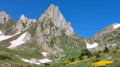
This route, which passes through Madres and Bernard Sauvage, is absolutely stunning.The climb up to Madres follows a very well-marked path.==> From this point (El Madrès), turn back if you’re not comfortable walking off the marked trail.The climb up to Bernard Sauvage is straightforward and easy to follow.The rest of the return route follows a good ridge path to La Glèbe (14). *From there to (15), you’ll need the GPX track on the app. *
Callau Refuge Circular Walk
 6.36 mi
+892 ft
-892 ft
5 hrs
Moderate
Departure from Mosset (Pyrénées-Orientales)
6.36 mi
+892 ft
-892 ft
5 hrs
Moderate
Departure from Mosset (Pyrénées-Orientales)
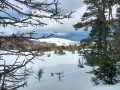
This year, with its exceptional snowfall, it is possible to tackle routes that were difficult to complete in previous years. There seems to be nearly a metre of snow, which is impressive. To climb up to the pass, we took advantage of a very clear road, with no snow or ice. A very beautiful circular route, a little challenging as you sink in a lot, but very interesting. For the less adventurous, a round trip on the flattest part of the route makes for an easy discovery hike (between the Col de Jau at 1,506 metres and the point (2) at 1,529 metres).
Pic Dourmidou
 4.77 mi
+1,332 ft
-1,316 ft
4 hrs
Moderate
Departure from Mosset (Pyrénées-Orientales)
4.77 mi
+1,332 ft
-1,316 ft
4 hrs
Moderate
Departure from Mosset (Pyrénées-Orientales)
This year, with its exceptional snowfall, allows you to do this route on snowshoes in good conditions. To climb up to the pass, we took advantage of a very clear road, with no snow or ice. A beautiful hike that takes you to the summit of Pic Dourmidou with heavy snowfall, just after 5 to 10 centimetres of fresh snow fell during the night, adding to the thick layer that had fallen in previous days. Beautiful 360° view from the summit before the fog rolled in.
Around Saint-Martin-Lys
6.73 mi
+2,175 ft
-2,149 ft
5h 00
Moderate
Departure from Saint-Martin-Lys (Aude)
A beautiful, shaded hike in the forest of the charming village of Saint-Martin-Lys, at the foot of the River Aude. This route is well worth the detour, with a beautiful viewpoint over the Axat Valley at the start of the trail.
Below the Col Jau, towards the old ski lift
 4.26 mi
+1,014 ft
-1,017 ft
4 hrs
Moderate
Departure from Mosset (Pyrénées-Orientales)
4.26 mi
+1,014 ft
-1,017 ft
4 hrs
Moderate
Departure from Mosset (Pyrénées-Orientales)
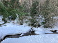
Circular hike starting below the Col de Jau at the start of the old ski resort. Except for the track leading from the road to the car park, we were able to complete the entire hike in virgin snow and discover areas marked only by animal tracks in all directions.
From Puyvalador to the Quérigut Pond
 10.67 mi
+1,650 ft
-1,627 ft
6h 20
Moderate
Departure from Puyvalador (Pyrénées-Orientales)
10.67 mi
+1,650 ft
-1,627 ft
6h 20
Moderate
Departure from Puyvalador (Pyrénées-Orientales)
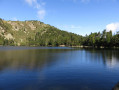
A beautiful border getaway between the Pyrénées Orientales and Ariège that will take you to the wild Étang de Quérigut in Donezan.
The 5 Senses Trail from the Col de Jau road
 4.15 mi
+1,398 ft
-1,378 ft
3h 05
Easy
Departure from Mosset (Pyrénées-Orientales)
4.15 mi
+1,398 ft
-1,378 ft
3h 05
Easy
Departure from Mosset (Pyrénées-Orientales)
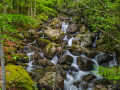
A superb, very easy hike that is accessible to everyone and will allow you to appreciate the Mosset communal forest.
Below the Col de Jau, Sentier des 5 Sens
 4.19 mi
+1,332 ft
-1,332 ft
4h 39
Moderate
Departure from Mosset (Pyrénées-Orientales)
4.19 mi
+1,332 ft
-1,332 ft
4h 39
Moderate
Departure from Mosset (Pyrénées-Orientales)
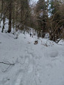
Inspired by a Visorandonneur hike called "Le Sentier des 5 Sens depuis la route du Col de Jau" (The 5 Senses Trail from the Col de Jau road), the idea of doing it on snowshoes was made possible by the exceptional snowfall of the previous days. There was enough good snow to avoid having to climb up and start from the Col de Jau as we did in other winters. Apart from the track leading from the road to the car park, the entire hike took place in virgin snow, allowing us to see animal tracks in all directions. It was a real treat!
Le Roc Blanc via the Étang du Laurenti then the Porteille de Barbouillère
 7.93 mi
+3,058 ft
-3,058 ft
6h 20
Difficult
Departure from Le Pla (Ariège)
7.93 mi
+3,058 ft
-3,058 ft
6h 20
Difficult
Departure from Le Pla (Ariège)
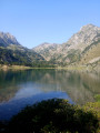
A refuge, a large pond, a pass, a legendary peak and a small pass during this mountain hike.
The route is accurate. Do not cut corners. Natura 2000 site: specific rules apply.
Signposting in good condition (17 July 2021). There are very few directional posts.
Allow at least 5 hours’ walking time. Marked in yellow / red and yellow / unmarked sections.
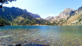
The walk around Étang du Laurenti
 3.97 mi
+1,129 ft
-1,102 ft
2h 50
Moderate
Departure from Le Pla (Ariège)
3.97 mi
+1,129 ft
-1,102 ft
2h 50
Moderate
Departure from Le Pla (Ariège)
Discover the Étang de Laurenti, one of the most beautiful lakes in the Ariège region, which reveals all the magic of the Donezan, a mountain range rightly nicknamed ‘the little Quebec of the Ariège’.
On arrival, after passing through a beautiful forest of beech and fir trees, you’ll discover, in an enchanting and majestic setting, a lake fringed with pine trees, nestled at the foot of the Roc Blanc.
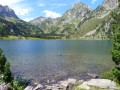
Roc Blanc via the Étang de Laurenti
 6.43 mi
+2,963 ft
-2,963 ft
5h 30
Difficult
Departure from Le Pla (Ariège)
6.43 mi
+2,963 ft
-2,963 ft
5h 30
Difficult
Departure from Le Pla (Ariège)
This climb in the sunny Pyrenees is a real classic, which means it can get quite busy in good weather. However, the magnificent Étang de Laurenti and the 360° view from the summit of Roc Blanc are well worth the effort required during the hike.
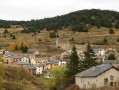
The Heights of Puyvalador
 4.32 mi
+1,230 ft
-1,230 ft
3h 05
Easy
Departure from Puyvalador (Pyrénées-Orientales)
4.32 mi
+1,230 ft
-1,230 ft
3h 05
Easy
Departure from Puyvalador (Pyrénées-Orientales)
Here is a lovely hiking route open to all that will immerse you in the Hauts de Puyvalador amidst the stunning Capcinoise vegetation.
The Sentier d’Émilie starting from Puyvalador Station
 1.47 mi
+469 ft
-469 ft
1h 05
Easy
Departure from Puyvalador (Pyrénées-Orientales)
1.47 mi
+469 ft
-469 ft
1h 05
Easy
Departure from Puyvalador (Pyrénées-Orientales)
A short circular loop starting from Puyvalador Station, taking about 1 hour at a leisurely pace. The route is signposted and can be completed on foot or in snowshoes, depending on the weather. Most of the route is in the shade of the trees in the forest.
From the Puyvalador ski resort to the Pic de Ginèvre
5.60 mi
+2,156 ft
-2,156 ft
4h 25
Moderate
Departure from Puyvalador (Pyrénées-Orientales)
A fairly wild hike away from the crowds, taking you to the Pic de Ginevre and its magnificent 360° views.
Please note, three-quarters of the hike is off-trail.