Country:
 City:
City:


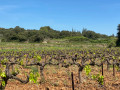
To reach the starting point from the centre of Bourg-Saint-Andéol, take the D4 towards Saint-Remèze for about 3 km. Then turn left onto the Chemin de Liby, keep to your left, and park 300 to 400 metres further on, at a three-way junction.
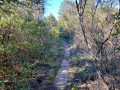
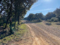
(S/E) Head south along the Chemin du Haut Darbousset for about 150 metres, then continue straight on along the forest track. Cross the GR®42 at right angles and carry on straight ahead.
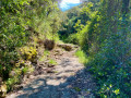
(1) 300 metres further on, don’t miss the small path on the right, which heads west at the start. About 200 metres further on, take the first path on the right (the next one is too steep). This path descends to the stream bed. The last 30 metres are quite steep, over flagstones which may be slippery after a downpour, so take care.
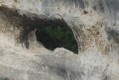
(2) Walk up the stream on the right-hand side and follow it to the Combe des Acacias. Before you reach it, at a bend, you’ll notice the Banc des Novis on the right: a huge horizontal limestone stratum several tens of metres thick.
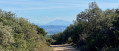
(3) Leave the Combe des Acacias on your right and take the very stony climb on the left, heading south. This is a variant of the GR®42. At the end of this climb, continue southwards until you rejoin the GR®42 on a tarmac road.
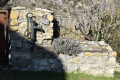
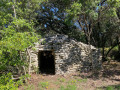
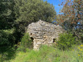
(4) A few metres further on, take the path on the left which heads north. Continue more or less straight ahead to rejoin the stream you left earlier. Take the path, veering slightly to the right, which climbs into the woodland of the nature trail. Keep heading north until you reach a small meadow. As you walk through this meadow, you’ll notice two beautiful drystone shelters. Turn back and head north again, keeping to the left as you leave the meadow. 400 metres further on, turn left, heading west, onto the wide grassy path for 100 metres. A third drystone shelter is located here. Head north again, staying on this path, which leads back to the junction you passed on the way out.
(1) Follow the outward route in the opposite direction back to the car park (S/E).

 Visorando Member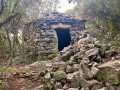

 Average