Haut Darbousset and the discovery trail

A circular walk, alternating between tarmac and forest tracks.
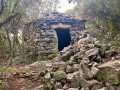
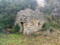
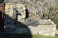
You’ll be able to explore two magnificent drystone shelters that have been beautifully restored.
The nature trail takes you right up to the beautiful stone-paved section of the Sardagne stream.

Details

43207488
Creation:
Last update:
Last review:
  • Walking
    Activity: Walking
  • ↔
    Distance: 4.20 mi
  • ◔
    Average duration: 2h 20 
  • ▲
    Difficulty: Easy

  • ⚐
    Back to start: Yes
  • ↗
    Ascent: + 476 ft
  • ↘
    Descent: - 446 ft

  • ▲
    Highest point: 922 ft
  • ▼
    Lowest point: 479 ft

Photos

Description of the walk

The car park is situated on either side of the Chemin du Haut Darbousset at the Fork in the road with the Chemin des Cistes.

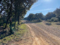
(S/E) Take the Chemin du Haut Darbousset downhill, then turn right off it onto the forest track that starts at the bend. Continue downhill until you reach theGR®42.

(1) Cross it and continue straight ahead to reach the Sentier Découverte.

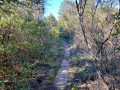
(2) Turn right onto it and follow the yellow and white markings. You’ll reach the Ruisseau de Sardagne.

(3) Turn left, still on the Sentier Découverte, and begin a gentle climb to reach a crossroads of paths.

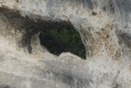
(4) Leave the Sentier Découverte here and turn right onto the road to reach the small spring in the karstic cave at Aven de Darbousset.

(5) Take the path on the right, enter a woodland, then make a wide circular loop to the left to rejoin theGR®42.

(6) Turn left onto it and follow it to return to the junction you passed on the way out.

(1) Keep straight on along theGR®, continuing the climb to reach the junction of footpaths at the highest point.

(7) Turn left atthe first junction to make a circular route through the Banc des Novis woods. To do this, always take the right-hand path at the following junctions, then rejoin the GR®. Walk a few steps to the right and return to the junction where the circular route begins.

(7) Then leave theGR® and head left; stay on this path to return to the Haut Darbousset car park (S/E).


Waypoints

  1. S/E : mi 0 - alt. 751 ft - Haut Darbousset car park
  2. 1 : mi 0.31 - alt. 745 ft - Crossroads at the end of the circular loop
  3. 2 : mi 0.73 - alt. 597 ft - Discovery Trail
  4. 3 : mi 1.27 - alt. 479 ft - Sardagne stream - Tourne (ruisseau) - Affluent du Rhône
  5. 4 : mi 1.64 - alt. 597 ft - Crossroads on the Discovery Trail
  6. 5 : mi 1.92 - alt. 584 ft - Aven de Darbousset (Bourg-Saint-Andéol)
  7. 6 : mi 2.25 - alt. 564 ft - GR42
  8. 7 : mi 3.38 - alt. 886 ft - Crossroads at the highest point
  9. S/E : mi 4.2 - alt. 751 ft - Haut Darbousset car park

Notes

An easy, very accessible walk.
No water points along the route.

Worth a visit

Between (2) and (4). Two drystone shelters on the Discovery Trail.
(5) The Darbousset karstic cave.

Always be cautious and plan ahead when you're outdoors. Visorando and the author of this route cannot be held responsible for any accidents occurring on this route.

The GR® and PR® markings are the intellectual property of the Fédération Française de Randonnée Pédestre.

Reviews and comments

4.2 / 5
Based on 4 reviews

Reliability of the description
4 / 5
Ease of following the route
3.8 / 5
Route interest
4.8 / 5
Rodger0è
Rodger0è

Thank you very much for your kind comment
Roger

Machine-translated

mancusoagnes
mancusoagnes

Overall rating : 5 / 5

Date of your route : Mar 24, 2025
Reliability of the description : ★★★★★ Very good
Ease of following the route : ★★★★★ Very good
Route interest : ★★★★★ Very good
Very busy route : No

No trouble following the signposts. The climb starts on a fairly stony path with a few ‘steep steps’ – nothing too bad. Lovely views and a nice little route around the borries (drystone shelters). The return route is on tarmac, but you can avoid some of it by walking along the edge of a field. A spectacular finish with the gour and the wash house full of water. A lovely walk.

Machine-translated

achettejc
achettejc

Overall rating : 3.7 / 5

Date of your route : Aug 18, 2024
Reliability of the description : ★★★☆☆ Average
Ease of following the route : ★★★☆☆ Average
Route interest : ★★★★★ Very good
Very busy route : No

It’s difficult to do this walk without the Visorando app on your mobile. You have to climb over the electric fences that protect the vineyards from wild boars. This walk is interesting for the drystone shelters that dot the discovery route.

Machine-translated

vivalpierrelatte
vivalpierrelatte

Overall rating : 4 / 5

Date of your route : Mar 04, 2024
Reliability of the description : ★★★★☆ Good
Ease of following the route : ★★★☆☆ Average
Route interest : ★★★★★ Very good
Very busy route : No

A lovely walk, even though we got a bit lost

Machine-translated

ericelec
ericelec

Overall rating : 4 / 5

Date of your route : Jan 30, 2024
Reliability of the description : ★★★★☆ Good
Ease of following the route : ★★★★☆ Good
Route interest : ★★★★☆ Good
Very busy route : No

What a lovely surprise to see these drystone shelters in Bourg-Saint-Andéol – thanks to the photographer.

Machine-translated

Other walks in the area

For more walks, use our search engine .

The GPS track and description are the property of this route's author. Please do not copy them without permission.