Around the Chapel of Chalon

The most iconic site in the Bois du Laoul remains the Chapel of Chalon, famous for the pilgrimage to the Virgin of Chalon, which still takes place on 8 September in the heart of the pleasant clearing. As you admire this enchanting Romanesque church, built in the 12th century, you’ll notice numerous carved and engraved stones.
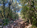
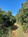
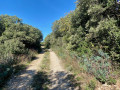
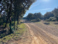
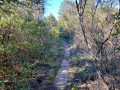
This walk will take you through a small section of this woodland along tracks and narrow paths that are in good condition. You won’t encounter too many stones, as the surfaces are mainly earth and gravel.
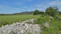
Along the way, you’ll enjoy a beautiful view of Mont Ventoux.

Details

65024411
Creation:
Last update:
Last review:
  • Walking
    Activity: Walking
  • ↔
    Distance: 4.12 mi
  • ◔
    Average duration: 2h 20 
  • ▲
    Difficulty: Easy

  • ⚐
    Back to start: Yes
  • ↗
    Ascent: + 469 ft
  • ↘
    Descent: - 469 ft

  • ▲
    Highest point: 1,309 ft
  • ▼
    Lowest point: 846 ft

Photos

Description of the walk

The starting point is at the foot of the Chapelle de Chalon.

(S/E) Take the road heading south until the next junction.

(1) Continue due south along a path for about 100 m.

(2) Take the track on your left heading east. Follow this track for about 2.2 km, ignoring the paths to the right and left.

(3) When you reach a T-junction, take the right-hand branch heading north-west uphill. Follow this track for about 2.5 km, ignoring any side tracks, until you reach the junction you passed on the way there.

(2) Turn right onto the track in the opposite direction to your outward journey and rejoin the road.

(1) Take the track on the left heading west for about 400 m.

(4) Leave the track and take a path on the right heading north for about 630 m.

(5) When you reach a T-junction, turn right heading north-east for about 200 m.

(6) Be careful not to miss a path on the right heading south-east; it’s a bit hidden, but a small cairn marks this junction. At the end of this lovely path, take the road on the right heading south-east-south to reach the Chapelle de Chalon (S/E).


Waypoints

  1. S/E : mi 0 - alt. 1,299 ft - Chapelle Notre-Dame de Chalon (Bourg-Saint-Andéol)
  2. 1 : mi 0.12 - alt. 1,273 ft - Junction with the 2nd circular loop
  3. 2 : mi 0.21 - alt. 1,266 ft - Junction with the first circular loop
  4. 3 : mi 1.52 - alt. 846 ft - Junction with a track
  5. 4 : mi 3.26 - alt. 1,276 ft - Junction. Forest track
  6. 5 : mi 3.65 - alt. 1,263 ft - Narrow path
  7. 6 : mi 3.78 - alt. 1,276 ft - Junction: take the path on the right
  8. S/E : mi 4.12 - alt. 1,299 ft - Chalon Chapel

Notes

As part of the walk is in the sun, do bring a hat and plenty of water.
On the few rocky sections, walking poles might be helpful.
You can have a picnic at the Chapel.

Worth a visit

Chalon Chapel

Laoul is, above all, the domain of the marvellous Dona Vierna de Balladun, a noble lady of the Middle Ages, celebrated by the troubadours and a benefactor to the town for having gifted it the Bois du Laoul.

View of Mont Ventoux, which rises to 1,909 metres. The name Ventoux derives either from the Celtic phrase ‘ven top’ (white mountain) or from the Provençal word ‘ventour’ (exposed).

Reviews and comments

3.9 / 5
Based on 4 reviews

Reliability of the description
4 / 5
Ease of following the route
3.8 / 5
Route interest
4 / 5
Rodger0è
Rodger0è

Thank you very much for your feedback.
Happy hiking
Roger

Machine-translated

User 28430343

Overall rating : 4.7 / 5

Date of your route : Apr 06, 2026
Reliability of the description : ★★★★★ Very good
Ease of following the route : ★★★★★ Very good
Route interest : ★★★★☆ Good
Very busy route : No

A circular, easy walk, though it does require a bit of exercise. The route starts at a lovely chapel, which wasn’t open on the day of our walk. The whole group really enjoyed this short stroll.

Machine-translated

Sissou30
Sissou30

Overall rating : 1.7 / 5

Date of your route : Apr 24, 2025
Reliability of the description : ★☆☆☆☆ Very disappointing
Ease of following the route : ★☆☆☆☆ Very disappointing
Route interest : ★★★☆☆ Average
Very busy route : No

This walk isn’t signposted. There are no markers or colours to follow. The directions on the information sheet aren’t clear because, once you’re there, there are countless possible routes, so we rely on a compass and keep track of the distance covered… which isn’t straightforward or accurate. When you’re in the woods on very stony paths with constant ups and downs, it’s almost impossible to tell whether you’ve just covered 1 or 2 km… All these reasons meant we lost our way, which meant we ended up walking an extra 4 kilometres – and even then, we only managed to find our way back thanks to the GPS on our phone.

Machine-translated

Chout
Chout

Overall rating : 4.3 / 5

Date of your route : Feb 24, 2025
Reliability of the description : ★★★★★ Very good
Ease of following the route : ★★★★☆ Good
Route interest : ★★★★☆ Good
Very busy route : No

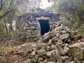
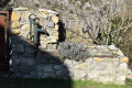
A pleasant walk starting from the beautiful spot by the chapel. You can see a ‘lavogne’ (a drinking trough for wild boar and other animals), a ruined ‘drystone shelter’ (a shepherd’s shelter) and the remains of a charcoal kiln. These woods were certainly bustling with life in days gone by! Please be aware of hunting seasons; do not proceed if a drive hunt is signposted. Many thanks to the person who created this route.

Machine-translated

Carillion
Carillion

Overall rating : 5 / 5

Date of your route : Feb 03, 2025
Reliability of the description : ★★★★★ Very good
Ease of following the route : ★★★★★ Very good
Route interest : ★★★★★ Very good
Very busy route : No

Machine-translated

Other walks in the area

For more walks, use our search engine .

The GPS track and description are the property of this route's author. Please do not copy them without permission.