


Las Hayas, Los Creces and Arure


A circular walk that starts in the undergrowth of the tropical forest and ends amongst terraced plots of palm trees, fig trees and aloe plants… There are several magnificent views of the island along the way. In short, it’s magnificent!
Details
Creation:
Last update:
Last review:
–
–
-
 Activity: Walking
-
 Distance: 7.83 mi
-
 Average duration: 4h 40
-
 Difficulty: Moderate
-
-
 Back to start: Yes
-
 Ascent: + 1,230 ft
-
 Descent: - 1,230 ft
-
-
 Highest point: 3,648 ft
-
 Lowest point: 2,625 ft
-
 Country:
Canary Islands
-
 City:
Valle Gran Rey
-
 Start/End: N 28.12948° / W 17.29243°
-


 Hour-by-hour weather


Waypoints
- S/E : mi 0 - alt. 3,320 ft
- 1 : mi 2.09 - alt. 3,642 ft - Montana de la Arana
- 2 : mi 3.4 - alt. 3,301 ft - Car park
- 3 : mi 5.29 - alt. 2,694 ft - Arure
- S/E : mi 7.83 - alt. 3,327 ft
Other walks in the area
La Gomera and the Las Creces garden
 Visorando Member3.07 mi
+335 ft
-318 ft
1h 40
Moderate
 Departure from Valle Gran Rey (Province de Las Palmas)
Park near the Las Creces garden hotel. Walk up to the bend and turn left, following the GR® trail. Follow it to Las Creces. There is a table and chairs for picnics. Head towards Las Hayas and follow the path until you reach the way you came. Do not follow Las Hayas to the end, but take the pretty path on the right. Once on the road, turn right. And you're back.
From Chipude to Garajonay
10.65 mi
+2,313 ft
-2,303 ft
6h 55
Moderate
Departure from Vallehermoso (Province de Las Palmas)
The hike begins in the peaceful village of Chipude and leads through the small villages of Apartadero and Pavon to the foot of La Fortaleza, the sacred mountain of the Guanches.It is possible to climb to its summit (1,243 m). It is believed that the ancient inhabitants of the island cherished this mountain because of its unusual shape. It is a gift from the gods. In any case, on a clear day, it can be seen from the neighbouring island of La Palma!
From forest to beach on the island of La Gomera
8.62 mi
+584 ft
-4,081 ft
4h 30
 Difficult
Departure from Valle Gran Rey (Province de Las Palmas)
From forest to beach, a pleasant way to discover the island of La Gomera.
Las Creces
 2.62 mi
+266 ft
-279 ft
1h 25
 Easy
Departure from Valle Gran Rey (Province de Las Palmas)
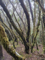
This is an easy, shady hike in the Garajonay National Park.
Circular route in Garajonay National Park from Chipude
6.90 mi
+1,729 ft
-1,726 ft
4h 40
Moderate
Departure from Vallehermoso (Province de Las Palmas)
This walk in the peaceful village of Chipude leads, via the small villages of Apartadero and Pavón, to the foot of La Fortaleza, the sacred mountain of the Guanches.It is possible to climb to its summit (1,243 m). It is thought that the island’s ancient inhabitants cherished this mountain because of its unusual shape. It is a gift from the gods. In any case, on a clear day, it can be seen from the neighbouring island of La Palma!
From Arure to Taguluché
 5.01 mi
+3,235 ft
-3,241 ft
5h 05
Difficult
Departure from Valle Gran Rey (Province de Las Palmas)
We're discovering the wonderful landscapes of La Gomera, an island in the Canary archipelago 35km from Tenerife, which is unspoilt by tourism and a hiker's paradise.
A fairly challenging route from the village of Arure to Taguluche, 800m below. The descent is steep, but the scenery is breathtaking.
A very mineral landscape, then a final descent through tiered gardens to finish on the lava paths by the sea.
Alto de Garajonay
 6.17 mi
+1,122 ft
-1,135 ft
3h 50
Moderate
Departure from Vallehermoso (Province de Las Palmas)
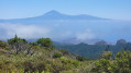
A hike leading to the highest point on the island of La Gomera, known as Alto de Garajonay.
El Guro - Barranco de Arrure - El salto de Agua
 2.06 mi
+719 ft
-719 ft
1h 35
Moderate
Departure from Valle Gran Rey (Province de Las Palmas)
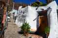
A very pretty, easy hike that begins with the village of El Guro, a very typical village with highly decorated houses.The path then climbs along the Barranco de Arrure to a small waterfall.
For more walks, use our search engine .
The GPS track and description are the property of this route's author. Please do not copy them without permission.

