


Refine your search for walks in Lac Long (Mercantour)
Lac Long (Mercantour) walks


 Lac des Neuf Couleurs below Brec de Chambeyron
 Visorando Member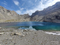
 9.46 mi
 +3,179 ft
 -3,182 ft
 7h 05
7h 05
 Difficult
 Departure from Saint-Paul-sur-Ubaye (Alpes-de-Haute-Provence)
Hike leading to the Lac des Neuf Couleurs surrounded by the Aiguille de Chambeyron, the Brec de Chambeyron and the Tête de la Fréma, just a stone's throw from the French-Italian border.The hike includes high-altitude lakes, rivers, waterfalls, animals depending on the time of day and your luck (marmots, chamois, etc.), scree slopes, and more.
Tour of Brec Chambeyron
 12.32 mi
+4,747 ft
-4,754 ft
8 hrs
12.32 mi
+4,747 ft
-4,754 ft
8 hrs
 Very difficult
Departure from Saint-Paul-sur-Ubaye (Alpes-de-Haute-Provence)
Very difficult
Departure from Saint-Paul-sur-Ubaye (Alpes-de-Haute-Provence)
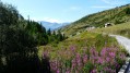
A loop around Brec de Chambeyron, leaving from the hamlet of Fouillouse.
Trek around Chambeyron Mountain Range (3) Refuge du Chambeyron - Maljasset
 10.64 mi
+2,454 ft
-4,764 ft
8 hrs
Very difficult
Departure from Saint-Paul-sur-Ubaye (Alpes-de-Haute-Provence)
10.64 mi
+2,454 ft
-4,764 ft
8 hrs
Very difficult
Departure from Saint-Paul-sur-Ubaye (Alpes-de-Haute-Provence)
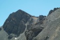
The most demanding stage of the hike during which you'll go through at least 4 passes at over 2700 metres in altitude. Beautiful scenery all along the way! The "Lacs Marinet" offer the opportunity for refreshments before the final descent.
Trek around Chambeyron Mountain Range (2) Pointe de Chauvet and Lac Noir
 3.40 mi
+2,228 ft
-2,228 ft
3h 30
Difficult
Departure from Saint-Paul-sur-Ubaye (Alpes-de-Haute-Provence)
3.40 mi
+2,228 ft
-2,228 ft
3h 30
Difficult
Departure from Saint-Paul-sur-Ubaye (Alpes-de-Haute-Provence)
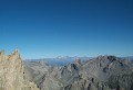
A climb to the highest point of this hike around the Chambeyron mountain range, at over 3000 metres in altitude. A summit offering an unobstructed view over Queyras and the neighbouring mountain ranges. A downhill route allowing a well-deserved rest by a lake.
A circular route from the Val Maira to the Ubaye Valley
43.80 mi
+14,711 ft
-14,708 ft
5 days
Difficult
Departure from Acceglio (Cuneo)
This cross-border route consists of 5 stages. It runs partly through the Val Maira, one of the four valleys of Occitan Piedmont in Italy, and through the Ubaye Valley in France. The first stage is deliberately short. This allows you to drive to Ponte Maira and start the hike on the same day.Allow around 3 hours’ drive from the Roya Valley or the Ubaye Valley.
Trek around Chambeyron Mountain Range
 36.21 mi
+13,120 ft
-13,783 ft
5 days
Difficult
Departure from Saint-Paul-sur-Ubaye (Alpes-de-Haute-Provence)
36.21 mi
+13,120 ft
-13,783 ft
5 days
Difficult
Departure from Saint-Paul-sur-Ubaye (Alpes-de-Haute-Provence)
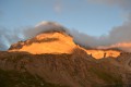
Reaching over 3000 metres in altitude, Aiguilles de Chambeyron and Brec de Chambeyron form an impressive mountain range halfway between Queyras and the Moncantour. This hike offers a trek with no techincal difficulty, with passes over 2700 m in altitude and a summit of over 3000 m. Set in an outstanding landscape and for the most part within a high mountain setting.
Walks near Lac Long (Mercantour)
From the Barenghi Bivouac to Larche via the Col du Vallonnet
13.36 mi
+3,953 ft
-7,723 ft
8 hrs
Very difficult
Departure from Saint-Paul-sur-Ubaye (Alpes-de-Haute-Provence)
This route largely followsGRP®® markings (Tour du Chambeyron). A safe option, yet still spectacular.Spectacular, because the route constantly alternates between stark, steep and rocky terrain and lush, rolling and reassuring landscapes.Safe, because it is fully signposted and even offers alternative routes to avoid the most difficult sections in the event of bad weather.
Trek around Chambeyron Mountain Range (1) Fouillouse - Refuge du Chambeyron
 3.88 mi
+2,470 ft
-36 ft
3h 55
3.88 mi
+2,470 ft
-36 ft
3h 55
 Moderate
Departure from Saint-Paul-sur-Ubaye (Alpes-de-Haute-Provence)
Moderate
Departure from Saint-Paul-sur-Ubaye (Alpes-de-Haute-Provence)
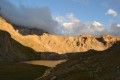
First stage around the Chambeyron Mountain Range which, after a steady climb, takes you to the shelter with the same name. You'll end up in a breath-taking setting, at the foot of Brec de Chambeyron.
Maljasset - Larche
15.60 mi
+4,199 ft
-4,898 ft
10h 50
Difficult
Departure from Saint-Paul-sur-Ubaye (Alpes-de-Haute-Provence)
Etape de la traversée des Alpes à partir du hameau de Maljasset qui suit la route de la Haute Ubaye avec une vue époustouflante sur les sommets qui bordent le flanc sud du Queyras. Traversée de la Haute Ubaye dans un univers minéral parmi les sommets de plus de 3000m.
Maljasset - Ceillac
 7.50 mi
+2,808 ft
-3,678 ft
5h 55
Difficult
Departure from Saint-Paul-sur-Ubaye (Alpes-de-Haute-Provence)
7.50 mi
+2,808 ft
-3,678 ft
5h 55
Difficult
Departure from Saint-Paul-sur-Ubaye (Alpes-de-Haute-Provence)
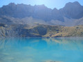
Return to Queyras by crossing the Col Girardin via a path that starts off quite steep but then levels out before ending with large hairpin bends that finish at the pass. This is followed by a long descent past the lakes, which reflect the famous Font Sancte, the highest point in Queyras.
Trek around Chambeyron Mountain Range (4) Maljasset - Refuge Campo Base
 9.28 mi
+2,408 ft
-3,304 ft
6h 20
Difficult
Departure from Saint-Paul-sur-Ubaye (Alpes-de-Haute-Provence)
9.28 mi
+2,408 ft
-3,304 ft
6h 20
Difficult
Departure from Saint-Paul-sur-Ubaye (Alpes-de-Haute-Provence)
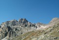
Quite a long stage but a steady route. A climb up to Col de Mary then a long downhill hike all the way to the shelter, in Chiaperra, Italy.
Maljasset - Ceillac
9.92 mi
+3,320 ft
-4,242 ft
7h 25
Difficult
Departure from Saint-Paul-sur-Ubaye (Alpes-de-Haute-Provence)
The passage between the two departments of Alpes de Haute Provence and Hautes Alpes is via the famousGR®5, which supports theGRP® of the Tour de la Font Sancte on this section.
Saint-Ours – Larche
 Association / Club / Walk leader
 5.26 mi
+1,102 ft
-1,417 ft
3h 25
Moderate
Departure from Meyronnes (Alpes-de-Haute-Provence)
5.26 mi
+1,102 ft
-1,417 ft
3h 25
Moderate
Departure from Meyronnes (Alpes-de-Haute-Provence)
Return to the starting point in Larche via theGRP® de la Frontière Fortifiée.
Chiappera - Chambeyron Refuge
 7.10 mi
+4,344 ft
-1,145 ft
6 hrs
Very difficult
Departure from Acceglio (Cuneo)
7.10 mi
+4,344 ft
-1,145 ft
6 hrs
Very difficult
Departure from Acceglio (Cuneo)
A lovely stage featuring a beautiful climb to the Stroppia Waterfall and the Lac des Neuf Couleurs.
Trek around Chambeyron Mountain Range (5) Refuge Campo Base - Larche
9.01 mi
+3,560 ft
-3,451 ft
7h 15
Very difficult
Departure from Acceglio (Cuneo)
Last stage of this trek around Chambeyron mountain range, taking you back to France through Col de Sautron. You'll find yourself in superb wildlife setting when arriving at the pass.
Larche - Saint-Dalmas-le-Selvage
17.35 mi
+5,102 ft
-5,633 ft
12h 25
Difficult
Departure from Larche (Alpes-de-Haute-Provence)
Étape de la traversée des Alpes par le GR®5 de Larche à Saint Dalmas le Selvage. Passage dans le Parc National du Mercantour sauvage et authentique puis transition entre la Haute Tinée et le Vallon de Jalorgues avec un passage sur la plus haute route d'Europe vers le Col de la Bonnette.