Refine your search for walks in Lac de Servières
Lac de Servières walks
 The Lac de Servières from the Lac de Guéry

The Lac de Guéry, of volcanic origin, is the starting point for this hike. At 1244 m, it is the highest lake in Auvergne. Along the way, you'll follow the ridge to the Lac de Servières.
⚠️Please note that the route of the GR® 30 has been modified since 2022, and several sections have been changed and no longer correspond with the IGN maps.
 Circular from Lac de Servières to Puy de l'Ouire
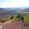
A circular starting from Lac de Servières takes you to the ridges, where you will have magnificent views of Lac de Guéry, La Banne d'Ordanche and the Sancy ridges. The climb is gentle on a forest road and the descent follows theGR®30trail, where walking poles will come in handy.
Walks near Lac de Servières
 From Pessade to Mont-Dore
Stage 3 of the "Between Puy de Sancy and Monts Dore" route.
A very pretty stage, starting with a route at the bottom of the valley and ending with passages along the ridges of the various puys before Mont-Dore.
 From Mont-Dore to Super Besse

Stage 4 of the 5-day route.
This stage takes you from Mont Dore to Super Besse via the summit of Sancy. A very steep climb from Mont Dore, ending with a descent to the resort of Super Besse.
See Practical information regarding certain restrictions.
 Voissières - Le Mont Dore

A return route to Mont Dore, taking care to avoid the same paths as the previous day.
 From Murol to Pessade

Stage 2 of the 5-day route.
This stage takes you to theGR®4trail through the countryside. You can visit Murol Castle at the start of the stage, then the troglodyte caves of Chautignat.
 La Bourboule - Mont Dore Resort

We will set off from the Étoile du Sancy in La Bourboule and head to the ECIR Chalet in the resort of Mont Dore, passing through Capucin, Puys de Cliergue, La Tour Carrée and Val de Courre.
 La Bourboule - Le Mont Dore route

A three-day hike starting from La Bourboule, taking you to several peaks in Auvergne (Capucin, Puy de Cliergue, Puy de la Tour Carrée, Le Sancy), the Chaudefour Valley, the Grande Cascade waterfall, etc., ending in the town of Le Mont Dore.
 Mont Dore - Puy de Sancy - Voissières station

Departure from Chalet ECIR in Mont Dore resort to reach Relais Voissières in...Voissières. Pass through the ridges along the Chaudefour valley.
The climb up Sancy can be difficult, but the rest is very easy.
 From Laschamps to La Cassière

Starting from Laschamps near Puy de Dôme, the route takes you to the village of Beaune le Chaud, then onto theGR®®4andGR®®30to climb the Puy de Lassolas and Puy de la Vache with magnificent panoramic views, before reaching La Cassière and its lake.
Please note: Access to the summits of Puys de la Vache and Lassolas will be closed for works between spring 2026 and early 2028.
Please note: the Montlosier car park will be closed for works between August 2025 and 2027.
 Laschamps - Orcines via Puy de Dôme
And finally, here is the fifth stage, marked by the ascent of Puy de Dôme. The route takes the Chemin des Muletiers for the ascent, then the Sentier des Chèvres to descend towards Orcines. There is, of course, a vast panorama from the highest point of this stage, overlooking the city of Clermont-Ferrand, the chain of puys, the Combrailles, the Plateau des Dôme and the Massif du Sancy.
 Saint-Genès bourg - Laschamps via the pass between Mercœur and Lassolas
This fourth stage marks the beginning of a wilder route that leads to the foot of the puys, through mountain pastures and woods. It also allows you to discover a pretty village, Beaune le Chaud, which has a beautiful traditional architectural heritage.
