The Voie de la Nive from Bayonne

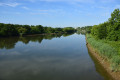
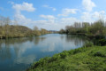
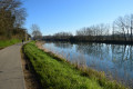
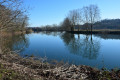
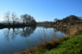
This return walk follows the banks of the River Nive along the towpath.

Details

n°4555797
Creation:
Last update:
Last review:
  • Walking
    Activity: Walking
  • ↔
    Distance: 3.86 mi
  • ◔
    Average duration: 1h 45 
  • ▲
    Difficulty: Easy

  • ⚐
    Back to start: Yes
  • ↗
    Ascent: + 7 ft
  • ↘
    Descent: - 7 ft

  • ▲
    Highest point: 20 ft
  • ▼
    Lowest point: 7 ft

Photos

Description of the walk

Park in the Floride car park, situated on the banks of the Nive below the Côte Basque Hospital. Saint-Léon site, Avenue Raoul Follereau.

(S/E) Walk down Avenue Raoul Follereau towards the River Nive and head south-west along Allée Maïté Barnetche, which follows the course of the River Nive.

Stay on this towpath, which is partially open to traffic, until you reach the junction with Chemin du Compagnet, which marks the end of this first section.

(1) Return along the same route to the car park (S/E).

Waypoints

  1. S/E : mi 0 - alt. 13 ft - La Floride car park
  2. 1 : mi 1.93 - alt. 13 ft - Chemin du Compagnet - Nive (rivière)
  3. S/E : mi 3.86 - alt. 13 ft - La Floride car park

Reviews and comments

5 / 5
Based on 1 review

Reliability of the description
5 / 5
Ease of following the route
5 / 5
Route interest
5 / 5
mick067
mick067

Overall rating : 5 / 5

Date of your route : Sep 04, 2024
Reliability of the description : ★★★★★ Very good
Ease of following the route : ★★★★★ Very good
Route interest : ★★★★★ Very good
Very busy route : No

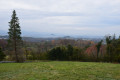
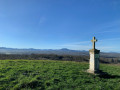
An easy and pleasant walk, in peaceful surroundings with a partial view of the Pyrenees on the way there.
It’s also the access road for local residents, but there’s very little traffic...

Machine-translated

Other walks in the area

For more walks, use our search engine .

The GPS track and description are the property of this route's author. Please do not copy them without permission.