Discovering the hidden Fagnes

A really lovely walk around the various Fagnes, which are a little less crowded. There are several possible shortcuts, but the majority of the paths taken are well worth it.

Details

44855181
Creation:
Last update:
Last review:
  • Walking
    Activity: Walking
  • ↔
    Distance: 11.13 mi
  • ◔
    Average duration: 5h 45 
  • ▲
    Difficulty: Moderate

  • ⚐
    Back to start: Yes
  • ↗
    Ascent: + 751 ft
  • ↘
    Descent: - 722 ft

  • ▲
    Highest point: 2,247 ft
  • ▼
    Lowest point: 1,788 ft

Photos

Description of the walk

Park in the small car park along the Route de l’Ancienne Douane, on the edge of the Fagne du Fraineu.

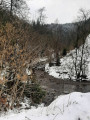
(S/E) Follow the Trô Maret stream for about 1 km.

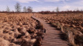
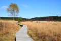
(1) Take the wooden walkways on the left to cross the Fagne du Fraineu.

(2) Turn left again to continue along the moor. At the end of the moor, turn right and follow the path for about 1 km.

(3) Turn right, then left to reach the Six Hêtres (centuries-old beech trees which, unfortunately, have not survived the storms of recent years). Then follow the path to the right, which winds its way between the forest and the moorland landscape.

(4) You’ll come to an information board explaining the landscape you’ve been walking through; turn right to reach the Fange de Setai. Then turn left and walk alongside it for just over a kilometre.

(5) Be careful not to miss the well-hidden path on the left. Follow this path to a gamekeeper’s cottage, where it can be a lovely spot for a picnic.

(6) Continue along this path until you reach the road.

(7) Head up the road to the right for about fifty metres to join the path on the left which overlooks the moorland all the way to the Fagne de Polleur. Follow the wooden walkways to the right until you reach a fork.

(8) Turn right towards the N68, which you must cross to continue straight on, across the fen, for 1 km.

(9) Turn right and follow the only authorised path through the Fagne de Neûr Lowé until you reach the track.

(10) Follow this track to the right until you reach the road. Walk along the road to the left for 200 m, then turn left again onto the path that runs alongside the Ruisseau de Bayehon.

(11) Turn right at a place called ‘le Vieux Chêne’ to follow a path between the forest and the meadow until you reach the crossroads.

(12) Turn right towards Les Trois Hêtres. Follow the track as it bends to the left, passing Les Trois Hêtres.

(13) Turn right onto a faintly marked path and join the N68. Cross the road with care and follow the path opposite until you reach the water supply point. Turn left and follow the track back to the starting point (S/E).


Waypoints

  1. S/E : mi 0 - alt. 1,788 ft - Car park on the Route de l’Ancienne Douane
  2. 1 : mi 0.47 - alt. 1,877 ft - Towards the Fagne du Fraineu
  3. 2 : mi 0.83 - alt. 1,972 ft - Fagne du Fraineu junction
  4. 3 : mi 1.68 - alt. 2,051 ft - Junction towards Les Six Hêtres
  5. 4 : mi 2.54 - alt. 2,044 ft - Information board
  6. 5 : mi 3.82 - alt. 2,087 ft - End of the Fagne de Setai
  7. 6 : mi 4.19 - alt. 2,028 ft - Hunters’ hut
  8. 7 : mi 4.37 - alt. 2,051 ft - Road junction
  9. 8 : mi 5.39 - alt. 2,172 ft - Turn right
  10. 9 : mi 6.16 - alt. 2,244 ft - Fagne de Neûr Lowé
  11. 10 : mi 6.89 - alt. 2,133 ft - Trail
  12. 11 : mi 8.57 - alt. 1,942 ft - The Old Oak, on the right
  13. 12 : mi 8.9 - alt. 1,991 ft - Heading for the Trois Hêtres
  14. 13 : mi 10.35 - alt. 1,906 ft - Tricky junction – turn right
  15. S/E : mi 11.13 - alt. 1,788 ft - Car park on the Route de l’Ancienne Douane

Notes

Please note that the paths can be very muddy; good waterproof footwear is essential.
Not suitable for pushchairs or people with reduced mobility.

Worth a visit

Fagne de Fraineu, Les Six Hêtres, Fagne de Setai, Fagne de Polleur, Fagne du Neûr Lowé and the Bayehon Stream are the main points of interest on this walk.
Do feel free to visit the highest point in Belgium at the Signal de Botrange, just a few kilometres from the start.

Reviews and comments

4.3 / 5
Based on 3 reviews

Reliability of the description
5 / 5
Ease of following the route
4.3 / 5
Route interest
3.7 / 5
viscoglut
viscoglut

Overall rating : 4.7 / 5

Date of your route : Jul 23, 2026
Reliability of the description : ★★★★★ Very good
Ease of following the route : ★★★★☆ Good
Route interest : ★★★★★ Very good
Very busy route : No

A lovely walk through the fagnes; not too busy, apart from a short stretch between points 8 and 9. The scenery is varied, and there are quite a few shortcuts if you want to shorten the route. That said, it’s flat, so it’s a very easy walk.

Machine-translated

cile200
cile200

Overall rating : 4.3 / 5

Date of your route : Dec 30, 2024
Reliability of the description : ★★★★★ Very good
Ease of following the route : ★★★★☆ Good
Route interest : ★★★★☆ Good
Very busy route : Yes

Not an easy hike in snowy and icy conditions.

Machine-translated

Willems Grâce-Hollogne

Overall rating : 4 / 5

Date of your route : May 21, 2024
Reliability of the description : ★★★★★ Very good
Ease of following the route : ★★★★★ Very good
Route interest : ★★☆☆☆ Disappointing
Very busy route : No

Very beautiful hike, even though it was raining, so it was quite wet.

Machine-translated

Other walks in the area

For more walks, use our search engine .

The GPS track and description are the property of this route's author. Please do not copy them without permission.