Country:

 City:
City:


PR® (yellow markings)
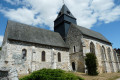
Park on Rue de l’Église in Touffreville.
(S/E) Go up the steps and then take the street leading to the forest. Turn left onto the tarmac road, Chemin de la Côte Saint-Pierre, which runs alongside the forest before continuing as a footpath for about fifty metres. Near a fence, turn right onto the path that climbs into the forest (please note: the map is incorrect at this point; follow the route and markings carefully). Carry on straight ahead until you reach the Carrefour du Hêtre à Dieu.
(1) Take the first road on the left, a tarmac track. At the next two junctions, turn right. You’ll come out onto the Route Forestière de Touffreville; follow it to the left. At a Fork in the road, keep left. Pass in front of a memorial stone, go downhill, cross the D321 and head back up the opposite side to reach the foot of the church at Rosay-sur-Lieure.
(2) Continue up the Côte de l’Église. As you come out of the right-hand bend, turn left onto a path running alongside the entrance to a property. After about 50 metres, take the path on the right uphill. Cross the Rue Principale and continue straight on along the Sente des Jardins. At the next junction, turn right onto the Rue des Écoles.
(3) Cross the Côte de l’Église (D11) and take the Côte du Château opposite. Take the first left, Rue du Fol Accard. Ignore the path leading down to the right, then follow the wall bordering the Château de Rosay estate. Continue along the path leading back down the hill to the Côte de la Chaîne.
(4) Turn right. Walk alongside the Lieure and take the first left, a dead-end at the corner of a property (gate).
(5) After about 300 m, turn right onto a path that descends between hedges and cross two branches of the Lieure in succession. You’ll come out onto the D321; follow it to the left for about 150 m. Then cross the road to take a path that leads diagonally into the forest, just before the sign indicating the exit from Le Roule. Continue to a junction (incorrectly marked on IGN but correctly on OSM).
Unmarked
(6) Keep going straight on, ignoring all side paths. You will then reach the Route Forestière du Gaffé.
PR® (yellow markings)
(7) Turn left onto it, then take a right and a left. Cross the D321 diagonally across the central reservation and turn right onto the road leading down into the hamlet of Villaine. Cross the Lieure again and head back up towards the forest. Ignore a turn-off on the left and continue to a T-junction at the entrance to the forest.
PR® (blue markings)
(8) Turn left and head uphill to another junction.
PR® (yellow and blue markings)
(9) Then turn sharply right. Follow the path to the edge of the forest (a tree-lined avenue in a large clearing). The Chapelle Saint-Jean is on the left behind the hedge (picnic area available).
(10) Turn right onto a tree-lined path, then immediately veer right to re-enter the forest. Stay on this path (ignore all side paths) until you reach a clearing near the D6.
(11) Just before the road, turn right onto the path leading downhill. Further down, it runs alongside a field before turning left to join the D6 at a bend. Follow this road towards Lyons-la-Forêt to reach the Church of Saint-Denis.
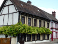
(12) Turn right to go down the street. Cross the Lieure again, then turn left onto Rue du Bout de Bas (D321). Follow this street, lined with half-timbered houses, to the junction between Rue de la Rouge Mare and Rue de l’Hôtel de Ville (junction of the D321 and D6).
Unmarked section
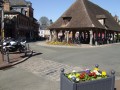
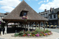
(13) Keep to the left onto the Route de la Rouge Mare (D321). Shortly afterwards, turn right into Rue de la République. You’ll come out onto Rue d’Enfer (with some lovely houses on the left, across the grassy square) and follow it to the right. Pass the market hall then turn right again onto Rue de l’Hôtel de Ville. Then turn left onto Rue du Trou Grenu.
(14) Shortly afterwards, take the Sentier de Derrière les Jardins on the right, which winds its way between the houses. Let the Sente des Soupirs branch off to the right and carry on straight ahead along the properties. Cross Rue de la Grosse Jeanne and continue straight ahead along the Sentier de Derrière les Jardins until you reach the Val Sauret neighbourhood.
(15) Turn left and head uphill towards the forest. At the very top of the field (on the left), carry on for a few metres before taking the first path branching off to the right (please note: this is poorly marked on maps, so follow the route carefully). After a left-hand bend, it joins another path. Follow this path uphill until you reach a T-junction.
PR® (yellow markings)
(16) Turn right. At the next junction, turn left, then right after about 70 m.
Unmarked
(17) Turn left (note: this path is not shown on IGN maps and is positioned slightly off on OSM). At the end, rejoin the Route Forestière du Gaffé and follow it to the left.
(18) Cross the D2 and take the path opposite which runs diagonally to the right. At the next junction, stay on this path which turns slightly to the right. Join the Route Forestière du Val aux Ânes and turn right onto it.
(19) Cross the D2 again and continue straight ahead on this same forest road. Stay on this road until you come across the signposting for the Sentier de la Jacassière (PR® – yellow).
PR® (yellow markings)
(20) Keep left and join a tarmac road. Follow the wooden fence, heading left.
(21) Further up, turn right onto a track. Follow the track as it bends first to the right and then to the left. Pass close to the Fieffes riding centre. The track continues by turning left after the centre. You will then reach a T-junction.
(22) Turn right onto the Route Forestière du Sabbat. At the first junction, carry on straight ahead until you reach a T-junction.
(23) Turn right onto the Route Forestière du Hêtre à Dieu (tarmac). After about 300 m, turn left along plot no. 851. Carry on straight ahead until you leave the forest. A little further down, on the right, you’ll reach the car park for Touffreville Church (S/E).
 Visorando Member
 Moderate