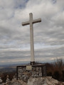
La Tête d’Âne at Touron

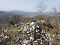
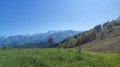
A very pleasant round-trip walk offering a 360° view very close to Saint-Girons.

Details

5931570
Creation:
Last update:
Last review:
  • Walking
    Activity: Walking
  • ↔
    Distance: 2.34 mi
  • ◔
    Average duration: 1h 45 
  • ▲
    Difficulty: Easy

  • ⚐
    Back to start: Yes
  • ↗
    Ascent: + 807 ft
  • ↘
    Descent: - 807 ft

  • ▲
    Highest point: 2,677 ft
  • ▼
    Lowest point: 1,870 ft

Photos

Description of the walk

9 km south-east of Saint-Girons, take the D33 towards Rivèrenert, then head up towards Touron, or take the D603 directly towards Touron. There may be one or two parking spaces available on the circular route between Aulussat and Touron.

(S/E) Head towards Touron, then take the path that climbs diagonally to your left.

(1) Follow the path to the left for about 350 metres and turn right at the hairpin bend.

(2) About thirty metres after a sharp left-hand bend, take the path to the right, then turn left at the next junction until you reach the pass track.

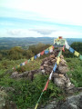
(3) Turn right, then follow the barely marked path across the meadow, which leads to the summit of the Tête d’Âne.

(4) Retrace your steps in the opposite direction to return to the car park at the hairpin bend (S/E).

Waypoints

  1. S/E : mi 0 - alt. 1,870 ft - Hairpin bend between Aulussat and Touron
  2. 1 : mi 0.11 - alt. 1,962 ft - Junction: A/ left – R/ right
  3. 2 : mi 0.55 - alt. 2,218 ft - Junction: A/ to the right – Return/ to the left
  4. 3 : mi 0.87 - alt. 2,500 ft - Pass path
  5. 4 : mi 1.17 - alt. 2,677 ft - Tête d’Âne
  6. S/E : mi 2.34 - alt. 1,870 ft - Hairpin bend between Aulussat and Touron

Notes

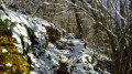
The walk is shaded for half the route.
The path leading to the summit is barely marked, but the meadow is open and you simply need to head towards the summit.

Reviews and comments

4.8 / 5
Based on 2 reviews

Reliability of the description
5 / 5
Ease of following the route
5 / 5
Route interest
4.5 / 5
chespeel
chespeel

Overall rating : 5 / 5

Date of your route : Dec 01, 2025
Reliability of the description : ★★★★★ Very good
Ease of following the route : ★★★★★ Very good
Route interest : ★★★★★ Very good
Very busy route : No

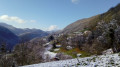
I have done this hike several times. It is accessible to everyone. I did it on a beautiful blue sky day with a lovely view of the snow-capped Pyrenees. There are markers all along the way, making it suitable for all seasons.

Machine-translated

merapic
merapic

Overall rating : 4.7 / 5

Date of your route : Nov 27, 2023
Reliability of the description : ★★★★★ Very good
Ease of following the route : ★★★★★ Very good
Route interest : ★★★★☆ Good
Very busy route : No

A pleasant little hike on a hillside that was, fortunately, very sunny for late November.
Just under an hour’s easy climb to have lunch at the summit.
A stunning view of the mountain range, particularly of the Vallier.

Machine-translated

Other walks in the area

For more walks, use our search engine .

The GPS track and description are the property of this route's author. Please do not copy them without permission.