Country:

 City:
City:


Park at La Chaume du Rouge Gazon.
Blue Disc signposting
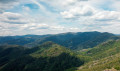
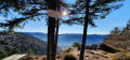
(S/E) From the car park, leave the farmhouse inn behind you and head right. Then turn left towards the Tête du Rouge Gazon. At the junction, keep right and ignore the two paths on the left. At the pass, turn right to reach the summit of the Tête du Rouge Gazon and enjoy the panoramic views.
(1) Then return to the level of the scree via the same route.
Red Disc markings
Turn left and head for a junction.
(2) Keep to the left again on a narrow and occasionally technical path that crosses a few scree slopes. You’ll reach a fork.
Yellow Triangle markings
(3) Continue downhill to the left. At the large junction, ignore the two paths on the left and take another one.
Green Cross signpost
(4) Continue to the right. At the track, turn right.
No markings
Then leave the path on your left and head towards a large crossroads. Keep straight ahead to join the path leading to Gazon Vert and its waterfall.
Marked with a red Rectangle crossed out in white
(5) Head right towards Gazon Vert and the waterfall. At the junction, stay on the path on the right, which is the narrowest and steepest.
Signpost: Blue Rectangle with a white cross
At the next fork in the road, turn right to reach the viewpoint by a footbridge and a railing.
(6) Return to the junction and take the track leading uphill to the right. Then continue straight ahead until you reach the Gazon Vert farmhouse inn.
(7) Go round the building on the left and stay on the path to the right towards the Col des Perches. Then continue straight ahead, uphill. Turn right onto a track, then quickly turn left. When you cross this track again a little further up, go straight ahead, then do the same when you cross it for the third time. Reach the Col des Perches.
Blue Rectangle Markings
(8) Turn right, then immediately left. Descend steeply and leave the path on your right as you head down the slope. You will then reach the Lac des Perches dam.
Blue Triangle signpost
(9) Continue straight ahead to reach a viewpoint.
(10) Return to the dam.
Blue Rectangle signpost
(9) Turn left to pass at the foot of the dam and cross the Seebach stream. Once on the other side, keep left before passing the Red Triangle markings on your left. After a more technical section, you’ll reach the Rocher du Corbeau.
(11) Continue along the path to reach the junction between the Haute Bers and the Moyenne Bers.
Blue Rectangle markings with a white cross
(12) Turn right, then quickly turn left at a right angle. Begin a long, winding descent and, at the first bend, keep to the left. Cross a footbridge and reach a junction.
Markings: Red Ring
(13) Turn left, cross the footbridge and reach the viewpoint overlooking the Grand and Petit Neuweiher.
(14) Continue along the path.
Blue Rectangle signpost
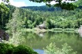
Pass a junction on the left, then another on the right, to reach the Grand Neuweiher and its dam.
Yellow Saltire signpost
(15) Continue straight ahead. The signposting is out of date on IGN maps. Walk alongside the Petit Neuweiher and head up to the right to walk alongside the lake again and rejoin the Grand Neuweiher.
Blue Rectangle Signpost
Then head up the track to the left and continue left again a little further on. Next, ignore a path leading down to the right before cutting across a track.
(16) At the next Fork in the road, head straight ahead then immediately turn right to tackle a winding climb. Once at the top of the climb, pass a track on the left and another on the right before passing another path on the left. The path follows the contour line. Pass a path on the left to reach the Gresson Moyen.
(17) At the junction by the inn, turn right to pass in front of it. Just as you leave the inn, turn right towards the Ballon d’Alsace and climb the scree slope.
Blue Cross markings
(18) Just at the top, head up to the right, before following a path on the right. The trail plunges into the forest and runs alongside a low wall.
Blue Triangle markings
(19) At the Fork in the road, turn right, follow the switchbacks and join the GR®5.
Red Rectangle Markings
Turn left to reach a Fork in the road.
Red Rectangle with a white cross
(20) Always keep to the right towards the Roche de l’Enfer.
(21) Take in the view, then head down the path as it continues.
Red Rectangle Signpost
When you rejoin the GR®5, turn left.
(22) At the Col des Charbonniers, continue to the left, then keep to the right. Pass a thatched cottage and reach a junction.
(23) Keep straight ahead before repeating this at the next junction. Take the track on the right.
Unmarked
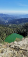
Head down to the right again to reach the viewpoint over the Neuweiher lakes.
(24) Return to the track.
Red Rectangle Markings
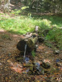
Turn right and walk past the Source du Hêtre. At the Fork in the road, keep left and ignore the path leading to the spring on the right. You’ll soon reach another junction.
Blue Rectangle with a white cross
(25) Head up to the left. Then descend slightly to reach a junction.
No markings
(26) Keep to the right, then stay on the left-hand path to reach the Tête des Perches and its viewpoint.
(27) Return to the pass via the same route.
Signposting: Blue Rectangle with a white cross
(26) Head down the wide grassy path on the right. When you reach the farm, turn right onto the track to reach the car park (S/E).
 Visorando Member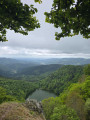
 Moderate