La Roche aux Faucons and the two Boubous

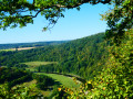
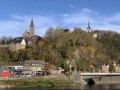
Winding its way from one bend in the Ourthe to the next, this walk takes in four viewpoints over the valley and the towpath, passing through the village of Méry, Brialmont Abbey and the elegant two-level bridge at Tilff.

Details

104137964
Creation:
Last update:
Last review:
  • Walking
    Activity: Walking
  • ↔
    Distance: 8.53 mi
  • ◔
    Average duration: 4h 50 
  • ▲
    Difficulty: Moderate

  • ⚐
    Back to start: Yes
  • ↗
    Ascent: + 1,086 ft
  • ↘
    Descent: - 1,076 ft

  • ▲
    Highest point: 774 ft
  • ▼
    Lowest point: 240 ft

Photos

Waypoints

  1. S/E : mi 0 - alt. 673 ft - La Roche aux Faucons car park
  2. 1 : mi 0.03 - alt. 627 ft - Roche aux Faucons viewpoint
  3. 2 : mi 1.02 - alt. 604 ft - Spotting
  4. 3 : mi 1.54 - alt. 479 ft - Château Sainte-Anne
  5. 4 : mi 2.02 - alt. 259 ft - Méry
  6. 5 : mi 2.29 - alt. 272 ft - Saint-Pierre Church
  7. 6 : mi 2.52 - alt. 610 ft - Petit Boubou (viewpoint)
  8. 7 : mi 3.29 - alt. 715 ft - Donnay Monument
  9. 8 : mi 3.35 - alt. 643 ft - Grand Boubou (viewpoint)
  10. 9 : mi 3.5 - alt. 610 ft - Chantoir Donnay
  11. 10 : mi 3.55 - alt. 558 ft - Trou des Nutons
  12. 11 : mi 4.51 - alt. 568 ft - Brialmont Abbey
  13. 12 : mi 4.72 - alt. 387 ft - Sainte-Anne (viewpoint)
  14. 13 : mi 5.3 - alt. 243 ft - Picnic area
  15. 14 : mi 6.18 - alt. 246 ft - Tilff Bridge - Ourthe (rivière) - Belgique
  16. 15 : mi 6.38 - alt. 279 ft - Picnic area - Ourthe (rivière) - Belgique
  17. 16 : mi 7.3 - alt. 279 ft - Tunnel and Chemin de Monceau - Ourthe (rivière) - Belgique
  18. S/E : mi 8.53 - alt. 673 ft - La Roche aux Faucons car park

Notes

The path is paved between (3) and (5), as well as along the entire route beside the River Ourthe.

It is advisable to walk the circular route in the direction indicated, as the path between Méry and Le Petit Boubou is easier going uphill than downhill.

There is a bench at the first three viewpoints.
There are numerous benches between (13) and (14), as well as in the park to the east of (14) (off the route).

Other walks in the area

For more walks, use our search engine .

The GPS track and description are the property of this route's author. Please do not copy them without permission.