Country:

 City:
City:



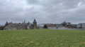
Car park opposite Saint-Firmin’s Church and the castle, Rue du Centre in Bonneville.
(S/E) With your back to the church, cross the square and take the grassy path running behind the gardens. At the end, turn left then right onto the main street.
(1) At the Fork in the road immediately ahead, turn right onto Rue de Bruyère. This street continues as Rue du Chauffour and then as a farm track; follow it right to the end.
(2) Then turn right, then right again to join the Route des Trois Frères, which you should follow to the left.
(3) At the fork in the road, keep right onto Rue de Gaurre. This road overlooks the Meuse hillside and offers a few views of the valley through the trees. When you reach the bottom of the street, opposite No. 13, turn left onto Rue Mosseroux.
(4) Continue down the hill, taking the hairpin bend into Rue de Thon. Halfway down the slope, once you’ve left the hamlet, turn onto the forest track to the left and then immediately right: there’s a view of an old quarry beyond the junction. Join the N942 (Rue de Gramptinne) at a bend.
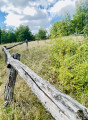
(5) Walk up the road to the left for 300 m, cross it and, after the car park, turn right onto the road leading to Maizeret: signposted. This road runs alongside and then crosses the River Samson. Shortly afterwards, turn right onto the path climbing the hillside (a shortcut to avoid the long hairpin bend), to rejoin the road to Maizeret. Follow it up to the village entrance, taking the narrow gap behind the wooden safety rail if you wish.
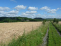
(6) At the cemetery, turn left onto the farm track which goes round the cemetery and then winds its way through meadows and fields to reach the ridge of the opposite slope. The path briefly crosses a copse before emerging at the corner of a large building (Girembois farm). Walk alongside it, turning left. The path leads out into the fields and heads towards the large Bois Wiame farm, now a rural lodge.
(7) Ignore the path on the right and head straight on along the lane leading to the farm (*). Go past the farm and continue straight on towards the pasture (*). Go through the gate (with a chicane on the right) and cross the pasture until you reach a sunken path running downhill, with a wood on the left and a meadow on the right. At the end of the woodland and the meadow, take the farm track on the right towards the woodland.
(8) Enter the woodland; at the Fork in the road, ignore the path leading down to the left and keep to the right onto the path running along the gently ascending slope. At the top, the path opens out onto a meadow and begins its descent towards the village of Goyet: view of the castle. The path leads onto Rue Bois-Là-Haut and then past a large building (care home): head down to the left towards Le Samson. At the bottom of the street, cross a river.
(9) Follow the N942 to the left, then immediately turn right up the Try de Goyet to climb the Samson hillside. At the top, the road continues as a stony track and passes through a copse (ignore the forest track on the right) before emerging into the fields.
(10) At the fork in the road (barrier), keep left.
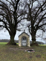
(11) At the Notre-Dame du Bon Secours Chapel, carry on straight ahead to emerge shortly afterwards onto Rue de la Bouteille, then Rue Sainte-Anne in the village of Bonneville. Turn right after No. 69 onto the dead-end street (signposted), which soon becomes a farm track.
(12) At the end of the track, turn left into Rue Sterpisse towards the village centre: the street runs alongside the side wing of the château and leads out opposite the church. Turn left to reach the nearby car park (S/E).




 Tourist office

 Easy
Easy  Visorando Member