Country:
 City:
City:


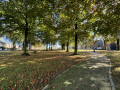
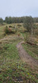
Start from the main car park at the Sclaigneaux Nature Reserve.
Access is via the lower end of Rue Saint-Joseph in Landenne, or via the upper end of Rue Boltry in Seilles, both in the municipality of Andenne.
Alternative car park at the entrance to the access path to the nature reserve (800 m from the start).
(S/E) From the reserve’s car park, go round the information board to the right and head into the woodland via the small path. This path passes over and under old cast-iron pipes, bends sharply to the left and climbs slightly.
Ignore the path branching off to the right and continue straight ahead along the track. This overlooks the reserve’s main path and then leads out onto an area dotted with small mounds (material dredged from the old settling basin, a little further to the right). It is best to cross this area using the central track.
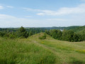
(1) At the end of the area, continue along the path through the woodland. This joins the reserve’s main track (now a path), which you follow to the right for 150 metres, before leaving it by taking the path to the left. This path leads to an open area (on the slope of the Meuse valley). Continue for about twenty metres (bench under a tree).
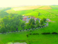
(2) Take the path on the left, which leads to a promontory and offers a fine view of the Meuse Valley and Chérimont Castle (on the opposite slope).
(3) Retrace your steps to the previous junction.
(2) Continue left along the path that runs along the top of the hillside. After 300 metres, the path takes a right-angle turn to the right, just opposite a small circular sand pit surrounded by a wooden fence, then joins a wider path. Take this path to the left.
The path runs alongside another sand pit (ignore the two paths on the right) and soon enters a slightly more wooded area (young birch trees).
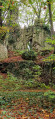
(4) (See practical information). Just as the path is about to make a wide bend to the right, take the narrower path directly opposite. This path follows the ridge line between the slopes of the Meuse valley and the Ruisseau de Loysse valley. The vegetation now consists of larger, denser deciduous trees. As it begins a gentle descent, this path becomes more rugged. Follow it to the end (where there are large boulders on the left).
(5) At the end of the path, do not take the steep descent usually used by mountain bikers; carry on for another fifteen metres or so and begin the descent amongst the trees, which is gentler and offers handholds. Once you reach the tarmac, head down to the left along it for about fifty metres to reach the crossing point (diagonally) over the stream beneath the road.
(6) Walk along the right-hand side of the bridge and take the path immediately after it. Follow the stream upstream along its right bank (ignore the small stone bridge). After about 400 m, the path veers away from the stream as it climbs, then joins the tarmac road. Turn left onto this road and follow it uphill for about 200 m.
(7) Just as the tarmac road begins to curve to the left, leave it and take the small path on the right which runs alongside the road below and follows the stream.
This path rejoins the road (opposite a forest track) after 800 m. Follow the road for 100 m, then head back down between the road and the stream and follow the path. The path rejoins the road at a small waterfall. Follow the road to the fork.
(8) Turn onto the track on the left (access to the Chant d’Oiseaux castle-farm) and continue straight on along the forest track (trail 36) at the end of the driveway. This track runs along the bottom of the valley, a short distance from the Ruisseau de Geminne. Ignore the tracks branching off to the left and continue until you reach a Fork in the road.
(9) Keep to the right to continue along the path, which narrows at this point and begins to climb.
Walk past the farm.
(10) Continue along the tarmac road (Rue Chant d’Oiseaux, village of Landenne). At the top end, turn right and then left into Rue de Troka.
(11) At the top of this street, take the concrete track on the right which leaves the village of Landenne and leads to Petit-Waret. After 600 m, near a large warehouse, take the farm track on the right and continue straight on to the village centre.
(12) After a slight left-right bend, carry on towards the church and take the second street on the right (Rue Louis Lahaye).
(13) Turn right onto the small path between a workshop and No. 200. This path runs between the buildings, alongside the gardens and then through the meadows and fields, emerging onto Rue du Château d’Eau. Turn left onto this road for 80 metres, then turn right again onto the path starting between numbers 411a and 412.
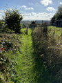
(14) This path runs between the two properties, leading into the fields, where it joins another path which you should take to the left (running alongside an unfenced property and a field) to come out onto Rue Maurice Bertrand. Cross it straight ahead and continue down the grassy path. The path leads onto Rue de Vieux Bois de Namur. Cross straight ahead to reach, shortly afterwards, Rue du Bois de Namur.
(15) Turn right onto this street and follow it for about twenty metres, then turn immediately left onto the grassy path (which is not very visible) that runs alongside the house and then through a meadow. At the end of the meadow (small wooden shelter), turn right between the meadow and a field. The path turns left and runs alongside a woodland, then passes in front of a farmhouse before widening out and finally emerging onto a tarmac road.
(16) Cross the road and take the first turn right then left to join the stony track (Rue de la Haie Monet) leading to the Sclaigneaux Nature Reserve (signposts).
Follow the path all the way to the top. It will cross through a woodland, then run alongside a field before reaching another woodland.
(17) Just as the path takes a right-hand bend followed by a slight left-hand bend, but before it emerges into a field again, take the path on the right which leads into the woodland and runs along the edge of the woodland a few dozen metres away. At the Fork in the road (information board), keep to the left.
At the end of the path, head down to the left and make your way back to the car park (S/E).

 Visorando Member

 Tourist office
 Easy
Easy